Wildland-Urban Interface (WUI)

This page is for Wildland-Urban Interface content brought to you by the California Fire Science Consortium. Due to the ubiquitous nature of fire losses in the wildland-urban interface of California, the WUI module of the California Fire Science Consortium encompasses the entire state. The WUI module will disseminate pertinent biophysical and sociopolitical science to stakeholders by a variety of active and passive means, and intends to:
- Develop annotated bibliographies that capture scientific findings before, during and after a WUI fire event.
- Summarize key manuscripts and scientific findings of WUI fires.
- Develop workshops and webinars that illustrate key concepts, strategies, and science in the WUI.
- Develop field tours that demonstrate how local communities can successfully implement strategies to reduce fire losses.
- Coordinate applicable special sessions at relevant conferences (e.g., conferences sponsored by Association for Fire Ecology, International Association for Wildland Fire, International Association of Fire Chiefs, etc).
In order to most reduce the losses and costs from WUI fires, the module will target potential end-users from a wide array of fields including federal, state, and local fire personnel (at both field and management levels), local and regional Fire Safe Councils, residents, community planners, educators, and others. It should be noted that concepts from other areas of the world (e.g., Australia) will be considered in this module so as to better improve the design, management, and resiliency of the WUI in California.
Please contact Chris Dicus with suggestions for topics that you would like to see covered by the WUI module.
Download a poster about the WUI module (PPT) >
Need to reach someone?
Wildland-Urban Interface Lead
Professor of Wildland Fire and Fuels Management
Cal Poly
San Luis Obispo, CA
cdicus@calpoly.edu
(805) 756-5104
Upcoming Events Related to WUI
If blank, there are currently no upcoming events for this region.
A new paper by USGS and partners investigated why some California wildfires are destructive and others are not.
To demonstrate where resources might be better allocated across the state, these authors examined the distribution of area burned and structures lost across five different California vegetation types and how the distribution of fire has changed in these landscapes through time.
Two years after the 2015 Wragg Fire burned the Reserve, a restored public trail was reopened for use. The authors used surveys to determine public perceptions of fire in this chaparral ecosystem.
Although the causes of the fires vary by ecoregion and require location- and driver-specific management tools, there are effective ways to reduce both structure exposure and structure sensitivity to fire across all of California.
Hardening homes was strongly correlated with structure survival in the Wildland Urban Interface. The best ways to “harden homes” are to: enclose eaves and use multiple pane windows; use fire-resistant exterior siding, composite deck materials, and fine-mesh vent screens.
The WUI is often synonymous with fire risk to buildings, but this research suggests that this is not the case in all fire-prone states. While fire outreach was often present near areas where buildings are destroyed by wildfire, many communities are established after major fires.
This research brief discusses national trends in rebuilding and new development after wildfire, as well as policy choices and adaptation measures local governments and communities pursued after fire, through case studies.
Both Southern France and California have large amounts of housing in the Wildland Urban Interface where local vegetation is highly dense and fire adapted. This research brief compares the land use policies used to reduce the exposure of homes to wildfire in these two locations.
The design and materials used in construction is critical to preventing structure loss during wildland urban interface (WUI) fires. This research helps planners and homeowners by ranking specific construction materials by fire safety effectiveness, then comparing their use to landscape-scale design attributes.
In Southern California, fuel treatment strategies often put fire risk reduction and biodiversity conservation goals at odds with each other. In response to this conflict, two of our briefs (Syphard et al. 2016; Butsic et al. 2016) explore a novel new approach.
This research brief discusses the lessons learned from the costly fires of 2003 in Southern California. Recommendations on future fuel reduction strategies and placement are discussed.
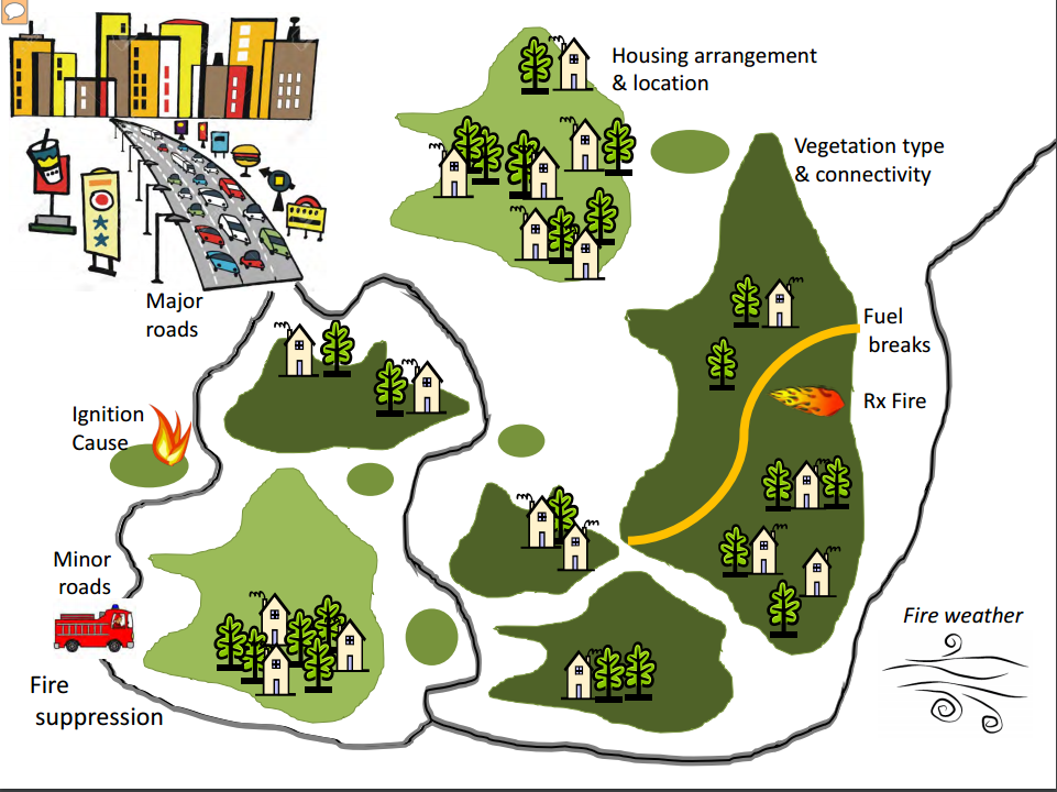
This study examined how housing location and arrangement affects the likelihood that a structure will be lost when a wildfire occurs.
This study found that the predictive capability of the commonly used Burning Index was quite limited and proposed an index with improved predictive ability for Los Angeles County, California.
View USGS Research Brief PDF >
A Bayesian Network model was used to evaluate the relative importance of fuel and fuel treatments compared to weather and variables of the built and natural environment on wildfire risk at the wildland-urban interface (WUI) in San Diego County.
View USGS Research Brief PDF >
The author examines social perceptions of risk of home ignition in the community of Forest Ranch, which is located in the Sierra-Cascade foothills near Chico in Butte County.
This study focuses on reducing fire ignition, specifically on discerning the most destructive ignition sources so that they might be targeted by managers.
View Research Brief PDF >
This 2003 study used aerial photos taken between 1939 and 1997 to quantify vegetation change in the landscape mosaic of grasslands, shrublands, woodlands and forests of the San Francisco Bay Area.
View Research Brief PDF >
This paper examined the 20th century fire history of the San Francisco East Bay landscape to understand to what extent fire management activities could account for changes in landscape patterns.
View USGS Research Brief PDF >
The 2003 and the 2007 wildfires in San Diego County were remarkably similar in their causes, impacts and the human responses they elicited.
View USGS Research Brief PDF >
Through modeling, field experiments, and case studies, the author demonstrated that home ignitability is largely dependent on a structure’s exterior materials and design combined with its exposure to flames and firebrands.
View Research Brief PDF >
Syphard, Brennan and Keeley asked how the size of the defensible space zone affected fire outcomes using a dataset of 687,869 homes with their property boundaries.
View Research Brief PDF >
The authors surveyed administrators of regulatory and voluntary wildfire reduction programs in 25 US states to gain information on how they are organized, what they are trying to accomplish, what obstacles existed in their implementation, and how well they may be working.
View Research Brief PDF >
Research Brief
Management strategies to reduce fire spread and severity typically involve targeted reduction of forest fuels through some combination of mechanical, hand, and/or burning treatments. A 2012 study by Safford et al. evaluates the effectiveness of such forest fuel treatments in mixed conifer and yellow pine forests in the California National Forests.
McCaffrey (2004) investigated what types of information are most useful to increase public support concerning defensible space, prescribed burning, and thinning activities.
View Research Brief PDF >
To better inform managers, there is a need for research to better explore many facets of WUI fires, including: hazard and risk assessment at small (e.g. community) scales; WUI fire behavior, including structure-to-structure spread; Structure exposure and vulnerability to both firebrands and heat; and Economic cost-benefit analyses of mitigation activities.
View Research Brief PDF >
Search for more Research & Publications >
Past Presentation and Conference Materials
These presentations are meant to provide background and fire prevention mitigation strategies for land use planners utilizing current science findings of the day. These three presentations provide targeted information and background that may be useful for a variety of planners.
Other Resources
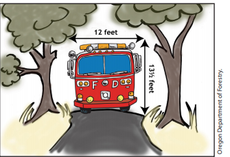
Chapter 5 of this publication has detailed recommendations and considerations on how to best install or improve access and roads.

A national Cooperative Extension website with many resources regarding fire preparation, including activities for home protection that can be done before, during, and after a fire occurs near your home.
Visit site >
The California Fire Safe Council provides resources and support for Californians to make their homes and communities fire safe, as well support for running local Fire Safe Councils in communities.


