Stanislaus-Tuolumne Experimental Forest field trip report

Despite the interest in heterogeneous fuel and fire treatments in California (See GTRs 220 and 237), there are few on-the-ground examples of finished treatments for managers to visit and learn from. On August 24th, 2012 Erick Knapp (USFS PSW) and Maria Benech (USFS Stanislaus NF) led a CFSC-organized field trip to the Stanislaus-Tuolumne Experimental Forest (STEF), where their crews have finished thinning treatments on one of the largest variable-density thinning projects currently underway in the state. The different treatments (variable thin-no burn, variable thin-burn, control) are part of a study intended to investigate the ecological effects of structural variability through forest thinning and burning operations.

The group stops to discuss in a gap - note the large legacy trees in the foreground opening, with denser groups of smaller trees in the background.One of the main goals of the project is to try to recreate a similar variable stand structure to what was found in the central Sierras prior to fire suppression and logging. In 1929 an inventory was taken of the same STEF lands for a “methods of cutting study”. Then, much of the forest area exhibited distinct gaps and patches of trees - separate groups of trees each with similar density, basal area, and canopy cover, along with gaps of understory vegetation with little to no trees mixed in to the overall stand.

The August field trip visited four different areas within the experimental forest. At each stop the group walked through different treatments and controls to discuss topics ranging from operational considerations to wildlife habitat. The variability within each treatment was obvious – there would be open patches with one to three large trees and snags next to dense groups of small firs and cedars. The thinned stands also provided a stark contrast to the untreated control stands, which were generally were dense with shade-tolerant understory trees and ladder fuels throughout, in addition to the larger legacy trees common throughout the STEF.

Marking guidelines

The high-variability treatment prescription evolved over 3 years after much discussion and planning with staff and stakeholders. Working with all the marking crews at once to mark sample treatments, before each crew went off to work individually, helped create a shared baseline of how to mark the treatments. Additionally, the marking crews included an assemblage of wildlife biologists, botanists, fuels specialists, silviculturalists, and planners. Most of the treatments used a leave-tree marking guideline, while cut-tree guidelines were used in some of the old-growth stands.

Knapp discussing marking protocols in an untreated control unit.Knapp and Benech emphasized that the marking guidelines are flexible – “this means few black and white decisions and no right or wrong answers, which was initially frustrating for some.” Often, certain stand characteristics such as remnant black oaks, root disease pockets, or legacy trees would be used as “anchors” to plan around. This fluid approach draws a contrast to the standardized thin-from-below treatments commonly used in traditional thinning projects. While more time-consuming at first, as the crews become more experienced at marking these complex treatments the rate of marking progress grew closer to the rate for more traditional treatments.

Wildlife habitat

Creating suitable wildlife habitat and refugia was a factor that helped guide the creation of patch and gap sizes and distributions. This was evident during the field tour: treated stands showed a variety of large-diameter and course woody debris on the forest floor as well as a spectrum of different tree sizes and crown densities. As such the treatments were designed to provide cover and habitat to a wide range of wildlife, and to avoid single-species management practices. The concept of this design is “not to manage every slice of pie for every species,” said Eric Knapp during the tour.

Sierra NF Wildlife Biologist and Climate Change Coordinator Greg Schroer discusses burn implementation and the creation of wildlife habitat while the group stops in a treated old growth standOutreach

Outreach to stakeholders was key to successfully implementing these treatments, particularly in regard to the lack of diameter limits on tree removal in the experimental forest. Throughout the planning process, meetings and field visits were held with stakeholders to help build trust and accountability. Showing a comparison of current density, tree arrangement, and understory vegetation to the 1929 stem maps of the forest helped to visualize and contextualize planned treatments.

Prescribed burning

Prescribed burns of some of the treated stands at the STEF are scheduled for this fall. Hopefully we’ll be able to plan another field visit afterwards or in the spring, so stay tuned.


Open tree crowns and retained snags in a treated unit.


A retained snag, in the center of the photo behind the group, shows large woodpecker holes.

Forest lands may benefit from active restoration after wildfire

This entry is a re-posting from the UC ANR Forest Research and Outreach blog.

Author: Susie Kocher
August 22, 2012

In the many forested areas where wildfires are currently burning, the question will soon arise: What should be done after the fire goes out? That depends on the severity of the burn and land owner goals.

For high severity burns where very few or no live trees remain to provide seed for the next generation, forest recovery can take a very long time. Typically forest landowners want to restore their lands to a forested condition as quickly as possible. In that case, an active approach can help them reach their goal sooner.

The California Tahoe Conservancy has just released a report on the outcomes of active restoration of 40 acres of Conservancy lands where all trees were killed by the 2007 Angora fire in South Lake Tahoe. That fire burned 3,100 forested acres as well as 250 homes.

Post-fire Conservancy goals were to re-establish a native forest, reduce hazards posed by dead trees, and avoid water quality impacts. Contractors cut large dead trees, skidded them to a landing, loaded them on a log truck and sent to a nearby mill. Some large dead trees were left on site to provide wildlife habitat. Small trees were ground up (masticated) and left on site to control erosion and suppress competing vegetation. Then one- to two-year-old native conifer seedlings were planted.

The report's authors estimate this active approach has hastened the return to a forested condition in the area by about 60 years. This is because planted seedlings are growing quickly while there are few naturally sprouting tree seedlings in adjacent untreated areas and these face competition from vigorously growing native brush that was stimulated by the wildfire. Soil monitoring showed no compaction by heavy equipment during tree removal and minimal soil erosion. Woody mulch left on site was also effective at suppressing brush to give newly planted tree seedlings a competitive edge.

Landowners looking for guidance on post-fire forest management are encouraged to download the free UC Cooperative Extension publication “Recovering from Wildfire: A Guide for California Landowners  and consult the UC Center for Forest Research and Outreach website at http://ucanr.edu/forestry.


CBS News piece on how suppression leads to mega fires

In an interesting follow-up to our last blog entry, we now have an example of a major media outlet connecting the current mega fires in the West not only to climate change but also to the century-long history of fire suppression in the West. M Sanjayan, the lead reporter on the story, is also a lead scientist with The Nature Conservancy. It would be great to see more similar collaborations between scientists and the media - much can get lost in translation, and shortening the chain of information to the general public certainly couldn't hurt.

Check out the video below:

Study shows TV and media rarely mention climate change in wildfire coverage

This blog is a re-post from the Media Matters research page. Read the entire post here, which includes individual responses from fire scientists (some from the CFSC) on the connections between climate change and wildfire.

News Outlets Avoid Topic Of Climate Change In Wildfire Stories

While numerous factors determine the frequency, severity and cost of wildfires, scientific research indicates that human-induced climate change increases fire risks in parts of the Western U.S. by promoting warmer and drier conditions. Seven of nine fire experts contacted by Media Matters agreed journalists should explain the relationship between climate change and wildfires. But an analysis of recent coverage suggests mainstream media outlets are not up to the task -- only 3 percent of news reports on wildfires in the West mentioned climate change.

Only 3 Percent Of Wildfire Coverage Mentioned Long-Term Climate Change Or Global Warming. The major television and print outlets largely ignored climate change in their coverage of wildfires in Colorado, New Mexico and other Western states. All together, only 3 percent of the reports mentioned climate change, including 1.6 percent of television segments and 6 percent of text articles.

Media Matters

METHODOLOGY: We searched Nexis and Factiva databases for articles and segments on (wildfire or wild fire or forest fire) between April 1, 2012, and June 30, 2012. News outlets included in this study are ABC, CBS, NBC, CNN, The New York Times, The Washington Post, The Associated Press, The Los Angeles Times, CNN.com, USA Today and The Wall Street Journal. MSNBC and Fox News were not included in this analysis because transcripts of their daytime coverage are not available in the Nexis database.

Media Matters

Evidence Suggests Climate Change Worsens Fire Risk In Parts Of Western U.S.

Climate Central: "Wildfires Require Several Factors To Come Together." A Climate Central article about the 2011 fire season noted that "major wildfires require several factors to come together," and that wildfires are strongly influenced by regional climate conditions, which in turn are influenced by global warming driven by greenhouse gas emissions:

As with most extreme weather and climate events, and their related impacts, major wildfires require several factors to come together in order [to] occur -- typically some combination of dry and windy weather, abundant and dry vegetation, and a spark, which can range from a carelessly tossed cigarette to a lightning strike.

Wildfires are a naturally occurring phenomenon closely tied to climate conditions, and as the world warms in response to rising amounts of greenhouse gases in the air, many studies show that wildfire frequency and severity will likely shift as well. 

[...]

Historical variations in climate can explain much of the large year-to-year and decade-to-decade variations in Western US fire activity. Thus, climate change is already increasing wildfire activity in the Western US. This may seem surprising, given the number of other factors (including forest management practices) that are known to affect fire activity. [Climate Central, 6/21/11]

Major Climate Report: "Wildfires in the United States Are Already Increasing Due To Warming." In a comprehensive report commissioned by the Bush administration and released in June 2009, the U.S. Global Change Research Program said earlier snowmelt and drying of soils and plants have worsened wildfires in Western states:

Wildfires in the United States are already increasing due to warming. In the West, there has been a nearly fourfold increase in large wildfires in recent decades, with greater fire frequency, longer fire durations, and longer wildfire seasons. This increase is strongly associated with increased spring and summer temperatures and earlier spring snowmelt, which have caused drying of soils and vegetation. [U.S. Global Change Research Program, 6/16/09]

The report included the following chart showing that the number of acres burned per fire has increased significantly since the 1980s:

Source: U.S. Global Change Research Program

[U.S. Global Change Research Program, 6/16/09]

A 2010 National Research Council report summarizing the state of climate science also stated that "the length of the fire season has expanded by 2.5 months":

[L]arge and long-duration forest fires have increased fourfold over the past 30 years in the American West; the length of the fire season has expanded by 2.5 months; and the size of wildfires has increased several-fold. Recent research indicates that earlier snowmelt, temperature changes, and drought associated with climate change are important contributors to this increase in forest fire. [National Research Council, 5/19/10]

Recent Study Found Western U.S. Particularly Vulnerable To Global Warming's Impact On Fires. From the New York Times' DotEarth blog:

Researchers using a decade of satellite data on fires and a suite of climate models have produced the first thorough global estimate of changes in the frequency of fires in the world's forests under greenhouse-driven global warming. There's ample uncertainty but the study, published today in the peer-reviewed online journal Ecosphere, points to a variety of outcomes, with fires likely becoming more frequent in zones you might expect -- like temperate North America and particularly the western United States -- but rarer in the tropics. [New York Times, 6/12/12]

National Research Council: Warming Expected To Expand Area Burned By Wildfires In Western North America. In a 2010 report, the National Research Council said that "for warming levels of 1°C to 2°C, the area burned by wildfire in parts of western North America is expected to increase by 2 to 4 times for each degree (°C) of global warming." Particularly vulnerable areas "include the Pacific Northwest and forested regions of the Rockies and the Sierra," according to the report, which also included the following map showing projected increases in "area burned for a 1°C increase in global average temperature" relative to the median annual area burned from 1950-2003:

Source: National Research Council

[National Research Council, 6/16/10]

Warming Has Boosted Tree-Killing Beetles, Adding Fuel For Fires. A National Academies website notes that the warming trend has boosted the population of bark beetles that kill trees in western forests:

This increase in wildfire is a legacy of both a changing climate and decades of total fire suppression that has resulted in a buildup of dead fuels. One important factor is drought. Wintertime precipitation is increasingly falling as rain instead of snow, and the snow that does accumulate is melting earlier in the spring--decreasing the amount of water available in the late summer months and contributing to longer and more intense droughts. Compounding the effects of these droughts is the increased susceptibility of drought-stressed trees to attacking insects. In the last decade, a bark beetle epidemic has exploded across 18,000 square miles of western mountain forests. Milder winter temperatures kill fewer beetles in their budworm phase than the colder winters of the past, helping to increase the bark beetle population, with devastating effects. As the beetles kill vast areas of forest, they leave standing dead wood, fueling even larger wildfires. [National Academies, accessed 6/28/12]

Responding To Increased Fire Risk Requires Policy Change, Vigilance Regarding Latest Science. The U.S. Global Change Research Program recommended that policymakers become versed in "what the latest climate science implies for changes in types, locations, timing, and potential severity of fire risks over seasons to decades and beyond" and change policy accordingly:

Living with present-day levels of fire risk, along with projected increases in risk, involves actions by residents along the urban-forest interface as well as fire and land management officials. Some basic strategies for reducing damage to structures due to fires are being encouraged by groups like National Firewise Communities, an interagency program that encourages wildfire preparedness measures such as creating defensible space around residential structures by thinning trees and brush, choosing fire-resistant plants, selecting ignition-resistant building materials and design features, positioning structures away from slopes, and working with firefighters to develop emergency plans.

Additional strategies for responding to the increased risk of fire as climate continues to change could include adding firefighting resources and improving evacuation procedures and communications infrastructure. Also important would be regularly updated insights into what the latest climate science implies for changes in types, locations, timing, and potential severity of fire risks over seasons to decades and beyond; implications for related political, legal, economic, and social institutions; and improving predictions for regeneration of burnt-over areas and the implications for subsequent fire risks. Reconsideration of policies that encourage growth of residential developments in or near forests is another potential avenue for adaptive strategies. [U.S. Global Change Research Program, 6/16/09]

Conservation and housing loss to wildfire

by Alexandra Syphard, Ph.D., Conservation Biology Institute

Why is housing loss to wildfire relevant?

(re-posted from the CBI blog)
(listen to a radio interview with Dr. Syphard on KCLU)
During an interview about our recent paper on housing loss due to wildfire, I told the reporter that I was from the Conservation Biology Institute.  She hesitated for a moment, and then asked the question that naturally followed:  “If you’re from the Conservation Biology Institute, then why are you studying factors that contribute to housing loss?” This question made me realize that the answer might not be readily apparent, especially to those who are unfamiliar with fire ecology in southern California. 
Wildland Urbanc Intermix Areas, southern California

My coauthors and I are concerned about community vulnerability to wildfire, and this paper is the first publication from a much larger project, the USGS Southern California Wildfire Risk Scenario Project.  Although one of the main components of this project is to identify the key factors that minimize housing loss, another major goal is to find solutions that balance management of fire hazards with natural resources – and ideally, identify ways to benefit both.

There are a number of reasons why housing loss to wildfire is strongly linked to conservation, and these tend to fall into three main groups.

1. The ecological impact of increased fire frequency in non-forested ecosystems

Throughout the US, particularly in the west, highly successful outreach about the perils of fire exclusion has led to the common belief that more wildfire is needed for its ecological benefits.  However, for those of us who study non-forested, crown-fire systems, like the shrublands in southern California, the opposite is true.  During the last several decades, human-caused ignitions have escalated due to population growth and urban expansion, and fire frequency has thus skyrocketed in the region.  Although many native species in southern California are resilient to periodic wildfire, the vegetation here is actually adapted to a fire regime with much lower fire frequency than in most conifer forest systems.  As a result, many species cannot withstand high-recurrence fire, especially if a fire repeats within 5 – 15 years.  Increased fire frequency not only contributes to the elimination of native shrubs, but it also imperils the many mammals who depend on shrubland habitat, and furthermore increases the potential for expansion of weedy, highly flammable annual grasslands.   As a biodiversity hotspot, southern California is home to the one of the largest numbers of threatened and endangered species in the US. 

Because the vast majority of ignitions are caused by humans in California, population growth and urban development have direct effects on the number of fires that occur.  If future development occurs in a way that not only reduces risk of home loss, but also reduces the number of fires that start, people and natural resources will both benefit.

2. The ecological impact of fuel treatments and prescribed fire in non-forested ecosystems

The most obvious and accessible approach for dealing with wildfire risk is to manage vegetation, or, the fuels that carry the fire.  Thus, reducing the volume and extent of fuels is usually considered to be the most important aspect of fire management.  In forested ecosystems, this approach presents few problems for conservation, and is actually mutually beneficial for reducing fire hazard and providing ecological benefits.  Unfortunately, this ecological benefit does not extend to non-forested, crown-fire ecosystems.   In southern CA, fuel treatment typically involves complete elimination of native shrubs in preference of exotic grasses and low fuel-volume vegetation.  These treatments facilitate the expansion of exotic species, and prescribed fire adds more fire to a landscape that is already suffering from an exorbitant amount of fire.  Fuel treatments also fragment important habitat for mammals.  Aside from the negative ecological impacts, these fuel treatments unfortunately provide insufficient protection to homes during the types of fires that lead to the most home loss – those under extreme weather conditions, with Santa Ana winds.   In these weather conditions, fires will not stop at a fuel treatment; in fact, flying embers have been known to jump major multi-lane freeways.

Therefore, our project is seeking solutions to substitute sole reliance on fuel treatments with a combination of approaches that not only provide the maximum public safety, but also reduce resource impacts.  We are finding that the best solutions will not only include strategically placed fuel treatments near homes that provide firefighting access, but the addition of land use planning and other measures, like fire-safe landscaping.

3. The ecological impact of housing development

Perhaps the most obvious reason that land use planning and housing loss are related to conservation is the potential for direct habitat loss and fragmentation brought on by development.  This is true not only for California, but for any fire-prone region in the world.  If new homes are constructed, this will clearly expand the footprint of development and remove habitat to clear the land.  And of course, there will simply be more homes available in the landscape to burn.  However, given a fixed number of new residences that need to be constructed, our research is finding that the location and pattern of those homes makes a very big difference in whether or not the homes will be destroyed in a wildfire. 

In particular, homes in low- to intermediate housing densities, in small, isolated neighborhoods, are the most at-risk, at a landscape scale; however, once a fire reaches a community, there is potential for house-to-house spread if the homes are too close together.   Because scattered, low-density housing typically results in larger conversion of habitat, these results imply that building new homes in existing urban areas or in larger, high-density clusters may not only make the homes safer, but can also minimize habitat conversion. 

Considering the tremendous economic impact of wildfires, from costs of fuel breaks and firefighting to property loss and fire insurance, we are finding that, like with so many other issues, ecology and economy (and in this case, public safety) really aren’t enemies.  In fact, what’s good for one can be good for the other, and we are identifying solutions that are beneficial in all aspects. In southern CA, large wildfires are simply unpreventable.  But we believe there are ways we can learn to live with them.

Wildfire video: managing for multiple objectives in the Southwest

The Southwest Fire Science Consortium just released two new videos on fire issues in the southwest. The below video covers changes to the federal fire policy made in 2009 and how they have affected managers abilities to manage fires for multiple objectives. For instance, federal fire managers can now suppress one flank of a fire while allowing another flank to burn through the remote backcountry, where it poses no threat to communities or infrastructure but could serve an important ecological role.

In the video, fire managers from the Southwest discuss how the new policy has changed their management techniques as well as some of the ongoing challenges of managing fires.


LA Times opinion piece: How our overabundance of forest trees affects rivers and water supplies

Our too-thirsty forests

Today, the hottest and thirstiest parts of the United States are best described as over-forested. Vigorous federal protection has stocked semiarid regions of public land with several billion trees too many. And day after day these excess trees deplete a natural resource that has become far more precious than toilet paper or 2-by-4's: water.

Scientists and water managers report that 39 states face water scarcity. Much of the nation's freshwater shortfall comes from our population growth, waste, hunger and contaminants. But we must also now implicate the escalating thirst of unnatural forests.

Water depletion from afforestation — the establishment of trees or tree stands where none previously were — is the unintended consequence of a wildly popular federal policy. For millenniums, fires set by lightning or Native Americans limited forest stocks to roughly a few dozen trees per acre. All that changed after the nationally terrifying Big Blowup wildfires of 1910, which led the United States to in effect declare war on wildfire. The government's wartime-like tactics included security watchtowers, propaganda, aerial bombing and color-coded threat alerts. Uncle Sam trained elite Hotshot and Smokejumper crews to snuff out enemy flames. Congress annually funded the war effort with an emergency blank check, now $2.5 billion.

Decades of heroic victories against fire led to gradual defeat in the larger war. Fuel builds up, and when it ignites, the fires burn hotter, faster and more destructively. More new trees compete for less sunlight, thinner soil nutrients and scarcer water resources. Native wildlife suffers. Insects and diseases spread faster. Public subsidies protect private properties at the wildland-urban interface.

Ironically, Congress enacted the anti-fire 1911 Weeks Act and 1924 Clarke-McNary Act to prevent erosion and thus secure downstream navigable rivers. That logic made sense in damp Eastern states, but it had the opposite effect in the semiarid West. There, fire exclusion degraded the integrity and runoff of high-elevation watershed recharge zones.

Naturally, forest managers focus on forest health. Yet combing through their extensive upland research, our analysis also found the larger scope of downstream casualties: suppression of fire causes suppression of flows.

Indeed, in some landscapes, you literally can't see the river for the trees.

Call it the water-fire nexus. To be sure, the dynamics are complex. Impacts fluctuate locally depending on forest slope, aspect, age, altitude, density, latitude, species composition and natural history. But adjusting for these variables reveals the nexus' overarching pattern.

First, the past century of fire suppression has resulted in roughly 112 to 172 more trees per acre in high-elevation forests of the West. That's a fivefold increase from the pre-settlement era.

Second, denser growth means that the thicker canopy of needles will intercept more rain and snow, returning to the sky as vapor 20% to 30% of the moisture that had formerly soaked into the forest floor and fed tributaries as liquid. But let's conservatively ignore potential vapor losses. Instead, assume that the lowest average daily sap flow rate is 70 liters per tree for an open forest acre of 112 new young trees. Even then, this over-forested acre transpires an additional 2.3 acre-feet of water per year, enough to meet the needs of four families.

Third, that pattern adds up. Applying low-end estimates to the more than 7.5 million acres of Sierra Nevada conifer forests suggests the water-fire nexus causes excess daily net water loss of 58 billion liters. So each year, post-fire afforestation means 17 million acre-feet of water can no longer seep in or trickle down from the Sierra to thirsty families, firms, farms or endangered fisheries.

So how do we unlock the nexus to replenish the Earth? A century's accumulation of dry fuel in public lands makes it too expensive and risky — for people, property, habitats or carbon emissions — to unleash prescribed fires throughout our 16-million-acre ponderosa tinderbox. Mechanical thinning generates popular distrust as long as timber industry chain saws try to cut "high grade" valuable mature growth to compensate for less profitable small-diameter "trash trees."

Happily, a lumber mill's trash has now become a water user's treasure. Thirsty downstream interests could organize to restrict thinning to scrawny excess trees simply for the purpose of releasing the liquid assets they consume. Western water rights markets value an acre-foot at $450 to $650 and rising. So rather than compete with forests for rain and snow, private and public institutions could invest $1,000 per acre (average U.S. Forest Service price) to cut down fire-prone trash trees, yielding at least $1,100 to $1,500 worth of vital water. To reduce fuel loads and increase runoff, the water-fire nexus pays for itself.

This pragmatic approach has regional precedents. The U.S. Endowment for Forestry and Communities cites forest-to-faucet agreements emerging from Denver to Raleigh, N.C. The only obstacle is our century-old cultural mind-set that if a dozen trees are good, 100 trees are better. But as temperatures rise, too much forest strangles too many watersheds. To replenish streams before they dry up, we lifelong tree-huggers must learn when and where to let go.

Helen M. Poulos is a fire ecologist and postdoctoral teaching fellow at Wesleyan University's College of the Environment. James G. Workman, a former wildland forest firefighter, is a visiting professor at Wesleyan and the author of "Heart of Dryness."

Climate change projections confirm increases in wildfire frequency across the US and Europe

Another media release below from the UC Berkeley News Center on new fire science research, this time from CFSC co-PI Max Moritz.

Analysis of global fire risk shows big, fast changes ahead

BERKELEY —

Climate change is widely expected to disrupt future fire patterns around the world, with some regions, such as the western United States, seeing more frequent fires within the next 30 years, according to a new analysis led by researchers at the University of California, Berkeley, in collaboration with an international team of scientists.

Fires burn across the hillside near homes in Portola Hills, Calif.

By the end of the century, almost all of North America and most of Europe is projected to see a jump in the frequency of wildfires, primarily because of increasing temperature trends. At the same time, fire activity could actually decrease around equatorial regions, particularly among the tropical rainforests, because of increased rainfall.

The study, published today ( Tuesday, June 12) in Ecosphere, an open-access, peer-reviewed journal of the Ecological Society of America, used 16 different climate change models to generate what the researchers said is one of the most comprehensive projections to date of how climate change might affect global fire patterns. 

“In the long run, we found what most fear — increasing fire activity across large parts of the planet,” said study lead author Max Moritz, fire specialist in UC Cooperative Extension. “But the speed and extent to which some of these changes may happen is surprising.”

“These abrupt changes in fire patterns not only affect people’s livelihoods,” Moritz added, “but they add stress to native plants and animals that are already struggling to adapt to habitat loss.”

The projections emphasize how important it is for experts in conservation and urban development to include fire in long-term planning and risk analysis, added Moritz, who is based at UC Berkeley’s College of Natural Resources.

UC Berkeley researchers worked with an atmospheric scientist from Texas Tech University to combine over a decade of satellite-based fire records with historical climate observations and model simulations of future change. The authors documented gradients between fire-prone and fire-free areas of Earth, and quantified the environmental factors responsible for these patterns. They then used these relationships to simulate how future climate change would drive future fire activity through the coming century as projected by a range of global climate models.

“Most of the previous wildfire projection studies focused on specific regions of the world, or relied upon only a handful of climate models,” said study co-author Katharine Hayhoe, associate professor and director of the Climate Science Center at Texas Tech University. “Our study is unique in that we build a forecast for fire based upon consistent projections across 16 different climate models combined with satellite data, which gives a global perspective on recent fire patterns and their relationship to climate.”

The fire models in this study are based on climate averages that include mean annual precipitation and mean temperature of the warmest month. These variables tend to control long-term biomass productivity and how flammable that fuel can get during the fire season, the researchers said.

Variables that reflect more ephemeral fluctuations in climate, such as annual rainfall shifts due to El Niño cycles, were not included because they vary over shorter periods of time, and future climate projections are only considered representative for averages over time periods of 20-30 years or longer, the authors said.

The study found that the greatest disagreements among models occur for the next few decades, with uncertainty across more than half the planet about whether fire activity will increase or decrease. However, some areas of the world, such as the western United States, show a high level of agreement in climate models both near-term and long-term, resulting in a stronger conclusion that those regions should brace themselves for more fire.

“When many different models paint the same picture, that gives us confidence that the results of our study reflect a robust fire frequency projection for that region,” said Hayhoe. “What is clear is that the choices we are making as a society right now and in the next few decades will determine what Earth’s climate will look like over this century and beyond.”

“We need to learn how to coexist with fire,” said Moritz.

Study co-author David Ganz, who was director of forest carbon science at The Nature Conservancy at the time of the study, noted the significance of the findings for populations that rely upon fire-sensitive ecosystems.

“In Southeast Asia alone, there are millions of people that depend on forested ecosystems for their livelihoods,” he said. “Knowing how climate and fire interact are important factors that one needs to consider when managing landscapes to maintain these ecosystem goods and services.”

The researchers noted that the models they developed focused on fire frequencies, and that linking these to other models of fire intensity and vegetation change are important next steps.

The Natural Sciences and Engineering Research Council of Canada, the U.S. Forest Service, the National Science Foundation and The Nature Conservancy helped support this study.

RELATED INFORMATION

New comprehensive study on prescribed fire effects, wildfire risk, and forest health

The below media release from the UC Berkeley News Center summarizes the findings of a new paper that addresses some of the concerns regarding increaling the scale and pace of prescribed fire treatments in the Unitied States.

Let it burn: Prescribed fires pose little danger to forest ecology, study says

BERKELEY —

Fighting fire with fire has been given the green light by a new study of techniques used to reduce the risk of catastrophic wildfires. And with a rise in wildfires predicted in many parts of the country, researchers say controlled burns and other treatments to manage this risk should be stepped up.

A prescribed fire in the central Sierra Nevada is set to reduce fuel that could otherwise feed a catastrophic wildfire. (Jason Moghaddas photo)

The paper, published in the June issue of the peer-reviewed journal BioScience, and led by researchers at UC Berkeley, synthesizes 20 years of research throughout the country on the ecological impact of reducing forest wildfire risk through controlled burns and tree thinning. It comes as California braces for a potentially bad fire season, particularly in the southern Sierra where precipitation was half its normal level.

“We need to act, because climate change is making fire season longer, temperatures are going up, and that means more fire in many regions, particularly ones with a Mediterranean environment,” said lead author Scott Stephens, UC Berkeley associate professor of fire science. 

The study authors, which included scientists from the U.S. Forest Service and six research universities in the United States and Australia, relied upon data from the U.S. Fire and Fire Surrogates Study, in addition to a wide range of other studies. Together, the studies represented a broad spectrum of ecological markers, detailing the effects of fuel-reduction treatments on wildlife, vegetation, bark beetles, soil properties and carbon sequestration.

“Some question if these fuel-reduction treatments are causing substantial harm, and this paper says no,” said Stephens. “The few effects we did see were usually transient. Based upon what we’ve found, forest managers can increase the scale and pace of necessary fuels treatments without worrying about unintended ecological consequences.”

A few of the researchers’ specific ecological findings include:

  • For the first five years after treatment, some birds and small mammals that prefer shady, dense habitat moved out of treated areas, while others that prefer more open environments thrived. The study authors said these changes were minor and acceptable.
  • When mechanical tree thinning was followed by prescribed fire, there was an increase in the overall diversity of vegetation. However, this also included non-native plant species. The researchers recommend continued monitoring of this effect.
  • Only 2 percent or less of the forest floor saw an increase in mineral soil exposure, which could lead to small-scale erosion. Other soil variables, such as the level of compaction, soil nitrogen and pH levels, were temporary, returning to pre-treatment levels after a year or two.
  • Increases in bark beetles, a pest that preys on fire-damaged trees, was short-lived and concentrated in the smaller diameter trees. Researchers noted that thinning out a too-dense forest stand improves tree vigor and ultimately increases its resilience to pests, in addition to fire.

The results of this paper may help inform an analysis of one of the larger prescribed fires in the history of the U.S. Forest Service. Called the Boulder Burn, the proposed treatment covers 6,000-9,000 acres in the Southern Sierra Nevada’s Sequoia National Forest and is tentatively set to begin by late fall.

“This paper is more comprehensive and definitive than any other article I’ve seen,” said Malcolm North, research scientist with the U.S. Forest Service and an associate professor in forest ecology at UC Davis. “In one place, it summarizes the state of the science in fuel-reduction treatments, and to my mind, it shuts the door on those who say that any type of fuels treatment is detrimental to the forest. If done properly where surface fuels are reduced, treatments work. It’s time to get on with it.”

A masticator is used to mechanically thin a mixed-conifer forest in the central Sierra Nevada. The thinning is done to reduce potential ladder fuels for destructive wildfires. (Jason Moghaddas photo)

Nearly a century of fire suppression and the preferential logging of large-diameter trees, which are better able to withstand forest fires, have left forests vulnerable to more destructive, albeit less frequent, wildfires, the researchers said. In addition, the lack of fire has hindered nutrient cycling in forests and the proliferation of certain plant species, such as the sequoia, that rely upon fire to promote seed dispersal.

This realization led to the gradual re-emergence during the past 20 years of fuel-reduction as a forest management tool. The goal is simple: Thin or remove dense stands of trees, ground vegetation and downed woody debris in a carefully controlled way before they become fuel for a raging wildfire. When low- or moderate-intensity controlled burns are not an option, fire-prone trees are mechanically removed or shredded on site.

Such techniques are an attempt to emulate the frequent fires common in California for thousands of years. Before 1800, Stephens said, an estimated 1.1 million acres of forest burned annually in California, including wildfires ignited by lightning and other natural sources, and blazes set intentionally by Native Americans as a way to manage or alter landscapes. Most were blazes of low-to-moderate intensity that more than 80 percent of the trees could survive, unlike the catastrophic wildfires of modern times.

“Today, the combination of wildfires and fuel-reducing treatments only touch 6-8 percent of the land that used to burn annually before 1800, and fuel-reducing treatments alone only affect 1 percent,” said Stephens. “That’s a pittance. At that level, it’s just triage rather than fire prevention.”

To approach levels that have a chance of reducing wildfire risk in the long term, he said, the amount of land to be treated in a year would need to increase by 2-4 percent — still low compared to historical levels.

Stephens noted that two-thirds of the fuel-reduction treatments in the western United States rely upon mechanical thinning, which would be much more costly than prescribed burns to scale up. In the southeast region, the use of prescribed fire dominates.

In the West, particularly in California, the biggest challenge to expanding controlled burns is the potential reduction in air quality during treatment, said Stephens.

“We have a choice,” he said, “of dealing with lower levels of smoke from prescribed fires that may only be needed every 15 years or so, and which can be timed for optimum wind conditions, or acute levels of smoke from catastrophic fires that can last for months when they hit.”

The U.S. Department of Agriculture-U.S. Department of the Interior Joint Fire Science Program helped support this research.

RELATED INFORMATION

The River of Fire: Prescribed Fire Video from Everglades NP

The fire staff at Everglades National Park made the below video documenting a prescribed burn in fire-dependent sawgrass prairie in the fall of 2011. The video has great footage showing the logistics of burning in one of the few fire-dependent ecosystems where the fuels being burned are above three feet of water! It's also a great example of the planning, outreach, and general hard work that go into executing prescribed fires. Definitely a video worth watching.

If anyone knows of any similar videos showing prescribed fires in California or the west, send them my way so I can post them here! Email the link to: tkline@berkeley.edu

Estimating Wildfire Probability

Southern Sierra Nevada Prescribed Fire and Smoke Symposium - Meeting Summary

Southern Sierra Prescribed Fire and Smoke Symposium

March 26th – 27th 2012  •  Clovis, CA

Event Summary

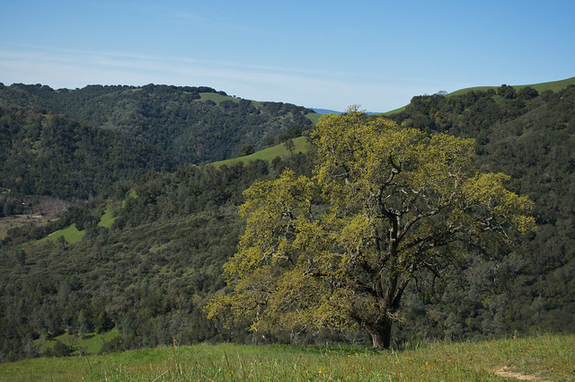
Field Tour - March 26, 2012
High Sierra Ranger District, Sierra National Forest

The half-day field trip scheduled at the Southern Sierra Prescribed Fire and Smoke Symposium last week was snowed out. So participants stayed snug in the High Sierra Ranger District conference room and had a great four-hour conversation. According to the workshop evaluations, it was a good trade: although they missed having a field experience, participants reported wanting more opportunities to share in an open dialog of this kind.

Meeting at the High Sierra Ranger District – Despite being forced inside by weather,
many reported that the four hours of mostly unstructured conversation were productive and useful

Carolyn Ballard, High Sierra Ranger District Fire Management Officer and fire and fuels management specialist on the Dinkey Landscape Restoration Project (CFLRP) led the impromptu dialog. The session opened with Carolyn giving the history of the landscape through a series of photos. Carolyn shared photos of an area on the Sierra National Forest treated with three entries of prescribed fire that is also home to the Pacific fisher. A casual group discussion followed her presentation, covering numerous topics related to prescribed burning and air quality issues. Below are some of the topics of discussion.

General discussion

  • Are we burning this landscape at the appropriate intensities?
  • What are the acceptable ranges of mortality?
  • Are small (3 day) burn windows for prescribed fire forcing fire practitioners to homogenize burns?
  • Penalties and fines for ozone exceedances. San Joaquin Valley Air Pollution Control District was fined $29 million dollars for a recent air exceedance and now residents, business, and all registered vehicles are paying ~$12/registered vehicle. How does smoke from wildland fires contribute to ozone levels?
  • Summer burn windows are available, but there is usually a draw down on suppression crews due to the wildfire season. What should the staffing levels be in the summer months to allow use of these burn windows?
  • In the Great Basin Air Pollution Control District there is low smoke dispersion. The standard is 1-mile visibility for 24 hours. There are many nuisance calls that are made when visibility is in the acceptable range. 80% of the burn days are on marginal days, which are permissive burn days.
  • Both San Joaquin Air Pollution Control District and Great Basin Air Pollution Control District charge a fee for burning – Great Basin is an annual flat fee in accordance with Rule 308. More details at http://www.gbuapcd.org/rulesandregulations/PDF/Rule308.pdf. The San Joaquin Valley APCD charges $5.84/acre (blackened) and $3.50/pile/acre.

Limitations identified

  • Coordination across agencies needs to take place.  Example: A pool of shared funds that would allow agencies to work together on larger landscape burns and also use resources when needed.
  • Staffing and Budget constraints
  • Need for more education/outreach: both within public agencies and for the general public
  • Not enough type 1 fire for keeping up to date with the qualification. Type 1 burns are more complex. For example, a helitorch burn would be considered a type 1 complexity burn.

Needs identified

  • Response to climate change in the larger trees. How does our fire management now affect climate change in the future?
  • How do we incorporate adaptive management and monitoring to help with the climate change uncertainty?
  • Need incentives for allowing fire practitioners to allow fire to burn to man made or natural barriers instead of spending resources to put in a fire line to contain a fire.
  • Training and coordination for increased fire qualification and experience – Prescribed Fire Training School

Things that are working

  • Science to managers


March 26th Keynote Speaker – Evening Social at Di Cicco’s
Rick Sneeuwjagt – Southwest Australia
[Download PDF of presentation]

Rick Sneeuwjagt retired from the position of Principal Fire Projects Officer with the Department of Environment and Conservation (DEC) in southwestern Australia in December 2011, after moving on in May 2010 from his previous post as the State Manager for Fire Management Services for the DEC, a position he has held since 1994.  The DEC is responsible for the fire and land management of about 115 million hectares of conservation lands throughout Western Australia.

In his keynote address, Rick presented on the extensive prescribed burning program in southwestern Australia. The DEC uses large scale prescribed burns (generally ranging from 1000 to 6000 acres in size) to reduce wildfire severity and threats to communities at the landscape scale, as well as to maintain biodiversity for a wide range of species. Rick’s team coordinates closely with researchers within the DEC to monitor the effectiveness of their treatments, and runs an outreach program designed to demonstrate the effectiveness of their prescribed fire treatments to rural and urban communities and politicians. For more information, contact Rick Sneeuwjagt at Rick.Sneeuwjagt@dec.wa.gov.au


March 27th – Clovis Memorial Veteran’s Hall
Southern Sierra Prescribed Fire and Smoke Symposium

About 80 people were in attendance at Tuesday’s symposium, representing numerous disciplines from the Forest Service, the National Park Service, NGOs, universities, the EPA, the California Air Resources Board, and the San Joaquin Valley, Great Basin, Mariposa, Tuolumne, and Monterey Air Pollution Control Districts. The symposium featured a number of presentations describing the ecological need for increased prescribed fire as well as the regulatory framework that manager’s face in implementing prescribed burns. These presentations were followed in the afternoon with breakout discussion sessions to identify the barriers, needs, and opportunities to collaborate around prescribed fire and smoke issues in the southern Sierra Nevada region, as well as the role that a Prescribed Fire Council could play to help take advantage of those opportunities. 

Breakout groups discuss barriers, needs, and opportunities for collaboration around
prescribed fire and smoke issues in the southern Sierra Nevada region.


Featured Presentations

Malcolm North, Pacific Southwest Research Station and UC-Davis

Using fire to increase the scale, benefits and future maintenance of fuels treatments

Malcolm North is a research ecologist with Pacific Southwest Research Station and an associate professor at UC Davis. Malcolm gave an overview of new research he is working on with Brandon Collins (USFS PSW and UC Davis) and Scott Stephens (UC Berkeley). His presentation framed the roadblocks that the large-scale use of prescribed fire and managed wildfire faces in California forests. He outlined historic fuels reduction compared to current fuels reduction, the decline of ecological and economic benefits as fuel reduction is postponed, how to use stretch goals and backcasting to achieve restoration and a desired future condition. Malcolm emphasized that the only effective means of restoring and maintaining California’s forest must include prescribed and managed fire, and provided recommendations regarding how constraints on burning may be overcome in the future. For more information, Malcolm can be contacted at mnorth@ucdavis.edu


Don Hodge, Federal Environmental Protection Agency

Summary of EPA Fire Policy and Exceptional Events Rule
[Download PDF of presentation]

Don Hodge has been with the Pacific Southwest Region office of the EPA since 1994. Don gave a summary of the Exception Events Rule, which is a process to “exclude monitored exceedances of the National Ambient Air Quality Standards from consideration when designating an area as nonattainment” relative to those standards. Don’s presentation outlined the basics of the National Ambient Air Quality Standards, the process to exclude or include NAAQS attainment, and described the characteristics of an air quality exceedance event that would qualify under the Exceptional Events Rule. For more information on the Fire Policy Process, Don can be reached at Hodge.Don@EPA.gov or by phone at (415) 972-3240. For more information on Exceptional Events, contact Katherine Hoag, Air Quality Analysis Office at Hoag.Katherine@EPA.gov or by phone at (415) 972-3970.


Dar Mims, California Air Resources Board

The California Smoke Management Program as a Response to EPA Policy
[Download PDF of presentation]

Dar is the Air Pollution Specialist for the California Air Resources Board. Dar presented an overview of the Health and Safety Code as they relate to the smoke management guidelines of Title 17 of the California Code of Regulations. Dar also summarized the current cooperation of CARB with local air pollution control districts through smoke management plans, air monitoring and meteorological data, and models for evaluating data and making burn day decisions. His presentation emphasized that the California Air Resources Board is committed to continued relationships with stakeholders and improving outreach and education. For more information Dar Mims can be contacted via email at dmims@arb.ca.gov


Shawn Ferreria, San Joaquin Air Pollution Control District

San Joaquin Air Pollution Control District Rules and Operation as a Response to the California Smoke Management Program
[Download PDF of presentation]

Shawn is the Senior Air Quality Specialist for the San Joaquin Air Pollution Control District, which has a jurisdiction of over 25,000 square miles in 8 counties. Shawn presented on the challenges the air district faces with nonattainment for ozone and PM 2.5 and the overall district strategy on prescribed burns and wildfires. Shawn discussed the decision-making process as it relates to burning through seasonality, size, minimizing smoke emissions, location, cumulative impact, and public messaging. Shawn also introduced an ongoing collaborative effort to address the challenges faced by the air district through working closely with land managers and monitoring local and regional smoke impacts. For more information Shawn can be reached at shawn.ferreria@valleyair.org or by phone at (559) 230-5823.

Shawn Ferreria, Senior Air Quality Specialist at the San Joaquin Valley APCD,
presents on compliance issues faced by his district.

Nick Goulette, Hayfork Watershed Research and Training Center

Exploring the Role of Prescribed Fire Councils – Lessons from Northern California and Beyond
[Download PDF of presentation]

Nick is the Director of the Hayfork Watershed Research and Training Center, the co-chair of the Northern California Prescribed Fire Council, and is also involved with the Klamath-Sisykiou Fire Learning Network. Nick presented a summary of issues around increasing the use of prescribed fire and how a Prescribed Fire Council in northern California and other parts of the country are coordinating to overcome the complexities of increased prescribed fire use. Nick’s presentation highlighted the successful collaboration and collective actions of other Prescribed Fire Councils through their “One message, many voices” outreach campaigns. For more information on these messaging campaign visit www.visitmyforest.org and www.goodfires.org. Prescribed Fire Councils are quickly becoming a national organizing force and a national voice for prescribed fire use. Please visit www.prescribedfire.net for additional information on the National Coalition for Prescribed Fire Councils and for more information on the Northern California Prescribed Fire Council visit http://thewatershedcenter.farming.officelive.com/default.aspx. Nick can be contacted at nickg@hayfork.net and by visiting www.thewatershedcenter.com


Brent Skaggs, USDA Forest Service, Sequoia National Forest

Lion Fire Lessons Learned and the Value of Webcams for Monitoring Wildfire
[Download PDF of presentation]

Brent Skaggs is the Forest Deputy Chief on the Sequoia National Forest. Brent gave an overview of the 2011 Lion Wildland Fire in the Golden Trout Wilderness. The Sequoia National Forest is unique because of the webcams that are available on the forest and were used on the Lion Fire to monitor smoke dispersion in surrounding communities. Brent showed a series of slides, including distant views of smoke as well as close up views along the same ridgelines in different areas. The use of webcams gave the forest and the air district the ability to monitor in real time – a valuable tool in monitoring smoke from wildfires. For more information contact Brent at bskaggs@fs.fed.us.


Leland Tarnay, National Park Service, Yosemite National Park

Post-fire Smoke Documentation, Real Time Monitoring and Exceptional Events
[Download PDF of presentation]

Leland is the Physical Scientist and Air Resource Specialist for Yosemite National Park. He presented on the post-fire smoke documentation and monitoring data in Yosemite National Park. Specific topics Leland covered included: daily emissions monitoring on the Tamarack Fire, particulate matter measurements, webcam use, MODIS, and the Hazard Mapping System to help in monitoring fires and smoke in Yosemite National Park. The work that Leland is doing in the park has many practical applications, including public buy-in, operational decisions, and compliance with NAAQS and Title 17. The long-term goals of Yosemite are to build a knowledge base for smoke behavior in the park’s watersheds and to help build resilient landscapes that allow for more opportunity to manage fires. For more information contact Leland at Leland_Tarnay@nps.gov


Northern California Prescribed Fire Council - Spring 2012 Meeting Summary

      Northern California Prescribed Fire Council

      Spring 2012 Meeting Summary

      Blog entry written by Lenya Quinn-Davidson


The Northern California Prescribed Fire Council held its 6th biannual meeting on March 28-29, 2012 in Chico, CA. This meeting was the biggest Council gathering yet, with over 70 people attending the Wednesday field tour and over 100 present at the full-day meeting on Thursday. Meeting attendees enjoyed a break in the storm and basked in the sun at three different field tour sites, chatted over beer at the Sierra Nevada Brewery that evening, and participated in a full day of research and management presentations and workshops in the brewery’s conference room the following day. See below for more details, and check our website at www.norcalrxfirecouncil.org for presentations and more photos. Thanks!

Field Tour – March 28, 2012

This spring’s field tour was organized by Don Hankins, a professor at Chico State University. Don coordinated three different sites for the field tour, including the Big Chico Creek Ecological Reserve (pictured below right), a burn unit in Chico’s Bidwell Park, and the Rio Vista Unit of the Sacramento River National Wildlife Refuge. Prescribed fire is used in all three sites, but each site has unique burn objectives and models of implementation.

At the Reserve, Don explained how he uses fire as a management tool and as a learning opportunity. He plans and conducts burns with his students, approaching fire from a Traditional Ecological Knowledge perspective. For more information, contact Don at dhankins@csuchico.edu.

At Bidwell Park, manager Dan Efseaff explained how they use Rx fire to address invasive plant problems, even though the park is within city limits. They’ve had great success eradicating yellow starthistle, and they have used their burn program as an opportunity for public education and outreach. For more information, contact Dan at defseaff@ci.chico.ca.us.

At the Rio Vista Unit (pictured below), we were hosted by Dale Shippelhoute and Kipp Morrill, both Fire Management Officers with the US Fish and Wildlife Service. They use fire on the refuge for a variety of reasons, including invasive plant control and wildlife habitat restoration. One of the burn units that we visited had just been burned this spring. For more information, contact Dale at dale_shippelhoute@fws.gov or Kipp at kipp_morrill@fws.gov.

Full-day Meeting – March 29, 2012

The full-day meeting was held in the conference room of the Sierra Nevada Brewery, and included a wide range of presentations and workshops. Morgan Varner, the Council Chair, started the meeting off with a round of introductions, demonstrating the diversity of managers, researchers, students, NGOs, and others present in the room. See below for more information on the presentations and workshops.

Don Hankins – Prescribed fire in the Chico Area 

Don, who organized and hosted the field tour the previous day, gave us a comprehensive overview of prescribed fire in the Chico area. A range of agencies and organizations use Rx fire in the region, and Don’s presentation provided great local context for the meeting. For more information, contact Don at dhankins@csuchico.edu.

Eric Knapp – Using fire to restore historic forest structure – opportunities and challenges

Eric, a researcher with the USDA Forest Service Pacific Southwest Research Station, talked about forest restoration in the context of historic forest structure, drawing on research he’s been leading in the Stanislaus Tuolumne Experimental Forest. For more information, contact Eric at eknapp@fs.fed.us. (PDF the presentation)

Morgan Varner – Shifting flammability in northwestern California woodlands and forests

Morgan’s presentation focused on shifts in species composition and flammability in a range of northwestern California ecosystems. These shifts, which can result from lack of disturbances (like fire) and from forest diseases (like sudden oak death), can complicate efforts to reintroduce fire and restore ecosystems. For more information, contact Morgan at jmvarner@humboldt.edu. (PDF of the presentation)

Becky Estes – Effects of thinning on fuel moisture and fire

Becky, a Province Ecologist with the USDA Forest Service, shared results of a study that tracked fuel moisture in thinned and unthinned stands. Results show that fuel moisture differed between the two sites early in the season, but evened out later in the summer, demonstrating that although thinning may result in decreased fuel moistures in the spring, it won’t change fire behavior during fire season. For more information, contact Becky at bestes@fs.fed.us

Nick Goulette – Report on the Trinity Integrated Fire Management Partnership

Nick Goulette, Executive Director of the Watershed Research and Training Center, provided an overview of the Trinity Integrated Fire Management Partnership, a collaborative Rx fire project that’s getting started in the Hayfork Valley this spring. For more information, contact Nick at nickg@hayfork.net.

Rick Sneeuwjagt – Development and application of Rx burning thresholds for the protection of community and biodiversity values in SW Australian forests

Rick, who was visiting from Australia, gave an inspiring presentation about the Rx fire program that he leads in the SW part of his country. The audience was enthralled with the amount of Rx fire they use there, and they were impressed by the sophisticated research and coordination that Rick and his colleagues incorporate into their program. All agreed that California has a lot to learn from that part of the world! For more information, contact Rick at Rick.Sneeuwjagt@dec.wa.gov.au.

Daniel Berlant – Social media and fire

Daniel is a Public Information Officer and CAL FIRE’s primary spokesperson (photo on left). He gave a presentation on social media, explaining the increasingly important role it plays in the communications and outreach programs of government agencies, NGOs, and individuals. Daniel manages the Facebook and Twitter sites for CAL FIRE, and had great insights on effective messaging and communication. For more information, contact Daniel at Daniel.Berlant@fire.ca.gov. (PDF of the presentation)

Afternoon workshops on communications and outreach

Community education for fuels management

Tia Rancourt, Public Education/Information Officer

North Lake Tahoe Fire Protection District, trancourt@nltfpd.net

Social media                        

Daniel Berlant, Public Information Officer

CAL FIRE, Daniel.Berlant@fire.ca.gov

Best practices for communicating your message to the public                          

Susie Kocher and Kim Ingram, UC Cooperative Extension sdkocher@ucdavis.edu and kcingram@ucdavis.edu

Success stories from the Butte County Fire Safe Council

Valerie Glass, Assistant Director

Butte County Fire Safe Council, buttefirechipper@yahoo.com

Public outreach and education for Rx fire in Australia

Rick Sneeuwjagt, Principal Fire Projects Officer

Dept of Environment and Conservation, Rick.Sneeuwjagt@dec.wa.gov.au


Today Show piece on IBHS ember testing

The Today Show aired the below video on IBHS's ember testing facility in Richburg, South Carolina. The Southern Fire Exchange, another JFSP fire science consortium, wrote the below blurb on the facility in their newsletter, Fire Lines.


Wildfires and Home Ignitions: Life Size Testing Indoors

The Insurance Institute for Business and Home Safety (IBHS) Research Center in Richburg, South Carolina has engineered a unique facility to test the vulnerability of full-size structures and structural components to wind-blown embers, direct flame contact, and radiant heat. Research in the facility will help refine specifications and guidelines for home safety in the wildland-urban interface. Post-wildfire observations frequently conclude that ember storms are often more likely to initiate structure ignition than actual flame contact from burning wildland vegetation. Recent studies at the Research Center clearly demonstrate the many different ways this can happen. Learn more about the IBHS facility by reading a recent article in Wildfire magazine or by watching a news clip of a fire test on the IBHS website.

Science Daily article on northern California wildfire trends

The following article from Science Daily about the paper "Trends and causes of severity, size, and number of fires in northwestern California, USA" was published March 1st 2012 on the website ScienceDaily.com. The scientific paper was authored by JD Miller, Carl Skinner, Hugh Safford, Eric Knapp, Eric E, and CM Ramirez.

To read a description of that paper and it in PDF form, visit http://treesearch.fs.fed.us/pubs/40143

To download the new CFSC brief of that article, click here.


Study of Wildfire Trends in Northwestern
California Shows No Increase in Severity Over Time

ScienceDaily (Mar. 1, 2012) — Even though wildfires have increased in size over time, they haven't necessarily grown in severity nor had corresponding negative impacts to the ecosystem, according to a recently published study appearing in the journal Ecological Applications.

A team of scientists from the USDA Forest Service and the University of California, Davis, assessed the size, severity and frequency of wildfires on four national forests -- Klamath, Mendocino, Shasta-Trinity and Six Rivers -- of northwestern California from 1910 to 2008 and their effects on the ecosystem. Fire severity is measured by its impact on resources such as watersheds, wildlife habitat, soils, vegetation and forest products. "High" severity patches within fires are areas where greater than 95 percent of the forest canopy was killed.

The study's key findings include:Map from Miller et al 2012 showing the study area of the paper

  • Despite an increase in total acres burned, there was no trend in the proportion of fires burning at high severity, which indicates that fires have not been getting worse.
  • Most areas burned since 1987 have been at low to moderate severity.
  • The more area burned in a year, the less the proportion that burned at high severity.
  • Lightning-caused fires, which burned at lower severity than human-caused fires, accounted for 87 percent of the 1.6 million acres that burned in northwestern California from 1987 through 2008.
  • Human-caused fires dominated the first half of the 20th century, while lightning-caused fires have dominated the last several decades.

These findings suggest that fires burning under less than extreme fire weather and fuel moisture conditions could be used to attain ecological and management goals since they generally produce less than severe results. In other words, the fires that are easy to put out could actually be used to achieve management goals.

Researchers note that these findings may be unique to the Klamath Mountains where the study was conducted. The steep, rugged mountains in northwestern California present different environmental features compared to the Sierra Nevada where similar studies did show a trend of increasing proportion of high severity over time.

"As we can see from these findings, one size does not fit all when it comes to managing wildfires," says Carl Skinner, PSW geographer, who co-authored the study. "This study has some very important implications for fire and forest management policies. Our results support the idea that wildfires could be managed for ecological benefit in this bioregion."

Current Status of the Sierra Nevada Adaptive Management Project (SNAMP)

(This entry is reposted from the UC ANR Forest Research and Outreach blog)

The 2004 Sierra Nevada Forest Plan Amendment that guides the management of the national forests in the Sierra has been ripe with controversy since its inception. Disagreements over harvesting plan details, the effectiveness of SPLAT fuels treatments and their effects on wildlife and water issues led to the formation of the Sierra Nevada Adaptive Management Project (SNAMP) as a way to address these controversies and learn from the best available science. The US Forest Service, US Fish & Wildlife Service and California Resource agencies contracted with the University of California to be an independent, neutral third party to research key management issues, develop a multi-party adaptive management program that builds on new research and to increase public participation in all aspects of the project. UC scientists are working in five areas: Fire & Forest Ecosystem Health, Water Quality & Quantity, Wildlife (CA Spotted Owl and Pacific Fisher), Spatial, and Public Participation. These teams are conducting scientific research in an open and transparent manner to measure physical and natural processes at relevant management scales, all the while integrating competing public interests, identifying conflicting outcomes and building public trust. The overall goal of this seven year project is to provide the Forest Service and resource agencies with quality information derived from deliberate experimentation that can be used to improve future management decisions and reduce conflict.

SNAMP has two study sites, Last Chance in the northern Sierra and Sugar Pine in the southern Sierra. These sites were selected because they represent the major bio-geographical features of the Sierra Nevada. They have mixed conifer forests with suitable control and treatment watersheds and old forest habitat for species at risk. They are also large enough to support fireshed scale research and active planning by local Forest Service districts for fuels management projects. Two to four years of pre-treatment data has been collected by the UC teams prior to the start of fuels reduction treatments (including thinning, mastication and prescribed fire) that began during summer 2011. Treatments are scheduled for completion by late 2012.

Figure 1
Logs being sorted at the Last Chance thinning project near Foresthill, CA, September 2012.
Photo by Shufei Lei

Analysis of pre-treatment data has led to some initial findings from the various UC science teams. The Forest Team collected data on tree size and species, as well as fuel loading in the study area, then modeled how fire behavior would be affected both before and after the treatment. They predict that both treatments will be effective at moderating wildfire behavior. They also analyzed hundreds of tree core samples and compared growth patterns between live and dead trees. Initial evidence suggests that thinning can improve tree growth even under adverse environmental conditions such as drought.

Figure 2
Dr. John Battles, UC Berkeley forest ecologists shows a SNAMP participant how to read a tree ring core. 
                                                                 Photo by Susie Kocher

The fisher team has used radio collars to track the movements and dispersal of over 66 Pacific fishers in the Sugar Pine area. By retrieving fisher carcasses, the team, in conjunction with UC Davis scientists, has identified the top four causes of fisher mortality in the study site: predation from bobcats, mountain lions and coyotes, disease, rodenticide and road kill.  They are currently developing measures of the population dynamics for the species, including reproduction and survival as well as locations of fisher source and sink areas in the study area.

The CA Spotted Owl Team has identified 75 owls in 48 territories within the SNAMP study area. Using data from monitoring territory occupancy and reproductive success of the owls, initial findings suggest that the owl population is in an overall decline. The team is conducting a retrospective analysis on the history of land use and vegetation looking at all observable changes in owl habitat due to disturbance to identify potential causes of decline.

With meteorological and hydrological instruments, the Water Team records and collects data on a daily basis. This data is fed into computer models to produce potential trends in stream discharge and sediment loading or snow accumulation and snowmelt rates. Using different parameters, such as a reduction in leaf area index (LAI), the team is modeling effects of fuels treatments on stream flows and evapo-transpiration rates.

Figure 3UC Merced graduate student Sarah Martin explaining water team field equipment.

Remote sensing of both study areas was done using Lidar (light detecting and ranging). This data has allowed the Spatial Team to produce many two and three dimensional maps and other products for use by the science teams. Examples include bare earth, slope, aspect and elevation maps; canopy cover and LAI maps; as well as providing information incorporated into fire behavior models. The team has developed methods to detect individual trees from a lidar data point cloud and has used this data to characterize habitat structure for the wildlife teams.

Figure 4        Figure 5
    Digital elevation model and vegetation layers                  Visualization of forest structure developed by the SNAMP
           developed by the UC Spatial Team                                         Spatial Team using Lidar data
   

The role of the Public Participation team is to promote SNAMP through strategic facilitation and outreach and to support the progress of adaptive management. The team reaches many diverse participants through meetings, field trips and workshops; presentations to community leaders and groups; submissions to blogs, industry publications and other media outlets; and the SNAMP website. Current work includes papers on perceptions of forest health, social network analysis and lessons learned through outreach.

Figure 6SNAMP participants in September 2011 on a field trip to see progress in implementation
of the Last Chance Project near Foresthill. Photo by Shufei Lei.

Funding difficulties affected the scope of the project in 2011. However, the majority of funding has been restored and the project will be completed with a few changes to the original scope of work.

Data collection by these teams will continue for a year after the fuels treatments are complete in order to characterize the effects of the treatments on forest health, fire, water, and wildlife. There will be a final report to agency partners and the public in 2014. For more information, please see the SNAMP website http://snamp.cnr.berkeley.edu/.

Tags: forest (3), Lidar (1), Sierra Nevada (2), SNAMP (1), spatial (1), University of California (1)

New book: Fire in Mediterranean Ecosystems

"Exploring the role of fire in each of the five Mediterranean- type climate ecosystems, this book offers a unique view of the evolution of fire-adapted traits and the role of fire in shaping Earth’s ecosystems. Analyzing these geographically separate but ecologically convergent ecosystems provides key tools for understanding fire regime diversity and its role in the assembly and evolutionary convergence of ecosystems. Topics covered include regional patterns, the ecological role of wildfires, the evolution of species within those systems, and the ways in which societies have adapted to living in fire- prone environments. Outlining complex processes clearly and methodically, the discussion challenges the belief that climate and soils alone can explain the global distribution and assembly of plant communities.

An ideal research tool for graduates and researchers, this study provides valuable insights into fire management and the requirements for regionally tailored approaches to fire management across the globe."

Read More

LANDFIRE’s Top 4 List for the Great State of California

This entry is written by Kori Blankenship, a fire ecologist with the Nature Conservancy working for the LANDFIRE program (http://www.landfire.gov/). You can contact her at: kblankenship@tnc.org. Thanks Kori!

You may know that LANDFIRE is a multi-year national project that is producing seamless fire and vegetation related spatial data and ecological models for the entire United States. California, as you certainly know, has a wealth of fire and vegetation related spatial data and local ecological models. Given that fact, why would a Californian care about LANDFIRE products? Briefly, and with the love of enumerated lists, I offer the following:

FOUR GREAT REASONS WHY A CALIFORNIAN SHOULD USE LANDFIRE PRODUCTS

4. To fill in the gaps. A few years back I worked on a climate change assessment for the Northern Sierra where LANDFIRE data was used on a 5+ million acre landscape to fill in the veritable black holes between the National Forest lands where no comparable datasets existed. We cross-walked the LANDFIRE vegetation map units to match those of the Forest maps, stamped our modified LANDFIRE data in the holes and voila (!) – a seamless map was ready for analysis.

3. To supplement local data. Saah and others (2009), recognizing the difficulty of creating or adjusting local datasets for broad scale spatial assessments, compared LANDFIRE data to local data to assess its utility in modeling wildfire behavior and emissions in California’s Sierra Nevada forests. They conclude that “Modification of LANDFIRE inputs based on field data may be the most desirable alternative at this point.” In a different type of application, the BLM’s Bishop Field Office completed its conservation action plan for the Bodie Hills and Mono Basin using local data and modified LANDFIRE data. By applying local adjustments to LANDFIRE data rather than starting from scratch, the BLM saved time and money.  

2. Great support. The quantity of data and tools available today is overwhelming, but few are supported by FREE support materials and a helpdesk staffed by live, responsive and helpful individuals. The LANDFIRE team has just released a series of in-depth guides, how-to videos and step-by-step tutorials to help users get the most out of its products—we call them HUGs (How to Use LANDFIRE Guides) These HUG materials build on existing LANDFIRE courses. Need more help? Contact any member of The Nature Conservancy’s LANDFIRE Team or the LANDFIRE helpdesk (helpdesk@landfire.gov).

1. A Plan for Data Updating. Many organizations have data that are current or nearly current today, but funding to keep them that way may be harder to come by in the future. LANDFIRE has a plan to update its products in the years ahead that could save you money down the road when funding grows scarce. In fact, LANDFIRE recently released improved and updated spatial products current through 2008 on its Data Distribution Site

- - -

If you’re not impressed with my Top Four list, check out the buzz about valuing pollinators in California agriculture using LANDFIRE or see why Van de Water and Safford (2011) consider LANDFIRE’s Biophysical Settings data the “...cur­rent state of the art for linking vegetation and pre-Euro-American settlement fire regimes across California.” LANDFIRE can’t replace local data but you may find it useful for filling gaps or supplementing local datasets particularly if they are outdated. What’s more, we can help you do it!

Tweet us with your use of LANDFIRE data and we’ll share with our followers: @nature_LANDFIRE.


LANDFIRE has two new user support guides available online to help users get the most from its vegetation models and spatial data.

37 Year Journey for Safety

This blog entry is reposted from JFSP's excellent new fire science blog: http://www.firesciencegov.blogspot.com. Check it regularly for updates on JFSP resources for firefighters, managers, and researchers. The JFSP Twitter feed is also a great way to stay connected.

The following entry was originally published on January 5th, and was written by JFSP Communications Director Tim Swedburg.
- - -

37 Year Journey for Safety

My first permanent job with the Forest Service was as a crew member on the Palomar Hotshots on the Cleveland National Forest in 1975.  We learned through the telling of stories by our foremen and superintendents with a large dose of practical experience.   I hope you will take a few moments to allow me to tell a story that means a lot to me and I hope to you as well.


The Cleveland had its share of fatalities starting with the Inaja Fire that resulted in the 10 Standard Firefighting orders.  My engine foreman Red Wilson survived the Decker Fire on the Ortega Highway of the Trabuco District.  The Loop Fire tragedy on the Angeles changed how we think about downhill line construction.  

From the 1970’s fires in southern California, research developed Firescope which became the Incident Command System first deployed on the Pacoima Fire. In 1975, Clive Countryman wrote a paper called “The Nature of Heat” (pdf).

Although I went to school at Humboldt State University, there were no classes in wildland fire science.  This stuff was new!  The Nature of Heat was written in understandable language with numerous illustrations.  Just the kind of publication a Hotshot crew could use. 


In 1978, Carl C. Wilson and James C. Sorenson wrote a pamphlet titled “Some Common Denominators of Fire Behavior on Tragedy and Near-Miss Forest Fires (pdf)”.  This work forever changed the discussions about wildland firefighter safety.  Dick Rothermel’s Spread Model, Behave and the Ti59 soon followed and we could model fires in the field.  Paul Gleason repackaged how we think about fire safety with LCES – Lookouts, Communications, Escape Routes and Safety Zones.  And Brett Butler has helped us understand how big a safety zone really needs to be and that rock pile I used so many times may not have been really safe.

In spite of these and many other pieces of research, fire fatalities continue.  An often heard phrase in these near-miss and fatal fires is, “the fire behavior was unexpected” or “it blew up.”  I’m pleased to announce new research insight for wildland firefighters about Extreme Fire Behavior with the JFSP sponsored publication of Synthesis of Knowledge of Extreme Fire Behavior: Volume 1 for Fire Managers (pdf).  

An even more detailed second volume will be published soon. I ask that all wildland firefighters download the document.  Spend time this winter learning about this subject that is central to everything we do. The Fire Behavior Committee will make changes in fire training based on this information and I urge due speed.  
Most importantly tell your own stories with your crews, unit, or post your thoughts here on firescience.gov.  All this month we will post the “classics” about fire behavior on our website and I hope you find them useful.  
 

Palomar Hotshots during the Gamboa Fire in the Los Padres National Forest 1980

Experience may be the best teacher, but it helps a lot to have the wisdom of science on your side too.  


Be Safe,

Tim Swedberg
Communications Director
Firescience.gov
Joint Fire Science Program

Upcoming UCANR Oak Management Webinar Series

UC Agriculture and Natural Resources will be hosting a series of webinars and field trips regarding management planning for oak woodlands during this spring. See below for more information (text taken from UCANR's Oak Woodland Management website):

Planner's Guidelines for Oak Woodlands


A series of lectures will be presented on the concepts in the ANR publication, “A Planner’s Guide for Oak Woodlands” (UC ANR Publication 3491). The goal will be to create an awareness of the ecological, economic and social values of California’s oak woodlands, and some general planning strategies to ensure long-term conservation of this resource. The selected audience includes city, county, regional and statewide planners, environmental consultants, conservation organizations, land trusts, resource professionals, elected officials, and NGO’s.

A four part series of 2-hour lectures will be offered on-line through a link to Adobe Connect. Publicity will be via lists of local planners, professional resource managers and general oak interest groups, as well as press releases. The series will be taped and a link to the taped webinar series will be provided for those who are unable to participate on the date and time of the live broadcast. There will also be a weekend field trip to Hopland and/or Sierra Research and Extension Centers at the end of the series. Participants will register for the webinar and pay a nominal fee ($30) to receive a copy of the publication, ”A Planner’s Guide for Oak Woodlands” and to cover incidental production fees. A social network site will be developed to enhance the sharing of information, and to provide follow-up networking opportunities. Following the completion of the series, surveys of participants will determine the program effectiveness, and planning activities implemented.

The sessions will be on March 8, 15, 22, and 29, 2012. The topics per session include:
March 8-Session 1: Overview of Hardwood Rangeland Resource
March 15-Session 2: Land Management Strategies
March 22-Session 3: Planning Strategies
March 29-Session 4: Sources of Assistance, Developing Plans

Session 5 includes an optional field trip to the Hopland Research and Extension Center on April 21,2012 and to the Sierra Foothill Research and Extension Center on May 5, 2012 from 10 am to 3 pm. The trip will discuss oak planting projects, landscape considerations, mitigation approaches, and addressing ecological functionality through the planning process.

 
Here's the LINK to the publication:
"A Planner's Guide to Oak Woodlands:"

REGISTER FOR THIS WEBINAR
HERE!