A Burning Need: Landscape-scale Prescribed Fire

by Eric Winford, Coordinator, California Fire Science Consortium - Sierra Nevada

The Sequoia National Forest isplanning to ignite one of the largest prescribed fires in California history – one unit, planned for fall 2014, will be 3,200 acres. The entire burn will eventually cover 14,300 acres over 5 years within the Boulder Creek watershed.

Larger prescribed fires are getting more attention because of the combination of ecological benefits and cost benefits. Most prescribed fires in California are 400 acres or less.[i] Annually, there is an average of 11,000 acres of prescribed fire for all the public lands in the Sierra Nevada.[ii]

The 2010 Sheep Fire as it moved down toward the Kings Rivers. Photo: NPS.

A recent paper in the Journal of Forestry by Forest Service and University of California forest and fire experts calls for a fundamental change in the scale and objectives of fuels treatments to move areas out of fire suppression into fire maintenance. Scaling up the size of prescribed fire can reduce costs, increase ecological benefits, and provide for future maintenance through managed fire. Once treatments have brought the forest into a stand structure that is more resilient to wildfires, firesheds could have their future management converted to maintenance through managed wildfire.[iii]

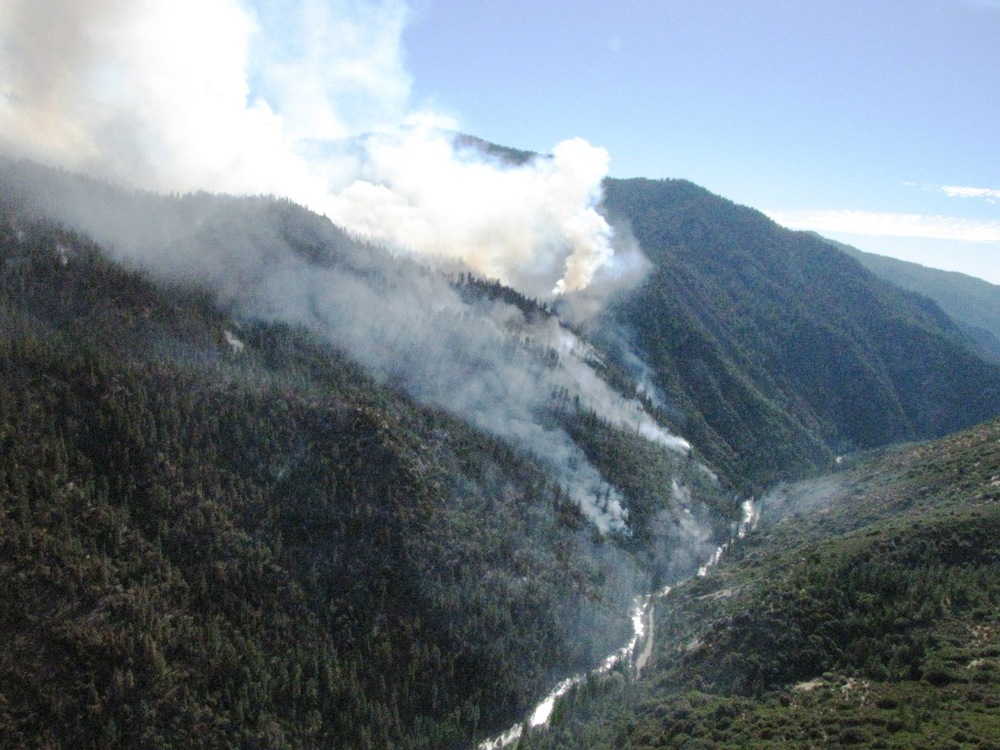
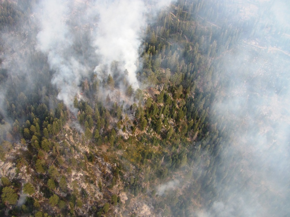
The project is currently waiting for the right time to burn, though they had planned a burn in October 2013, the federal government shutdown limited their window of opportunity. The timing of this first segment is partly based on weather and partly based on the ability to seize an opportunity created by another fire 3 years earlier. Paul Leusch, Fuels Officer for Sequoia National Forest, expects the higher humidity and shorter days of fall to increase fuel moisture so the fire doesn’t burn too intense in the 3,200 acre burn. He’s also using the boundary of the 2010 Sheep Fire to control the perimeter of the fire as it moves down the watershed.

“It was a really nice light burn and it cleaned up the heavy fuels we had in the area,” says Leusch. “Once it was out, we said, wow, if it had gotten into Boulder Creek drainage we could have had 14,000 acres of additional resource benefit.”

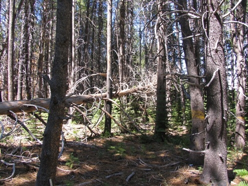
The Sheep Fire was a lightning-started fire managed for nearly 3 months for the ecological benefits that the fire brought to the area. It ultimately burnt 9,020 acres through Kings Canyon National Park and Sequoia National Forest. These types of low-intensity fires make forests more resilient to more intense fires by removing small trees, brush, and fine fuels; they also help cycle nutrients and create wildlife habitat. Leusch hopes that after treating the area with prescribed fire, managed wildfire can be used to maintain the forest.

“We’re considering fire as a tool, “Leusch says. “It’s our hope to have a natural, unmanaged fire cycle and allow natural ignitions to occur.” Portions of the Boulder Creek watershed are in a wilderness area, so there are no roads and mechanical thinning operations are out of the question. “We don’t have road access so everything we need we have to take in by hand,” Leusch says. In such areas, managed fires – either through human ignition or lightning ignition – are often the only way to remove excessive fuels and restore the forest to a more resilient stand structure.  

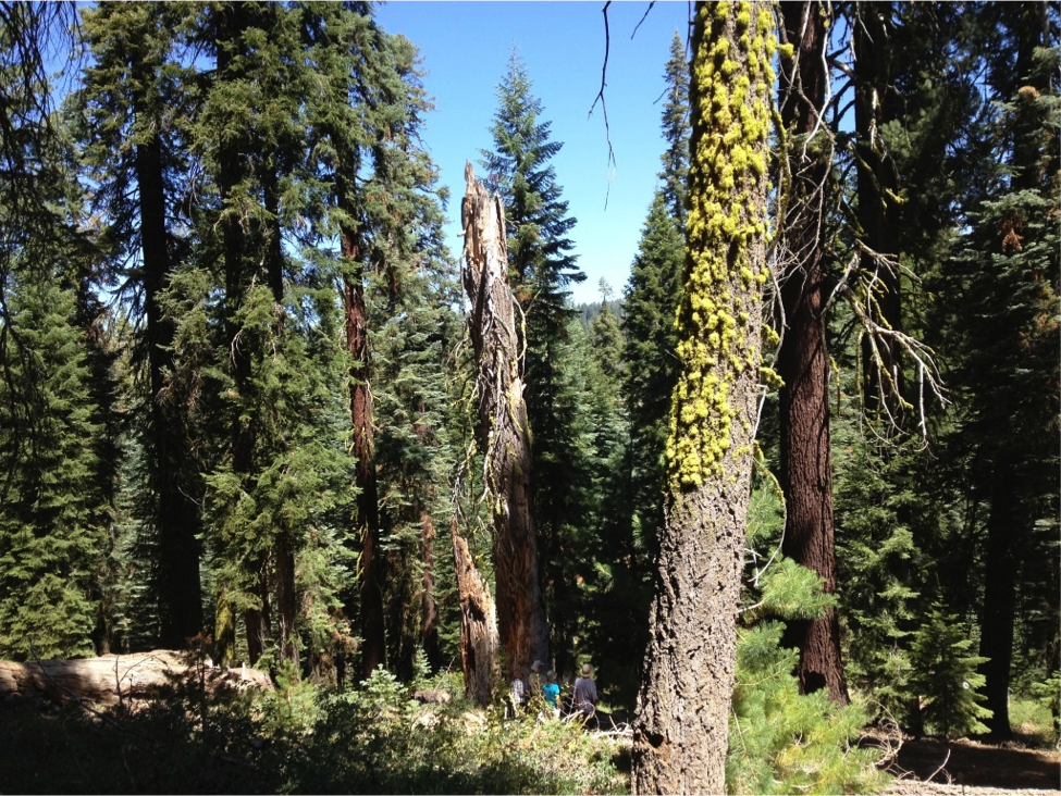
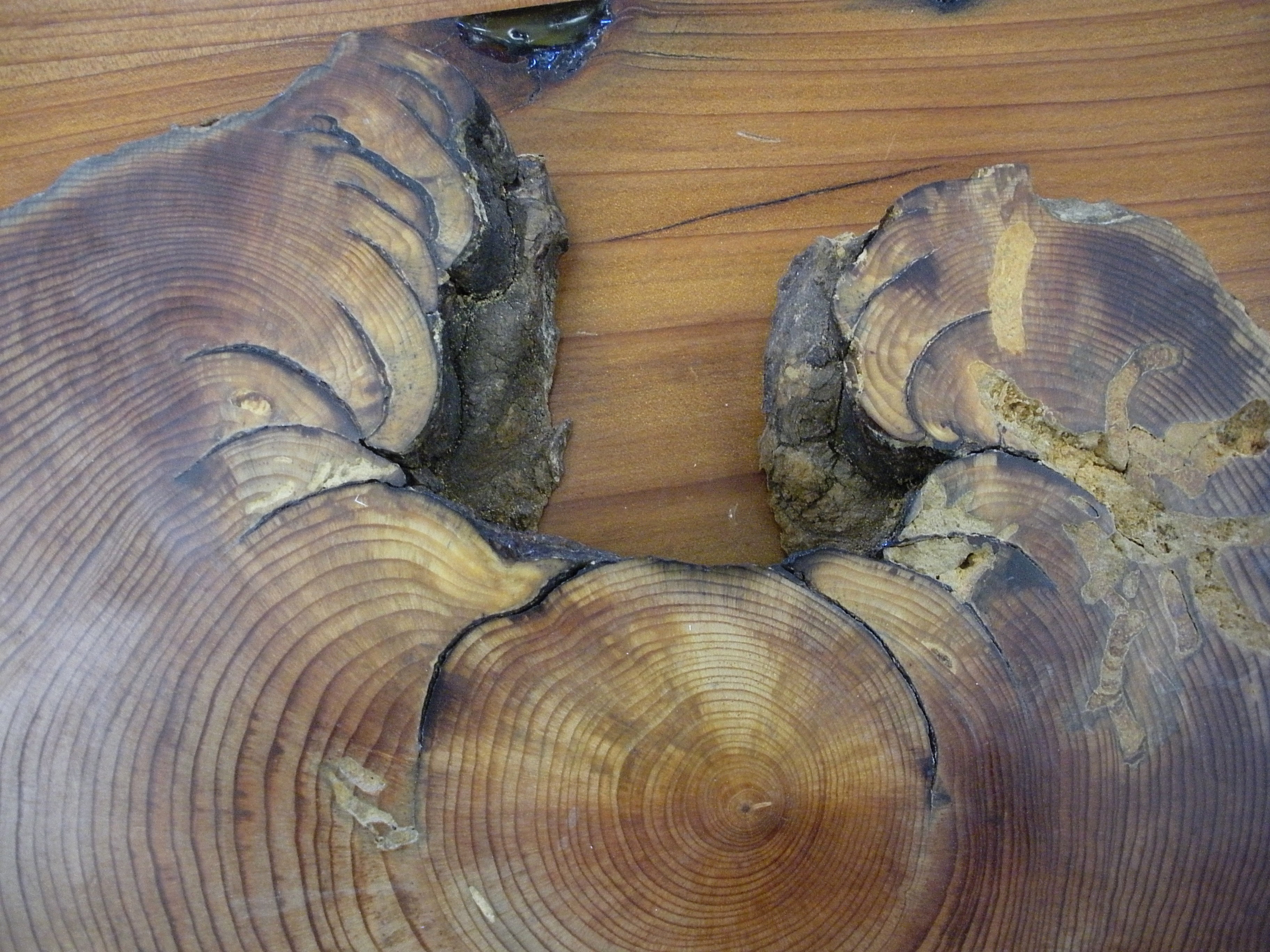
The vegetation in the Boulder Creek watershed changes from red fir at the top of the ridge to mixed-conifer around the middle to a shrub/oak mix at the bottom near the Kings River. It also has three giant sequoia groves – trees that need fire to help with seedling establishment. The historic fire frequency in these vegetation types varies on average from a 5 year cycle at lower elevations to a 45 year cycle at higher elevations.[iv] But with years of no fire in the area, there has been a build-up of fuels.

“This area hadn’t had fire in it for over 100 years and it was primed to go,” says Leusch. Building on the Sheep Fire helps Sequoia NF to increase the scale of prescribed fires. Small fires are fine if only there were enough of them, but funding and air quality – among other issues – limit the opportunity and the window when burns can occur. North et al. (2012) calculated that less than 20 percent of the forestland in the Sierra Nevada is receiving the fuels treatments (either through fire or mechanical treatment) needed to create and maintain historic fuel structures in the forest.[v] With the typical small scale project, there is simply not enough funding to do the necessary work. Cost is one hurdle solved by increasing the scale of the project.


The 2010 Sheep Fire was managed for a variety of resource benefits, including wildlife habitat and fuels reduction. Photo: NPS 

“As the size of the acreage grows in the project the cost per acre drops significantly,” Leusch said. But even as costs per acre drop, air quality remains a concern. Smoke plumes from fires in the Sierra Nevada can hang around local towns and drift down into larger cities in the Central Valley, increasing the amount of particulate matter and ozone to unhealthy levels and creating haze that reduces visibility. The Rim Fire – which was an unmanaged wildfire –  this summer near and in Yosemite National Park created unhealthy air quality conditions in towns as far away as Reno, NV, over 100 miles away.

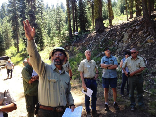
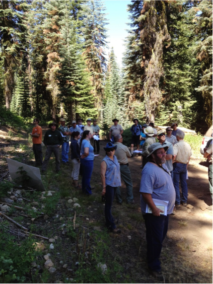
During the two and a half years of the planning stages coordination and collaboration with partners like the San Joaquin Valley Air Pollution Control District, but also with non-profits like the Sierra Forest Legacy, became essential to the success of the project.

“It was definitely a collaborative effort,” Leusch says.

But the relationship does not end at the planning stage. For Trent Proctor, air quality program manager for the Pacific Southwest Region of the USDA Forest Service, communication and coordination with the air board, and monitoring of smoke emissions from the fire, are vital to the success of prescribed fires. The California Air Resources Board limits the days when burns can occur to days when air quality is already good and the weather helps move the smoke away from communities. Prescribed fires ignited in the fall and spring can take advantage of weather patterns that allow the smoke to disperse. The season of the burn and the fuel moisture are two components that help determine the windows when burns can occur. The fuel moisture, along with the outside temperature and humidity, helps determine how hot the fire will burn.

“There is a window in fall we have to hit,” Proctor says. The burn window is limited by high ozone levels in the summer and high amounts of particulate matter from residential stoves in the winter. In addition, more moisture in the winter increases fuel moisture to the point where the fire may not spread like they want. Managers want fuel moistures low enough that there will be sufficient combustion, but high enough so that the fire will not escape control.

Leusch knows there are likely to be pockets of higher intensity fire, but is using the topography to his advantage to keep the fire under control. “We’re starting at the top and letting it back down naturally over a period of days,” he said. “Fire doesn’t carry as well with short days and higher humidities.”

The mix of vegetation types in the watershed, the topography, and the size of the burn will allow for a variety of fire behavior – such as sporadic areas of high intensity – which can be good for wildlife and vegetation alike. According to the recent Forest Service Sierra Nevada “Science Synthesis”, prescribed fires that are variable in their intensity can create heterogeneous forest structures that are more similar to historic conditions (i.e., before European settlement). [vi]  The use of prescribed fire over broad areas without restricting the area burned or the time the fire is allowed to burn can help restore the functionality of forests and provide the habitat variability scientists and managers are seeking.[vii]

The burn had been planned for earlier October of this year, but the federal government shutdown limited the burn window and they had to reschedule to fall 2014. Leusch and others plan to have a smaller 500-acre spring burn in another unit that will help to achieve resource goals.  


References: 

[i] California Department of Forestry and Fire Protection (CDFFP). 2012. Fire Perimeters Version 12_1. GIS Database, downloaded from: http://frap.fire.ca.gov/data/frapgisdata-sw-fireperimeters_download.php.

[ii] North, M., Collins, B., Stephens, S. 2012. Using Fire to Increase the Scale, Benefits, and Future Maintenance of Fuels Treatments. Journal of Forestry 110(7):392-401.

[iii] North, Malcolm, ed. 2012. Managing Sierra Nevada forests. Gen. Tech. Rep. PSW-GTR-237. Albany, CA: U.S. Department of Agriculture, Forest Service, Pacific Southwest Research Station. 184 p.

[iv] North, M., Collins, B., Stephens, S. 2012. Using Fire to Increase the Scale, Benefits, and Future Maintenance of Fuels Treatments. Journal of Forestry 110(7):392-401.

[v] Ibid.

[vi] Collins, B. and Skinner, C. 2013. Fire and Fuels. Chapter 4.1 in Science synthesis to promote resilience of social-ecological systems in the Sierra Nevada and southern Cascades. USDA Forest Service Pacific Southwest Research Station.

[vii] North, M. 2013. Forest Ecology. Chapter 2 in Science synthesis to promote resilience of social-ecological systems in the Sierra Nevada and southern Cascades. USDA Forest Service Pacific Southwest Research Station.


Dinkey Landscape Collaborative Public Field Trip

This blog post is written by Justine Reynolds, Program and Community Outreach Coordinator for the San Joaquin Valley Leadership ForumAll pictures are attributable to Pam Flick , California Representative at Defenders of Wildlife - thanks Justine and Pam!

Notes: Dinkey Landscape Collaborative Public Field Trip

July 19, 2013 9:00 AM to4:00 PM
Eastfork Management Unit

Handouts:

  • Dinkey Collaborative Public Field Trip Workbook: Forest Treatments and Wildlife Habitat
  • Map of Eastfork Management Unit with stops marked

Ramiro Rojas indicating different tree species to the participants 

Stop #1 – Pretreatment Landing, 11S40A

Ramiro explained what tree species were present: white fir, incense cedar, lodgepole pine, sugar pine, jeffrey pine, and black oak. He also explained how to identify each species. He went over the marking guidelines, how they are used, and the scientific basis for the marking guidelines. Carolyn Ballard, District Fuels Officer, added information about fire on this landscape.

Handout: Official marking guidelines for Buck Meadows 11S40 and campground

Participants observing the pretreatment landing site

Discussion:

  • FS does not trim/cut bank trees for stabilization
  • Dead tops were noted
  • Participants noticed large density of small trees.Lots of underbrush, but low
  • Lot of interest in mistletoe and its related opportunistic fungus, species specific mistletoe.
  • Fire return intervals can be between 30-300 years
  • Chipping and biomass question; how much is left and how much is chipped? 

Post Lunch Discussion: Buck Meadows Campground

Ramiro discussed how campgrounds are treated differently. Trees are treated to prevent root rot. Consideration has to be made for structures, and keeping areas open. Minimizing disturbance. Stream nearby also requires riparian corridor considerations.

Stop #2 – Post Treatment Landing and Plantation 10S70

Ramiro explained how the timber was cut, based on what guidelines.Indicated the difference between treated and untreated areas. Pointed out areas where heterogeneity has been maintained. Carolyn Ballard discussed how the brush pile would be dealt with. Some discussion of how contracts are put together and how timber is sold.

Handout: Official marking guidelines for 10S70

Discussion:

  • Noticed water bars
  • Benefits of leaving logs. Is there a problem with methane production?No not rotting.
  • Snags left if taller than 20ft, >15” dbh
  • Open-ness affecting wildlife species? Also provides opportunities for foraging.
  • What is the time period between treatments? When was this site last treated with fire?
  • Earlier hazard sale cuttings are why there are older stumps
  • What is a hazard? Closeness to the road, slope is a factor, has to have damage potential.
  • Variety of size classes and heterogeneity was noted
  • In plantation, piling of brush was noted
  • This unit has a lot of south facing slope, dictates level of harvesting is performed.
  • Brief discussion of bull thistle – noxious weed present in this unit
  • Will we go back to large scale logging? No, b/c that’s not the scope or the aim of this project. The volume produced still makes money. This treatment is new, still building trust
  • Things will shift back. Once we restore, we can sustainably log

Stop #3 – Fisher rest site & marking guidelines

There was a brief discussion of marking guidelines. Specific to help marking crews understand fisher habitat needs. Marked fisher sites include ones identified by PSW as active/used sites, as well as ones marked by FS crews. PSW checks FS marked areas afterwards for fisher activity.

Handout: Forest Plan Update meeting dates

Discussion:

  • What is a rest site used for?
  • Marked with the intention of retention of understory, temperature is cool

Opportunities for Improved Fire Use and Management in California: Lessons from Western Australia

Way back in the spring of 2012 the CFSC hosted Rick Sneeuwjagt, the recently retired State manager of Fire Management Services of the Western Australia Department of Environment and Conservation (DEC), on a "fire science and management tour" of California. We went to a fire and smoke workshop in the southern Sierras and a meeting of the Northern California Prescribed Fire Council, visited field sites, and met with a variety of other managers, administrators, and researchers along the way. 

Rick inspired jealousy among many Californian managers, researchers, and regulators, because the DEC is the land management, research, and regulatory agency that manages and studies fires and smoke throughout the the state of Western Australia. It's the only public land management agency in the state. Compare that to California's multiple state and federal land management agencies and regulatory agencies, which can make a managing fires and smoke (which don't recognize bureaucratic boundaries, as we know) difficult.

A prescribed fire burns in a eucalyptus-riparian area in Western Australia. Image credit: Western Australia DEC / Rick Sneeuwjagt

On top of the bureaucratic advantages of the DEC, that agency has run an impressively large-scale prescribed fire program for 50 years. The program burns an average of 2.5 million hectares each year, which comes out to 6% to 8% of the DEC's forested landscape. Much of this burning is planned to mitigate the risk of wildfires - large burn units averaging over 2000 hectares / 4800 acres (much larger than prescribed burns here in CA) are pre-planned multiple years in advance to maximize fire protection and ecological benefits. 

This DEC map of biomass change post-fire shows the high degree of variability within the prescribed burn unit. The width of the fire shown is roughly 7 kilometers. Image credit: Western Australia DEC

That's a lot of burning by any standards, but just as impressive is the amount of collaboration with researchers. The DEC managers and scientists work closely to study and improve the outcomes of their burns. One example: by burning in such large units, they've found that they not only reduce costs per acre but also create a highly beneficial mosaic of fire severities, fuel ages, and habitat types. The findings of DEC fire research are translated into public announcements to improve the understanding of fire use as well as to help convince politicians of the need for prescribed fires to prevent wildfires in Western Australia's seasonally dry, mediterranean climate.

We learned a lot from Rick's visit, and wrote up a report that's featured in the Forum section of August 2013 issue of Fire Ecology. We tried to focus on making constructive suggestions for fire management and policy in California, based on the successes and challenges seen by the DEC in Western Australia. We looked at six different areas: 1) novel man- agement practices, 2) inter-agency collaboration, 3) regulatory collaboration and policy, 4) research integration, 5) cultural acceptance, and 6) political support of prescribed fire.

Read the comparison here, and let us know if you have any responses through email or Twitter @CaFireScience

Western Australian fire manager Rick Sneeuwjagt meets with USFS Region 5 Regional Forester Randy Moore.

Sierra forests need to burn more often

Overcrowded forests are common in the Sierra Nevada.

This blog entry is re-posted from the UCANR Green Blog.

Fire ecology - a ‘hot’ career to attract students to science

* This is a re-posted blog entry from the UCANR Green Blog.

Fire ecology - a ‘hot’ career to attract students to science

Author: Kim Ingram

April 15, 2013

Ask most youth what they think about wildfires in forests and they will usually respond with "they kill trees and animals" or "it’s bad – they burn down homes and put out lots of smoke." They are partially right.

Ask youth about considering a career studying the history of fire from a tree cookie, a slice of tree branch that shows the rings, or lake bed sedimentation. Or ask them what role wind plays in how a fire jumps from treetop to treetop or how wildfire can help open pine cones and produce a huge flower show. Then they might respond with, "No way, is that a real job?"

Two eighth-grade students at Sutter Middle School in Sacramento got a chance to learn about fire ecology careers through a project in their science class requiring researching science careers. Students Maura Ingram and Jordan Johnston decided to explore fire ecology and learned that fire is a hot career choice.

Maura and Jordan interviewed Scott Stephens, professor in the Department of Environmental Science, Policy and Management at UC Berkeley*, about fire ecology careers. They learned that fire ecology as a discipline focuses on the origins of wildland fire and its relationship to the environment, both living and non-living. Fire ecologists recognize that fire is a natural and important process in the forested ecosystem, one that both animals and plants depend on.

“Some fire ecologists will be fire managers working with the U.S. Forest Service, National Park Service or private companies and will ignite and manage prescribed fires and manage wildfires,” Stephens said. “Other fire ecologists with jobs like mine will do research and write papers as teachers and university faculty. That will help guide fire managers in their work. More people are getting interested in fire ecology and the field has really grown in the last 15 years."

"Fire effects the forested landscape, by shaping the patterns of vegetation growth and mortality, recycles nutrients and changes the foraging and reproductive habitat for wildlife,” Stephens continued. “Fire is a critical part of most ecosystems in California and not allowing it to operate is causing great harm. We can do some operations with mechanical thinning and other methods to duplicate some aspects of fire, but not all of them.”

Anu Kramer and Kate Wilkin, UC Berkeley graduate students in the Stephens Fire Lab, showed Maura some of the tools they use in fire ecology research, such as lidar, computer fire models and the fire vortex used to demonstrate fire physics and extreme fire behavior.

“Extreme fire can create its own weather patterns including the creation and collapse of a fire column which can be very dangerous,” said Anu. “The fire vortex helps us visualize this on a small scale for our research.”

Maura and the fire vortex. (Photo: Kim Ingram)

Maura and the fire vortex. (Photo: Kim Ingram)

UC Berkeley students and researchers are working to understand how warming and precipitation changes due to climate change will affect fire frequency and behavior, and how fire disturbances affect plants by conducting scientific research and providing training in the fields of wildland fire science, ecology, and resource management. Students and researchers participate in interdisciplinary efforts when possible and share findings by publishing results in peer reviewed academic journals, posters for academic conferences, and conducting outreach to schools. Berkeley provides high quality scientific training and guidance for graduate students that will prepare them for careers in academia or professional fire science, policy or management.

“When you think about fire-related careers, most kids think that firefighters are the only ones that deal with fire directly,” said Maura. “But the career opportunities are endless. I have learned a lot about how important fire is. Fires can still cause a lot of damage to the forest and homes, but studying fire ecology is helpful because we can then use the data to apply fire in a more beneficial way – ways that help the forest, wildlife and the overall environment."

Tree cookies, horizontal slices from a tree trunk, are another tool used to estimate the total number of fire events in an area and how often a fire occurred in a tree’s life, as well as how the tree recovered from the fires. (Photo: Kim Ingram)

Tree cookies, horizontal slices from a tree trunk, are another tool used to estimate the total number of fire events in an area and how often a fire occurred in a tree’s life, as well as how the tree recovered from the fires. (Photo: Kim Ingram)

Stephens is one of the principle investigators of the Sierra Nevada Adaptive Management Project (SNAMP). SNAMP is investigating how fuels thinning projects effects fire behavior and forest health, water quality and quantity, and wildlife.

Kate Wilkins and Maura at the Stephens Fire Lab. (Photo: Kim Ingram)

Kate Wilkins and Maura at the Stephens Fire Lab. (Photo: Kim Ingram)

Kate Wilkins and Maura at the Stephens Fire Lab. (Photo: Kim Ingram)

Cal-Adapt website tools visually project future climate change effects in CA

This is a re-posted entry from the UCANR Forestry Blog.

Using Cal-Adapt.org to get a local snapshot of the future climate in California

Background

By 2008, the Public Interest Energy Research Program (PIER) led by the California Energy Commission (CEC) had collected more than 150 peer reviewed reports on climate change, had funded dozens of researchers and organizations investigating climate change scenarios, and produced thousands of statewide GIS (geographic information system) data layers depicting downscaled climate projections across the state. The agency had a number of needs: they wanted relevant information presented in easy to understand themes and topics, they wanted interactive maps and charts providing a variety of approaches to explore different aspects of climate change; and they wanted improved access to primary climate change data in GIS and tabular formats.

The agency wanted to develop an innovative web based platform to increase access to the wealth of climate change research and data being produced by the scientific community in California. They wanted a platform that addressed multiple types of publics: we wanted to address the general public, who want to learn about climate change data relevant to their area, we wanted to address local planners and technicians, who need to obtain meaningful information and data to help guide locally relevant climate action plans and adaptation strategies, and we wanted to address the scientific community, who need to access primary data relevant to an area of interest.

We at Berkeley’s Geospatial Innovation Facility (GIF) (http://gif.berkeley.edu) worked with the CEC to develop the “Cal-Adapt” analysis platform as an open source, web-based GIS and visualization project.  The Cal-Adapt.org website is a new resource for the state of California that: 1) hosts a wealth of GIS data on modeled climate futures, 2) allows users to visualize past and future projected climate layers in a map framework, 3) provides all the data for download. This blog gives you a quick look around the website. Please feel free to explore the site, and your own area.

Cal-Adapt's development is a key recommendation of the 2009 California Climate Adaptation Strategy: “The California Energy Commission will develop the Cal-Adapt Web site that will synthesize existing California climate change scenarios and climate impact research and to encourage its use in a way that is beneficial for local decision-makers.” – Page 9, 2009 California Climate Adaptation Strategy.

The Climate Background

Scientists studying climate change usually frame climate discussions in terms of four climate scenarios, of which two had been downscaled for California by Scripps Institution of Oceanography called “B1” - The lower emissions scenario, and “A2” - The medium-high emissions scenario. Scientists use a multitude of different global circulation models, each developed and run at different scientific labs, project how the climate will change under each of these two scenarios. Four of these were models were used by scientists at Scripps and made available to Cal-Adapt:

NCAR - National Center for Atmospheric Research Parallel Climate Model (PCM1);

CCSM - Community Climate System Model Version 3.0 (CCSM3);

GFDL - Geophysical Fluids Dynamic Laboratory (GFDL) CM2.1; and

CNRM - Centre National de Recherches Météorologiques.

Each model uses different assumptions and drivers and can lead to differences in their outputs, so there is an advantage to using a variety of these models when conducting analyses.

Local Snapshot Example: Eureka and Humboldt County, California.

Humboldt County, located in Northwest California, is the southern gateway to the Pacific Northwest. The County is bound on the north by Del Norte County; on the east by Siskiyou and Trinity counties; on the south by Mendocino County and on the west by the Pacific Ocean. The County encompasses 2.3 million acres, 80 percent of which is forestlands, protected redwoods and recreation areas. Humboldt County faces a range of changes to its local climate: temperature, snowpack, fire regimes and sea level. Each of these can be explored with Cal-Adapt Local Snapshot tool.

Temperature scenarios for Humboldt County, CA

Changes in Temperature

For example, if you want to explore the temperature changes projected over the next century, you can use our local climate snapshot tool. Figure 1, left, is the projected change in annual average temperatures across in Humboldt County’s under a low carbon emissions scenario (B1). The map above shows the projected difference in temperature between a baseline time period (1961-1990) and an end of century period (2070-2090).

In some areas of California, such as San Bernardino County, the average annual temperature is expected to go up by as much as 4°F (low emission scenario) to 7°F (high emission scenarios; in Humboldt County, temperatures are expected to increase by between 3° F to 5°F (low emission to high emission scenario). 

Changes in Snowpack

Projected changes in snowpack in Humboldt County, CA

Figure 2, right, shows the projected changes in April snow water equivalence (SNWE) across Humboldt County under a high carbon emissions scenario (A2). The map shows the projected difference in snow water equivalency between a baseline time period (1961-1990) and an end of century period (2070-2090). According to the projections, in some areas of California, up to 25 inches of snow water are expected to be lost in April over the next century. In Humboldt County, the modeled historical average snowpack is 2.91 in. Under the low-emissions scenario, snowpack is projected to be 88.5% of that amount; under the high-emissions scenario, 98% of snowpack is projected to be lost.  These drastic projections are thought to be the results a combination of factors including not only a decrease in preciption, but an earlier melt given warmer temperatures.

Projected sea level changes in Humboldt County, CA

Figure 3, left, shows areas vulnerable to a 100 year flood event as sea level rises. The blue areas on the map indicate areas already in threat today, while the lighter shades are areas projected to also be in threat given the expected sea level rise. Humboldt County has a long coastline, with considerable areas of coastal wetlands that might be vulnerable to sea level rise. According to the projections from the Pacific Institute, 18% more land in Humboldt County may be vulnerable to a 100 year flood with a 1.4m sea level rise. 43,067.4 acres are vulnerable now, with a 1.4m sea level rise, 52,607.3 acres could be at risk. Some areas of the state, including the San Francisco Bay Area face increases of up to 40+% in areas vulnerable to sea level rise.

Changes in Fire Regime

Projected changes in fire regimes in Humboldt County, CA

Figure 4, right, shows projected increase in potential amount of area burned in 2085, as compared to present risk, across Humboldt County under a low carbon emissions scenario (B1) for the CNRM model. The darker oranges displayed on this map above suggest up to a 3-fold increase in potential area burned. Other areas in California have a higher risk, for example, Siskiyou, Modoc and Shasta Counties have high projected increase in fire risk in the next century. These data and projections come from UC Merced: Climate Applications Lab.

Information Sharing

The website allows for sharing with your colleagues in a range of ways. You can create links that save your zoomed map with all its content and visualization choices, and these are shareable through Facebook and other social media projects:

You can also use many other sharing tools:

 Data Downloads

In addition to the examples above, there are many other data available for visualization and download at the Cal-Adapt.org website. For example, you can view and download monthly layers, from 1950-2099 for the following datasets: Actual evapotranspiration, Average temperature, Baseflow, Fire, Fractional moisture in the entire soil column, Maximum temperature, Minimum temperature, Net surface radiation, Precipitation, Relative humidity, Runoff, Snow water equivalent, Soil moisture at bottom layer, Soil moisture at middle layer, Soil moisture at top layer, and Wind.  These data can be downloaded in a range of formats, over any date range, and directly integrated into your own GIS or modeling software package.

More Information:

The site has been developed by UC Berkeley's Geospatial Innovation Facility (GIF) with funding and advisory oversight by the California Energy Commission’s Public Interest Energy Research (PIER) Program, and advisory support from Google.org.  The data used within the Cal-Adapt visualization tools have been gathered from California’s scientific community, and represent the most current data available wherever possible.  Learn more about the variety of scientists and organizations that have contributed data and resources to Cal-Adapt. For more information about mapping for a changing California, see Maggi Kelly’s website at: http://kellylab.berkeley.edu.

Wildland fire management video resources

The latest JFSP newsletter included two great resources for online fire science learning, so I thought I'd repost them here:

Southwest Fire Science Consortium Lessons Learned Videos

Widland Fire Lessons Learned Center Youtube Video Library

(Youtube is currently accessible on most federal computers.)

If you think that the California Fire Science Consortium should make some similar videos, let us know what topics you think would make good videos. We've  been currently focusing on written briefs/syntheses, webinars and in-person events instead of videos (in part because these are cheaper for us to make a lot of...), but videos could be an option in the future. The two sites above are great examples of the usefulness of short videos.

Represented through cake: mixed-conifer post-fire succession

Something so rare and wonderful happened this week that it must be shared:

The Stephens Wildland Fire Science Lab at UC Berkeley recently hosted a departmental happy hour. To celebrate the occasion, Stephens Lab PhD candidate Anu Kramer illustrated a typical Sierra Nevada post-fire succession in the form of three cakes:

The first cake, shown above, represents a dense Sierra mixed-conifer forest. Large sugar cones with green rice crispies are large remnant pines. The smaller cones with green shredded coconut represent invading shade-tolerant fir trees. Slivered almonds represent a heavy buildup of surface fuels.

To represent immediate post-high-severity fire effects, Anu employed a highly accurate rendering of stand conditions using a dense, flourless chocolate cake.

A passionfruit cake with chocolate-coconut frosting was used to demonstrate one year post-wildfire regeneration. Note the vibrant understory regeneration with wildflowers.

How's that for effective science communication? Pretty darn good, I'd say.

Big thanks to Anu for the cakes!

Photo credits to Anu Kramer and Lauren Hallett.

Northern CA Rx Fire Council - Fall 2012 meeting summary

This entry is written by Lenya Quinn-Davidson, the director of the Northern California Prescribed Fire Council and the coordinator of the consortium's northern California region.

Fall 2012 Meeting Summary

Well, we’ve done it again! One week ago, the Northern California Prescribed Fire Council held another successful meeting, this time in the Tahoe Basin. Like the spring meeting in Chico, we had over 100 people in attendance, and as usual, it was a diverse group. We had local folks from Tahoe there, in addition to fire managers, residents, government officials, researchers, and others from across northern California. We also had people come from as far away as Florida, Mississippi, Utah, and Washington, and we had a few participants from southern California. It was a great crowd!

John Washington and Kyle Jacobsen of the USFS LTBMU describe the challenges of burning in the Tahoe WUI. Photo: Susie Kocher

Steering Committee Strategy Meeting

On the evening of Wednesday, November 7, the council’s Steering Committee had their annual strategy meeting. The committee welcomed three new members: Eamon Engber, Fire Ecologist at Redwood National Park; Tom Garcia, Fire Management Officer at Whiskeytown National Recreation Area; and Jeff Kane, Professor of fire science Humboldt State University. The committee also named Lenya Quinn-Davidson, the long-time coordinator of the council, as the Council Director. These changes will help provide stability and leadership to the council as we begin transitioning to a new Chairperson. Morgan Varner, our current Chair and one of the co-founders of the council, has taken a faculty position at Mississippi State University, and he will be leaving the Chair position next spring. During the meeting, the committee also discussed upcoming projects and goals of the council, and worked on a strategic planning document, which should be ready for distribution at the spring meeting.

Conference, South Lake Tahoe, November 8, 2012

On Thursday, November 8, we met at the Embassy Suites in South Lake Tahoe for a full- day conference. Speakers included Joe Millar, the Director of Fire and Aviation for Region 5 of the Forest Service, as well as Norb Szczurek, Division Chief for the North Lake Tahoe Fire Protection District, and several top fire scientists, including the Forest Service’s Hugh Safford, Scott Stephens of UC Berkeley, and Jeff Kane of HSU. In the afternoon, we had workshops by Sonoma Technology, Inc., the Fire and Environmental Research Applications (FERA) team out of Seattle, and Miriam Morrill of the US Fish and Wildlife Service. We capped off the evening with a mixer at the hotel, dinner out at local breweries and restaurants, and the premiere of a new documentary on prescribed fire, put together by Will Harling and Stormy Staats of the Mid Klamath Watershed Council in Orleans, CA. The documentary will be available on DVD soon, and will be a great resource for the northern California prescribed fire community. It will also be featured at AFE’s International Fire Congress in Portland next month, but we got to see it first! Start thinking about whether you can organize a viewing in your hometown.

Field Tour, November 9, 2012

This unit is located below expensive homes in Incine Village and was treated with an understory burn in 2011. Photo: Susie Kocher.On Friday, brave meeting participants set out into the fresh snow to see how prescribed fire is used in the Tahoe Basin. First we visited two Forest Service burn units on the eastside of the lake. John Washington and Kyle Jacobsen, both fire managers with the USFS, led the group in a discussion of the challenges and opportunities present in the area.

The group spent the second half of the day with Norb Szczurek and Forest Schafer of the North Lake Tahoe Fire Protection District in Incline Village. They toured the impressive NLTFPD facilities, rode in the district’s crew buses, and took an inspiring walk through some of the units that Norb and his crew treat with prescribed fire. Many of those units are on steep, shrubby terrain below million dollar homes, but the NLTFPD has been successfully treating those areas for years with the support and trust of the local community. Needless to say, field tour participants were greatly impressed and inspired by the work of this municipal fire department.

Next NCPFC Meeting

We are planning our spring meeting for sometime in April in Mendocino County. We will be in touch early next year with more details. Please contact Lenya at nwcapfc@gmail.com if you have questions or ideas, or if you want to join our mailing list. We look forward to seeing you then!

Best practices for working with the media: Fire training

As most fire managers in California already know, getting mediaattention for fire and fuel treatments can be a challenge in our already saturated media markets. And if just getting coverage isn't hard enough already, working to make sure that your treatment - be it a prescribed fire, thin, or managed wildfire - is accurately presented presents another hurdle. The below guide from The Nature Conservancy's Fire Learning Network details a list of best practices for not only garnering media coverage in the first place, but also for prepping your team's message so that the resulting story gets your key points across to the public. While this guide is specific to a training event for fire staff, much of the same practices could be applied to any fire-related event.

You can download TNC's PDF of this guide here. Many thanks to TNC for letting us share this!

Background & Story:

The Nature Conservancy, Fire Learning Network and Santa Fe National Forest hosted an International Prescribed Fire Training event in northern New Mexico. The fire training brought Spanish-speaking and bilingual forest experts together from Argentina, Puerto Rico, Mexico and the U.S. to share and learn about prescribed burns, fire management and conservation practices to take back to their home landscapes. They implemented several prescribed burns, in addition to orientations and presentations. The fire exchange programs began in 2008 to help address the nation’s shortfall of qualified burners.

Placements:

Media staff working with event organizers secured eight placements from local newspapers and national outlets, ranging from E&E Greenwire and NY Times online to Univision and local radio and newspapers (see box for links).

Recipe for Success:

a. Great story elements:

  • topical (came on the heels of one of the worst wildfire seasons)
  • great visuals (fire on ground, forests)
  • heroes
  • critical work (protecting communities, water supplies, recreation)
  • global impact (experts participating from many countries)

b. Early planning
c. Pitching persistence
d. Great on-the-ground coordination

Timeline for Success:

3 Months before the Event:

  • Research the topic and develop questions for the leader
  • Meet with project leader to assess media goals and logistics, identifying opportunities and challenges:
    • Opportunity: Leader Jeremy Bailey clearly stated that media was important to the event and that he would take measures to ensure journalists could get on the ground and close to the action, and that fire experts would be prepped for interviews. Jeremy also communicated the importance of 24 hours’ notice being needed to ensure the best possible story and the safety of all involved.
    • Challenge: The event would be taking place over the course of two weeks, an hour-and-a-half to two hours from the metro media market, and in an area with spotty cell service.
  • Gather assets such as photos and video that can be shared with media. For example, I solicited head/field shots of Jeremy in case he was booked for a TV phone interview, since the Albuquerque metro area media market was two hours away.
  • Contact partners early to discuss media strategy/roles/deadlines. The Conservancy took the lead on this project. We agreed I would keep Forest Service in the loop when we secured interest.

1 Month before the Event:

  • Write a media release and vet it through partners.
  • Build a local targeted media list. Because fire experts were Spanish- speaking or bilingual we reached out to Spanish-language media.
  • Meet/communicate with other media teams in the organization to discuss regional/national outreach ideas and determine roles. In this case, I was going to reach out to the NY Times and E&E while the national office con- tacted Univision.

1 Week before the Event:

  • Email pitches/release with photos. I included a note that the training leaders needed 24 hours’ notice to ensure the best possible story and safety.
  • Follow-up phone calls: be persistent, take notes and schedule return calls.
  • As soon as I secured interest, I connected the journalist with Mary Huffman, who managed on-the-ground media coordination. I reminded the journalists that the leaders requested 24 hours to set up interviews to en- sure best possible story, on the ground with fire. (Managing expectations!)
  • Mary and I tracked media hits and shared stories with key team players/ partners/leadership. It was exciting to share the tremendous work on the ground through the creative media stories.
  • In an effort to extend our reach, some of the story links were posted on Facebook sites (e.g. FLN and NM and national Conservancy sites).

Lessons Learned:

Keep calling reporters until you connect live and in person. I was determined to get Univision to cover this story. I called four times before connecting live with a reporter. If you haven’t developed a relationship with a reporter inside a media shop, you may have to try a couple different ones (one at a time). One reporter may not get jazzed with your story, but his neighbor loves it. If I reach out to a second reporter in the same shop, I always mention I tried to connect with the other person but didn’t have success (full disclosure). I had success with Univision and KOAT (ABC) with this tactic.

Logistics were challenging. Fire experts were working long days in the woods where there was little or no cell service. In most cases, connections with media needed to be made early in the morning or in the evening. We realized this very early in the game. Mary Huffman stepped up to be our on- the-ground media coordinator. She responded as quickly as she could. She was thorough and ensured our media partners had everything they needed. The role Mary filled was critical to our success.

For more information, contact:

Jeremy Bailey

Fire Learning Network / Training
jeremy_bailey@tnc.org (801) 599-1394

Mary Huffman
Fire Learning Network
mhuffman@tnc.org (720) 438-5811

Tracey Kiest Stone
Senior Media Specialist
tstone@tnc.org (602) 322-6999

Media Coverage of International Prescribed Fire Training Exchange:

Rio Rancho Observer “Fire Experts Train in Area Forests”
http://www.rrobserver.com/news/local/article_e07b0466-feb1-11e1-adf8-0019bb2963f4.html

Univision New Mexico (Jim Morrison) regional newscast (story begins at 22:21)
http://www.kluz.tv/segmento/33/streaming/noticieros.html

Los Alamos Monitor (Tris DeRoma) “Fire Network Hosts Exchange”
http://www.lamonitor.com/content/fire-network-hosts-exchange-more-photos-added

New York Times Green blog (Glenn Swain)
“Burning a Forest to Save It”
http://green.blogs.nytimes.com/2012/09/26/burning-a-forest-to-save-it/

Greenwire (April Reese) “Learning Goes Both Ways in Nature Conservancy’s Fire School” http://www.eenews.net/Greenwire/2012/10/03/archive/11?terms=fire+new+mexico

A Future With Fire

by Lenya Quinn-Davidson
August 22, 2012

(This blog post is from the Summer 2012 issue of the Trees Foundation's Forest and River News)

It has been four years since the summer of 2008, when lightning strikes in late June ignited fires throughout California. During that fire season, over 1.3 million acres burned throughout the state; smoke filled our valleys for several months, and many of us saw the flames up close as we traveled from one region to another. We're all reminded of that summer every time we drive through the mountains of Northern California, or when we crack open a smoky bottle of 2008 wine.

For me, the 2008 fires were meaningful in a number of ways. I grew up in Hayfork, in the heart of Trinity County, where big fire years punctuated my childhood. I was 5 years old in 1987, when wildfires burned 54,000 acres, or 19%, of forests on the Hayfork Ranger District. I was 10 years old in 1992, when the Barker Fire almost burned down my best friend's house. And I was getting ready for my last year of high school in 1999, when the Lowden Fire--an escaped prescribed burn--devastated much of the nearby town of Lewiston. As luck would have it, 2008 was another important year for me: in June, I was preparing to head to Hayfork for the summer to start my master's research, which (coincidentally!) was focused on community support for prescribed fire.

Smoke from the 2008 wildfires in Hayfork, CA.
Photo: Brian Gossman

I hadn't planned my research to coincide with the biggest fire year in recent history; in fact, I was quite concerned that it would skew my results. Interviewing people about prescribed fire while they're choking on smoke probably isn't the best way to get an unbiased response. I thought the smoke, the fire crews, and the blackened hillsides would spark people's memories of the Lowden Fire, and their support for prescribed fire would, therefore, seem unusually grim.

Indeed, the wildfires did take center stage in my interviews--people wanted to talk about fire suppression tactics and costs, and I had to figure out a way to address my research questions in concert with those timely topics. However, the main themes that emerged in my interviews were not negative; in fact, people were surprisingly focused on the natural role of fire in the ecosystem, and they consistently framed negative remarks about the wildfires in the context of what they perceived to be the real problem: poor forest health and a lack of resilience resulting from a century of fire suppression.

New approaches, new attitudes

Though the attitudes I encountered in Hayfork were not what I expected at the time--especially given the 220,000 acres that burned in the Shasta-Trinity National Forest that year--I've come to see them as a signal of larger shifts in the way that people perceive and understand fire. These changes are occurring in the public sphere, as I observed in Hayfork, but they are also pronounced in the scientific and management communities, where there is increasing attention not only to fire science and ecology, but also to communication and collaboration.

Prescribed fire in the Bald Hills of Redwood National Park. The Park uses prescribed fire to maintain its oak woodlands and prairies and ward off encroachment by Douglas-fir.
Photo: Eamon Engber

In California, there are two major efforts that speak to this changing culture and attitude in fire: the Northern California  Prescribed Fire Council and the California Fire Science Consortium. Both of these groups are collaborative, involving a diverse array of organizations, agencies, and individuals, and both are focused on cultivating new knowledge, capacity, and cooperation within the state's fire community. I've had the honor to be involved in both of these groups--as the Coordinator of the Prescribed Fire Council since its inception in 2009 and more recently, as the primary staff person for the Northern California region of the Consortium--and I'm excited to use this space to share some of the resources and opportunities offered by these two groups. In their own ways, the Council and the Consortium are paving the way for a more fluid, grounded, participatory approach to fire in our region.

Northern California Prescribed Fire Council

In 2009, a small group of fire scientists and managers joined forces and spearheaded the Northwestern California Prescribed Fire Council. The Council joined over 20 other state and regional councils across the country, all working on issues and impediments associated with the responsible, effective use of prescribed fire. At that time, the Council was focused only on the northwestern corner of the state: west of Interstate 5 and north of highway 20. However, after the second meeting of the Council--where the audience included a number of interested folks from the northeastern and central parts of the state--Council participants agreed to expand the range of the nascent organization and change the name to the Northern California Prescribed Fire Council. The Council developed a set of by-laws, established a Steering Committee (including representatives from federal and state agencies, non-governmental organizations, tribes, academia, and more), named me the Council Coordinator, and chose Dr. Morgan Varner--a fire science professor at Humboldt State University and the visionary behind the effort--as the Council Chair. Nick Goulette, the Executive Director of the Watershed Research and Training Center in Hayfork and the Vice Chair of the Council, also stepped forward to provide administrative and financial support to the Council through the California Klamath-Siskiyou Fire Learning Network.

The mission of the Council is to provide a venue for the prescribed (Rx) fire community to work collaboratively to promote, protect, conserve, and expand the responsible use of Rx fire in Northern California's fire-adapted landscapes. The Council holds two public meetings a year, inviting a wide range of prescribed fire experts to share new information about the art, ecology, science, and culture surrounding prescribed fire. In order to maximize attendance, Council meetings are planned in a different location each time; they have taken place in Redding, Arcata, Berkeley, and Chico, and have included field tours of burn units in Whiskeytown National Recreation Area, Redwood National Park, the East Bay Municipal Park District, Big Chico Creek Ecological Reserve, Bidwell Park, and the Sacramento River National Wildlife Refuge. The next meeting will be held in Tahoe in early November.

In addition to the meetings, the Council is working on a number of projects. This summer, a sub-committee is working on a strategic communications plan for the Council. This plan will outline the Council's long-term communications and outreach goals, including unified messaging with other agencies and organizations and the dissemination of pertinent, accurate information about Rx fire. The Council is also working with the Fire Learning Network to plan an Rx Fire Training Exchange for the fall of 2013. The two-week event will take place throughout Northwestern California, and will include training burns on a range of landownerships.

For more information on the fall meeting in Tahoe or on the other efforts of the Council, please contact me at nwcapfc@gmail.com or visit the Council's website at www.norcalrxfirecouncil.org.

California Fire Science Consortium

Every year, significant resources are devoted to fire research and management, and the collective understanding of and relationship to fire is evolving with new scientific findings and adaptive management strategies. However, the interpretation and application of science remains a challenge, and fire scientists and managers often find themselves in separate spheres, with limited opportunities for shared learning and knowledge exchange.

Smoky sunset in Hayfork, CA, during the summer of 2008
Photo: Heather Gossman

The Joint Fire Science Program--a multi-agency program that funds wildland fire research--has recognized this issue, and fire science delivery has become one of its core objectives. Throughout the United States, the program has funded fire science delivery consortia: collaborative groups of fire scientists and outreach specialists who work together to improve the understanding and application of fire science. The California Fire Science Consortium, which is entering its second year, is a statewide organization with 5 regional teams; the Northern California region is based out of the Humboldt County office of UC Cooperative Extension, where I work with Yana Valachovic, the Forest Advisor, to develop materials and activities specific to our region.

The Consortium website has an "Ask a Scientist" form, where people can submit questions and have them answered by fire scientists; it also has links to webinars on a variety of topics and a wide range of research briefs on important fire science papers. Recent briefs have covered trends in fire severity, the influence of sudden oak death on fuels and fire behavior, fuelbed changes due to conifer encroachment in oak woodlands, and much more. These resources are all available to the public, and the Consortium is also open to suggestions, if landowners, managers, or other interested folks have ideas or specific issues they'd like to see addressed.

For more information, or to sign up for the mailing list, please visit the Consortium website at http://www.cafiresci.org or email me at lquinndavidson@ucdavis.edu.

A Future With Fire

It's an exciting time to be part of the fire community in Northern California; whether you're a fire management officer with a federal agency, a non-profit employee who wants to use fire as part of a restoration plan, or a landowner who wants to learn more about fire science, there are new doors opening every day. The Council and the Consortium are just two examples of recent innovative approaches to fire; other national and local programs, like the Fire Learning Network and the projects of the Mid Klamath Watershed Council and the Watershed Research and Training Center, are also pioneering new strategies and partnerships for reintroducing fire and increasing the resilience of our region's forests and woodlands. In many ways, I think we've transcended the Smokey the Bear era, and we--the public, the scientists, and the managers--are ready to approach fire from a more nuanced, collaborative angle that will allow us to adapt to changing social, political, and physical climates. If you aren't involved already, now is the time; attend the Prescribed Fire Council meeting this fall, submit ideas and questions to the Consortium, or get involved with your local fire managers, because the future of this region is a future with fire.


Lenya Quinn-Davidson is a Staff Research Associate with University of California Cooperative Extension in Humboldt County. She is also the Administrative Coordinator of the Northern California Prescribed Fire Council, and she serves on the Board of the Trees Foundation. Lenya was raised in Hayfork, in the heart of Trinity County. She received her bachelor's degree from UC Berkeley in 2004, and completed her master's at Humboldt State University, where she did research on impediments to prescribed fire in northern California. She can be reached at lquinndavidson@ucdavis.edu or (707) 445-7351. 

Stanislaus-Tuolumne Experimental Forest field trip report

Despite the interest in heterogeneous fuel and fire treatments in California (See GTRs 220 and 237), there are few on-the-ground examples of finished treatments for managers to visit and learn from. On August 24th, 2012 Erick Knapp (USFS PSW) and Maria Benech (USFS Stanislaus NF) led a CFSC-organized field trip to the Stanislaus-Tuolumne Experimental Forest (STEF), where their crews have finished thinning treatments on one of the largest variable-density thinning projects currently underway in the state. The different treatments (variable thin-no burn, variable thin-burn, control) are part of a study intended to investigate the ecological effects of structural variability through forest thinning and burning operations.

The group stops to discuss in a gap - note the large legacy trees in the foreground opening, with denser groups of smaller trees in the background.One of the main goals of the project is to try to recreate a similar variable stand structure to what was found in the central Sierras prior to fire suppression and logging. In 1929 an inventory was taken of the same STEF lands for a “methods of cutting study”. Then, much of the forest area exhibited distinct gaps and patches of trees - separate groups of trees each with similar density, basal area, and canopy cover, along with gaps of understory vegetation with little to no trees mixed in to the overall stand.

The August field trip visited four different areas within the experimental forest. At each stop the group walked through different treatments and controls to discuss topics ranging from operational considerations to wildlife habitat. The variability within each treatment was obvious – there would be open patches with one to three large trees and snags next to dense groups of small firs and cedars. The thinned stands also provided a stark contrast to the untreated control stands, which were generally were dense with shade-tolerant understory trees and ladder fuels throughout, in addition to the larger legacy trees common throughout the STEF.

Marking guidelines

The high-variability treatment prescription evolved over 3 years after much discussion and planning with staff and stakeholders. Working with all the marking crews at once to mark sample treatments, before each crew went off to work individually, helped create a shared baseline of how to mark the treatments. Additionally, the marking crews included an assemblage of wildlife biologists, botanists, fuels specialists, silviculturalists, and planners. Most of the treatments used a leave-tree marking guideline, while cut-tree guidelines were used in some of the old-growth stands.

Knapp discussing marking protocols in an untreated control unit.Knapp and Benech emphasized that the marking guidelines are flexible – “this means few black and white decisions and no right or wrong answers, which was initially frustrating for some.” Often, certain stand characteristics such as remnant black oaks, root disease pockets, or legacy trees would be used as “anchors” to plan around. This fluid approach draws a contrast to the standardized thin-from-below treatments commonly used in traditional thinning projects. While more time-consuming at first, as the crews become more experienced at marking these complex treatments the rate of marking progress grew closer to the rate for more traditional treatments.

Wildlife habitat

Creating suitable wildlife habitat and refugia was a factor that helped guide the creation of patch and gap sizes and distributions. This was evident during the field tour: treated stands showed a variety of large-diameter and course woody debris on the forest floor as well as a spectrum of different tree sizes and crown densities. As such the treatments were designed to provide cover and habitat to a wide range of wildlife, and to avoid single-species management practices. The concept of this design is “not to manage every slice of pie for every species,” said Eric Knapp during the tour.

Sierra NF Wildlife Biologist and Climate Change Coordinator Greg Schroer discusses burn implementation and the creation of wildlife habitat while the group stops in a treated old growth standOutreach

Outreach to stakeholders was key to successfully implementing these treatments, particularly in regard to the lack of diameter limits on tree removal in the experimental forest. Throughout the planning process, meetings and field visits were held with stakeholders to help build trust and accountability. Showing a comparison of current density, tree arrangement, and understory vegetation to the 1929 stem maps of the forest helped to visualize and contextualize planned treatments.

Prescribed burning

Prescribed burns of some of the treated stands at the STEF are scheduled for this fall. Hopefully we’ll be able to plan another field visit afterwards or in the spring, so stay tuned.


Open tree crowns and retained snags in a treated unit.


A retained snag, in the center of the photo behind the group, shows large woodpecker holes.

Forest lands may benefit from active restoration after wildfire

This entry is a re-posting from the UC ANR Forest Research and Outreach blog.

Author: Susie Kocher
August 22, 2012

In the many forested areas where wildfires are currently burning, the question will soon arise: What should be done after the fire goes out? That depends on the severity of the burn and land owner goals.

For high severity burns where very few or no live trees remain to provide seed for the next generation, forest recovery can take a very long time. Typically forest landowners want to restore their lands to a forested condition as quickly as possible. In that case, an active approach can help them reach their goal sooner.

The California Tahoe Conservancy has just released a report on the outcomes of active restoration of 40 acres of Conservancy lands where all trees were killed by the 2007 Angora fire in South Lake Tahoe. That fire burned 3,100 forested acres as well as 250 homes.

Post-fire Conservancy goals were to re-establish a native forest, reduce hazards posed by dead trees, and avoid water quality impacts. Contractors cut large dead trees, skidded them to a landing, loaded them on a log truck and sent to a nearby mill. Some large dead trees were left on site to provide wildlife habitat. Small trees were ground up (masticated) and left on site to control erosion and suppress competing vegetation. Then one- to two-year-old native conifer seedlings were planted.

The report's authors estimate this active approach has hastened the return to a forested condition in the area by about 60 years. This is because planted seedlings are growing quickly while there are few naturally sprouting tree seedlings in adjacent untreated areas and these face competition from vigorously growing native brush that was stimulated by the wildfire. Soil monitoring showed no compaction by heavy equipment during tree removal and minimal soil erosion. Woody mulch left on site was also effective at suppressing brush to give newly planted tree seedlings a competitive edge.

Landowners looking for guidance on post-fire forest management are encouraged to download the free UC Cooperative Extension publication “Recovering from Wildfire: A Guide for California Landowners  and consult the UC Center for Forest Research and Outreach website at http://ucanr.edu/forestry.


CBS News piece on how suppression leads to mega fires

In an interesting follow-up to our last blog entry, we now have an example of a major media outlet connecting the current mega fires in the West not only to climate change but also to the century-long history of fire suppression in the West. M Sanjayan, the lead reporter on the story, is also a lead scientist with The Nature Conservancy. It would be great to see more similar collaborations between scientists and the media - much can get lost in translation, and shortening the chain of information to the general public certainly couldn't hurt.

Check out the video below:

Study shows TV and media rarely mention climate change in wildfire coverage

This blog is a re-post from the Media Matters research page. Read the entire post here, which includes individual responses from fire scientists (some from the CFSC) on the connections between climate change and wildfire.

News Outlets Avoid Topic Of Climate Change In Wildfire Stories

While numerous factors determine the frequency, severity and cost of wildfires, scientific research indicates that human-induced climate change increases fire risks in parts of the Western U.S. by promoting warmer and drier conditions. Seven of nine fire experts contacted by Media Matters agreed journalists should explain the relationship between climate change and wildfires. But an analysis of recent coverage suggests mainstream media outlets are not up to the task -- only 3 percent of news reports on wildfires in the West mentioned climate change.

Only 3 Percent Of Wildfire Coverage Mentioned Long-Term Climate Change Or Global Warming. The major television and print outlets largely ignored climate change in their coverage of wildfires in Colorado, New Mexico and other Western states. All together, only 3 percent of the reports mentioned climate change, including 1.6 percent of television segments and 6 percent of text articles.

Media Matters

METHODOLOGY: We searched Nexis and Factiva databases for articles and segments on (wildfire or wild fire or forest fire) between April 1, 2012, and June 30, 2012. News outlets included in this study are ABC, CBS, NBC, CNN, The New York Times, The Washington Post, The Associated Press, The Los Angeles Times, CNN.com, USA Today and The Wall Street Journal. MSNBC and Fox News were not included in this analysis because transcripts of their daytime coverage are not available in the Nexis database.

Media Matters

Evidence Suggests Climate Change Worsens Fire Risk In Parts Of Western U.S.

Climate Central: "Wildfires Require Several Factors To Come Together." A Climate Central article about the 2011 fire season noted that "major wildfires require several factors to come together," and that wildfires are strongly influenced by regional climate conditions, which in turn are influenced by global warming driven by greenhouse gas emissions:

As with most extreme weather and climate events, and their related impacts, major wildfires require several factors to come together in order [to] occur -- typically some combination of dry and windy weather, abundant and dry vegetation, and a spark, which can range from a carelessly tossed cigarette to a lightning strike.

Wildfires are a naturally occurring phenomenon closely tied to climate conditions, and as the world warms in response to rising amounts of greenhouse gases in the air, many studies show that wildfire frequency and severity will likely shift as well. 

[...]

Historical variations in climate can explain much of the large year-to-year and decade-to-decade variations in Western US fire activity. Thus, climate change is already increasing wildfire activity in the Western US. This may seem surprising, given the number of other factors (including forest management practices) that are known to affect fire activity. [Climate Central, 6/21/11]

Major Climate Report: "Wildfires in the United States Are Already Increasing Due To Warming." In a comprehensive report commissioned by the Bush administration and released in June 2009, the U.S. Global Change Research Program said earlier snowmelt and drying of soils and plants have worsened wildfires in Western states:

Wildfires in the United States are already increasing due to warming. In the West, there has been a nearly fourfold increase in large wildfires in recent decades, with greater fire frequency, longer fire durations, and longer wildfire seasons. This increase is strongly associated with increased spring and summer temperatures and earlier spring snowmelt, which have caused drying of soils and vegetation. [U.S. Global Change Research Program, 6/16/09]

The report included the following chart showing that the number of acres burned per fire has increased significantly since the 1980s:

Source: U.S. Global Change Research Program

[U.S. Global Change Research Program, 6/16/09]

A 2010 National Research Council report summarizing the state of climate science also stated that "the length of the fire season has expanded by 2.5 months":

[L]arge and long-duration forest fires have increased fourfold over the past 30 years in the American West; the length of the fire season has expanded by 2.5 months; and the size of wildfires has increased several-fold. Recent research indicates that earlier snowmelt, temperature changes, and drought associated with climate change are important contributors to this increase in forest fire. [National Research Council, 5/19/10]

Recent Study Found Western U.S. Particularly Vulnerable To Global Warming's Impact On Fires. From the New York Times' DotEarth blog:

Researchers using a decade of satellite data on fires and a suite of climate models have produced the first thorough global estimate of changes in the frequency of fires in the world's forests under greenhouse-driven global warming. There's ample uncertainty but the study, published today in the peer-reviewed online journal Ecosphere, points to a variety of outcomes, with fires likely becoming more frequent in zones you might expect -- like temperate North America and particularly the western United States -- but rarer in the tropics. [New York Times, 6/12/12]

National Research Council: Warming Expected To Expand Area Burned By Wildfires In Western North America. In a 2010 report, the National Research Council said that "for warming levels of 1°C to 2°C, the area burned by wildfire in parts of western North America is expected to increase by 2 to 4 times for each degree (°C) of global warming." Particularly vulnerable areas "include the Pacific Northwest and forested regions of the Rockies and the Sierra," according to the report, which also included the following map showing projected increases in "area burned for a 1°C increase in global average temperature" relative to the median annual area burned from 1950-2003:

Source: National Research Council

[National Research Council, 6/16/10]

Warming Has Boosted Tree-Killing Beetles, Adding Fuel For Fires. A National Academies website notes that the warming trend has boosted the population of bark beetles that kill trees in western forests:

This increase in wildfire is a legacy of both a changing climate and decades of total fire suppression that has resulted in a buildup of dead fuels. One important factor is drought. Wintertime precipitation is increasingly falling as rain instead of snow, and the snow that does accumulate is melting earlier in the spring--decreasing the amount of water available in the late summer months and contributing to longer and more intense droughts. Compounding the effects of these droughts is the increased susceptibility of drought-stressed trees to attacking insects. In the last decade, a bark beetle epidemic has exploded across 18,000 square miles of western mountain forests. Milder winter temperatures kill fewer beetles in their budworm phase than the colder winters of the past, helping to increase the bark beetle population, with devastating effects. As the beetles kill vast areas of forest, they leave standing dead wood, fueling even larger wildfires. [National Academies, accessed 6/28/12]

Responding To Increased Fire Risk Requires Policy Change, Vigilance Regarding Latest Science. The U.S. Global Change Research Program recommended that policymakers become versed in "what the latest climate science implies for changes in types, locations, timing, and potential severity of fire risks over seasons to decades and beyond" and change policy accordingly:

Living with present-day levels of fire risk, along with projected increases in risk, involves actions by residents along the urban-forest interface as well as fire and land management officials. Some basic strategies for reducing damage to structures due to fires are being encouraged by groups like National Firewise Communities, an interagency program that encourages wildfire preparedness measures such as creating defensible space around residential structures by thinning trees and brush, choosing fire-resistant plants, selecting ignition-resistant building materials and design features, positioning structures away from slopes, and working with firefighters to develop emergency plans.

Additional strategies for responding to the increased risk of fire as climate continues to change could include adding firefighting resources and improving evacuation procedures and communications infrastructure. Also important would be regularly updated insights into what the latest climate science implies for changes in types, locations, timing, and potential severity of fire risks over seasons to decades and beyond; implications for related political, legal, economic, and social institutions; and improving predictions for regeneration of burnt-over areas and the implications for subsequent fire risks. Reconsideration of policies that encourage growth of residential developments in or near forests is another potential avenue for adaptive strategies. [U.S. Global Change Research Program, 6/16/09]

Conservation and housing loss to wildfire

by Alexandra Syphard, Ph.D., Conservation Biology Institute

Why is housing loss to wildfire relevant?

(re-posted from the CBI blog)
(listen to a radio interview with Dr. Syphard on KCLU)
During an interview about our recent paper on housing loss due to wildfire, I told the reporter that I was from the Conservation Biology Institute.  She hesitated for a moment, and then asked the question that naturally followed:  “If you’re from the Conservation Biology Institute, then why are you studying factors that contribute to housing loss?” This question made me realize that the answer might not be readily apparent, especially to those who are unfamiliar with fire ecology in southern California. 
Wildland Urbanc Intermix Areas, southern California

My coauthors and I are concerned about community vulnerability to wildfire, and this paper is the first publication from a much larger project, the USGS Southern California Wildfire Risk Scenario Project.  Although one of the main components of this project is to identify the key factors that minimize housing loss, another major goal is to find solutions that balance management of fire hazards with natural resources – and ideally, identify ways to benefit both.

There are a number of reasons why housing loss to wildfire is strongly linked to conservation, and these tend to fall into three main groups.

1. The ecological impact of increased fire frequency in non-forested ecosystems

Throughout the US, particularly in the west, highly successful outreach about the perils of fire exclusion has led to the common belief that more wildfire is needed for its ecological benefits.  However, for those of us who study non-forested, crown-fire systems, like the shrublands in southern California, the opposite is true.  During the last several decades, human-caused ignitions have escalated due to population growth and urban expansion, and fire frequency has thus skyrocketed in the region.  Although many native species in southern California are resilient to periodic wildfire, the vegetation here is actually adapted to a fire regime with much lower fire frequency than in most conifer forest systems.  As a result, many species cannot withstand high-recurrence fire, especially if a fire repeats within 5 – 15 years.  Increased fire frequency not only contributes to the elimination of native shrubs, but it also imperils the many mammals who depend on shrubland habitat, and furthermore increases the potential for expansion of weedy, highly flammable annual grasslands.   As a biodiversity hotspot, southern California is home to the one of the largest numbers of threatened and endangered species in the US. 

Because the vast majority of ignitions are caused by humans in California, population growth and urban development have direct effects on the number of fires that occur.  If future development occurs in a way that not only reduces risk of home loss, but also reduces the number of fires that start, people and natural resources will both benefit.

2. The ecological impact of fuel treatments and prescribed fire in non-forested ecosystems

The most obvious and accessible approach for dealing with wildfire risk is to manage vegetation, or, the fuels that carry the fire.  Thus, reducing the volume and extent of fuels is usually considered to be the most important aspect of fire management.  In forested ecosystems, this approach presents few problems for conservation, and is actually mutually beneficial for reducing fire hazard and providing ecological benefits.  Unfortunately, this ecological benefit does not extend to non-forested, crown-fire ecosystems.   In southern CA, fuel treatment typically involves complete elimination of native shrubs in preference of exotic grasses and low fuel-volume vegetation.  These treatments facilitate the expansion of exotic species, and prescribed fire adds more fire to a landscape that is already suffering from an exorbitant amount of fire.  Fuel treatments also fragment important habitat for mammals.  Aside from the negative ecological impacts, these fuel treatments unfortunately provide insufficient protection to homes during the types of fires that lead to the most home loss – those under extreme weather conditions, with Santa Ana winds.   In these weather conditions, fires will not stop at a fuel treatment; in fact, flying embers have been known to jump major multi-lane freeways.

Therefore, our project is seeking solutions to substitute sole reliance on fuel treatments with a combination of approaches that not only provide the maximum public safety, but also reduce resource impacts.  We are finding that the best solutions will not only include strategically placed fuel treatments near homes that provide firefighting access, but the addition of land use planning and other measures, like fire-safe landscaping.

3. The ecological impact of housing development

Perhaps the most obvious reason that land use planning and housing loss are related to conservation is the potential for direct habitat loss and fragmentation brought on by development.  This is true not only for California, but for any fire-prone region in the world.  If new homes are constructed, this will clearly expand the footprint of development and remove habitat to clear the land.  And of course, there will simply be more homes available in the landscape to burn.  However, given a fixed number of new residences that need to be constructed, our research is finding that the location and pattern of those homes makes a very big difference in whether or not the homes will be destroyed in a wildfire. 

In particular, homes in low- to intermediate housing densities, in small, isolated neighborhoods, are the most at-risk, at a landscape scale; however, once a fire reaches a community, there is potential for house-to-house spread if the homes are too close together.   Because scattered, low-density housing typically results in larger conversion of habitat, these results imply that building new homes in existing urban areas or in larger, high-density clusters may not only make the homes safer, but can also minimize habitat conversion. 

Considering the tremendous economic impact of wildfires, from costs of fuel breaks and firefighting to property loss and fire insurance, we are finding that, like with so many other issues, ecology and economy (and in this case, public safety) really aren’t enemies.  In fact, what’s good for one can be good for the other, and we are identifying solutions that are beneficial in all aspects. In southern CA, large wildfires are simply unpreventable.  But we believe there are ways we can learn to live with them.

Wildfire video: managing for multiple objectives in the Southwest

The Southwest Fire Science Consortium just released two new videos on fire issues in the southwest. The below video covers changes to the federal fire policy made in 2009 and how they have affected managers abilities to manage fires for multiple objectives. For instance, federal fire managers can now suppress one flank of a fire while allowing another flank to burn through the remote backcountry, where it poses no threat to communities or infrastructure but could serve an important ecological role.

In the video, fire managers from the Southwest discuss how the new policy has changed their management techniques as well as some of the ongoing challenges of managing fires.


LA Times opinion piece: How our overabundance of forest trees affects rivers and water supplies

Our too-thirsty forests

Today, the hottest and thirstiest parts of the United States are best described as over-forested. Vigorous federal protection has stocked semiarid regions of public land with several billion trees too many. And day after day these excess trees deplete a natural resource that has become far more precious than toilet paper or 2-by-4's: water.

Scientists and water managers report that 39 states face water scarcity. Much of the nation's freshwater shortfall comes from our population growth, waste, hunger and contaminants. But we must also now implicate the escalating thirst of unnatural forests.

Water depletion from afforestation — the establishment of trees or tree stands where none previously were — is the unintended consequence of a wildly popular federal policy. For millenniums, fires set by lightning or Native Americans limited forest stocks to roughly a few dozen trees per acre. All that changed after the nationally terrifying Big Blowup wildfires of 1910, which led the United States to in effect declare war on wildfire. The government's wartime-like tactics included security watchtowers, propaganda, aerial bombing and color-coded threat alerts. Uncle Sam trained elite Hotshot and Smokejumper crews to snuff out enemy flames. Congress annually funded the war effort with an emergency blank check, now $2.5 billion.

Decades of heroic victories against fire led to gradual defeat in the larger war. Fuel builds up, and when it ignites, the fires burn hotter, faster and more destructively. More new trees compete for less sunlight, thinner soil nutrients and scarcer water resources. Native wildlife suffers. Insects and diseases spread faster. Public subsidies protect private properties at the wildland-urban interface.

Ironically, Congress enacted the anti-fire 1911 Weeks Act and 1924 Clarke-McNary Act to prevent erosion and thus secure downstream navigable rivers. That logic made sense in damp Eastern states, but it had the opposite effect in the semiarid West. There, fire exclusion degraded the integrity and runoff of high-elevation watershed recharge zones.

Naturally, forest managers focus on forest health. Yet combing through their extensive upland research, our analysis also found the larger scope of downstream casualties: suppression of fire causes suppression of flows.

Indeed, in some landscapes, you literally can't see the river for the trees.

Call it the water-fire nexus. To be sure, the dynamics are complex. Impacts fluctuate locally depending on forest slope, aspect, age, altitude, density, latitude, species composition and natural history. But adjusting for these variables reveals the nexus' overarching pattern.

First, the past century of fire suppression has resulted in roughly 112 to 172 more trees per acre in high-elevation forests of the West. That's a fivefold increase from the pre-settlement era.

Second, denser growth means that the thicker canopy of needles will intercept more rain and snow, returning to the sky as vapor 20% to 30% of the moisture that had formerly soaked into the forest floor and fed tributaries as liquid. But let's conservatively ignore potential vapor losses. Instead, assume that the lowest average daily sap flow rate is 70 liters per tree for an open forest acre of 112 new young trees. Even then, this over-forested acre transpires an additional 2.3 acre-feet of water per year, enough to meet the needs of four families.

Third, that pattern adds up. Applying low-end estimates to the more than 7.5 million acres of Sierra Nevada conifer forests suggests the water-fire nexus causes excess daily net water loss of 58 billion liters. So each year, post-fire afforestation means 17 million acre-feet of water can no longer seep in or trickle down from the Sierra to thirsty families, firms, farms or endangered fisheries.

So how do we unlock the nexus to replenish the Earth? A century's accumulation of dry fuel in public lands makes it too expensive and risky — for people, property, habitats or carbon emissions — to unleash prescribed fires throughout our 16-million-acre ponderosa tinderbox. Mechanical thinning generates popular distrust as long as timber industry chain saws try to cut "high grade" valuable mature growth to compensate for less profitable small-diameter "trash trees."

Happily, a lumber mill's trash has now become a water user's treasure. Thirsty downstream interests could organize to restrict thinning to scrawny excess trees simply for the purpose of releasing the liquid assets they consume. Western water rights markets value an acre-foot at $450 to $650 and rising. So rather than compete with forests for rain and snow, private and public institutions could invest $1,000 per acre (average U.S. Forest Service price) to cut down fire-prone trash trees, yielding at least $1,100 to $1,500 worth of vital water. To reduce fuel loads and increase runoff, the water-fire nexus pays for itself.

This pragmatic approach has regional precedents. The U.S. Endowment for Forestry and Communities cites forest-to-faucet agreements emerging from Denver to Raleigh, N.C. The only obstacle is our century-old cultural mind-set that if a dozen trees are good, 100 trees are better. But as temperatures rise, too much forest strangles too many watersheds. To replenish streams before they dry up, we lifelong tree-huggers must learn when and where to let go.

Helen M. Poulos is a fire ecologist and postdoctoral teaching fellow at Wesleyan University's College of the Environment. James G. Workman, a former wildland forest firefighter, is a visiting professor at Wesleyan and the author of "Heart of Dryness."

Climate change projections confirm increases in wildfire frequency across the US and Europe

Another media release below from the UC Berkeley News Center on new fire science research, this time from CFSC co-PI Max Moritz.

Analysis of global fire risk shows big, fast changes ahead

BERKELEY —

Climate change is widely expected to disrupt future fire patterns around the world, with some regions, such as the western United States, seeing more frequent fires within the next 30 years, according to a new analysis led by researchers at the University of California, Berkeley, in collaboration with an international team of scientists.

Fires burn across the hillside near homes in Portola Hills, Calif.

By the end of the century, almost all of North America and most of Europe is projected to see a jump in the frequency of wildfires, primarily because of increasing temperature trends. At the same time, fire activity could actually decrease around equatorial regions, particularly among the tropical rainforests, because of increased rainfall.

The study, published today ( Tuesday, June 12) in Ecosphere, an open-access, peer-reviewed journal of the Ecological Society of America, used 16 different climate change models to generate what the researchers said is one of the most comprehensive projections to date of how climate change might affect global fire patterns. 

“In the long run, we found what most fear — increasing fire activity across large parts of the planet,” said study lead author Max Moritz, fire specialist in UC Cooperative Extension. “But the speed and extent to which some of these changes may happen is surprising.”

“These abrupt changes in fire patterns not only affect people’s livelihoods,” Moritz added, “but they add stress to native plants and animals that are already struggling to adapt to habitat loss.”

The projections emphasize how important it is for experts in conservation and urban development to include fire in long-term planning and risk analysis, added Moritz, who is based at UC Berkeley’s College of Natural Resources.

UC Berkeley researchers worked with an atmospheric scientist from Texas Tech University to combine over a decade of satellite-based fire records with historical climate observations and model simulations of future change. The authors documented gradients between fire-prone and fire-free areas of Earth, and quantified the environmental factors responsible for these patterns. They then used these relationships to simulate how future climate change would drive future fire activity through the coming century as projected by a range of global climate models.

“Most of the previous wildfire projection studies focused on specific regions of the world, or relied upon only a handful of climate models,” said study co-author Katharine Hayhoe, associate professor and director of the Climate Science Center at Texas Tech University. “Our study is unique in that we build a forecast for fire based upon consistent projections across 16 different climate models combined with satellite data, which gives a global perspective on recent fire patterns and their relationship to climate.”

The fire models in this study are based on climate averages that include mean annual precipitation and mean temperature of the warmest month. These variables tend to control long-term biomass productivity and how flammable that fuel can get during the fire season, the researchers said.

Variables that reflect more ephemeral fluctuations in climate, such as annual rainfall shifts due to El Niño cycles, were not included because they vary over shorter periods of time, and future climate projections are only considered representative for averages over time periods of 20-30 years or longer, the authors said.

The study found that the greatest disagreements among models occur for the next few decades, with uncertainty across more than half the planet about whether fire activity will increase or decrease. However, some areas of the world, such as the western United States, show a high level of agreement in climate models both near-term and long-term, resulting in a stronger conclusion that those regions should brace themselves for more fire.

“When many different models paint the same picture, that gives us confidence that the results of our study reflect a robust fire frequency projection for that region,” said Hayhoe. “What is clear is that the choices we are making as a society right now and in the next few decades will determine what Earth’s climate will look like over this century and beyond.”

“We need to learn how to coexist with fire,” said Moritz.

Study co-author David Ganz, who was director of forest carbon science at The Nature Conservancy at the time of the study, noted the significance of the findings for populations that rely upon fire-sensitive ecosystems.

“In Southeast Asia alone, there are millions of people that depend on forested ecosystems for their livelihoods,” he said. “Knowing how climate and fire interact are important factors that one needs to consider when managing landscapes to maintain these ecosystem goods and services.”

The researchers noted that the models they developed focused on fire frequencies, and that linking these to other models of fire intensity and vegetation change are important next steps.

The Natural Sciences and Engineering Research Council of Canada, the U.S. Forest Service, the National Science Foundation and The Nature Conservancy helped support this study.

RELATED INFORMATION

New comprehensive study on prescribed fire effects, wildfire risk, and forest health

The below media release from the UC Berkeley News Center summarizes the findings of a new paper that addresses some of the concerns regarding increaling the scale and pace of prescribed fire treatments in the Unitied States.

Let it burn: Prescribed fires pose little danger to forest ecology, study says

BERKELEY —

Fighting fire with fire has been given the green light by a new study of techniques used to reduce the risk of catastrophic wildfires. And with a rise in wildfires predicted in many parts of the country, researchers say controlled burns and other treatments to manage this risk should be stepped up.

A prescribed fire in the central Sierra Nevada is set to reduce fuel that could otherwise feed a catastrophic wildfire. (Jason Moghaddas photo)

The paper, published in the June issue of the peer-reviewed journal BioScience, and led by researchers at UC Berkeley, synthesizes 20 years of research throughout the country on the ecological impact of reducing forest wildfire risk through controlled burns and tree thinning. It comes as California braces for a potentially bad fire season, particularly in the southern Sierra where precipitation was half its normal level.

“We need to act, because climate change is making fire season longer, temperatures are going up, and that means more fire in many regions, particularly ones with a Mediterranean environment,” said lead author Scott Stephens, UC Berkeley associate professor of fire science. 

The study authors, which included scientists from the U.S. Forest Service and six research universities in the United States and Australia, relied upon data from the U.S. Fire and Fire Surrogates Study, in addition to a wide range of other studies. Together, the studies represented a broad spectrum of ecological markers, detailing the effects of fuel-reduction treatments on wildlife, vegetation, bark beetles, soil properties and carbon sequestration.

“Some question if these fuel-reduction treatments are causing substantial harm, and this paper says no,” said Stephens. “The few effects we did see were usually transient. Based upon what we’ve found, forest managers can increase the scale and pace of necessary fuels treatments without worrying about unintended ecological consequences.”

A few of the researchers’ specific ecological findings include:

  • For the first five years after treatment, some birds and small mammals that prefer shady, dense habitat moved out of treated areas, while others that prefer more open environments thrived. The study authors said these changes were minor and acceptable.
  • When mechanical tree thinning was followed by prescribed fire, there was an increase in the overall diversity of vegetation. However, this also included non-native plant species. The researchers recommend continued monitoring of this effect.
  • Only 2 percent or less of the forest floor saw an increase in mineral soil exposure, which could lead to small-scale erosion. Other soil variables, such as the level of compaction, soil nitrogen and pH levels, were temporary, returning to pre-treatment levels after a year or two.
  • Increases in bark beetles, a pest that preys on fire-damaged trees, was short-lived and concentrated in the smaller diameter trees. Researchers noted that thinning out a too-dense forest stand improves tree vigor and ultimately increases its resilience to pests, in addition to fire.

The results of this paper may help inform an analysis of one of the larger prescribed fires in the history of the U.S. Forest Service. Called the Boulder Burn, the proposed treatment covers 6,000-9,000 acres in the Southern Sierra Nevada’s Sequoia National Forest and is tentatively set to begin by late fall.

“This paper is more comprehensive and definitive than any other article I’ve seen,” said Malcolm North, research scientist with the U.S. Forest Service and an associate professor in forest ecology at UC Davis. “In one place, it summarizes the state of the science in fuel-reduction treatments, and to my mind, it shuts the door on those who say that any type of fuels treatment is detrimental to the forest. If done properly where surface fuels are reduced, treatments work. It’s time to get on with it.”

A masticator is used to mechanically thin a mixed-conifer forest in the central Sierra Nevada. The thinning is done to reduce potential ladder fuels for destructive wildfires. (Jason Moghaddas photo)

Nearly a century of fire suppression and the preferential logging of large-diameter trees, which are better able to withstand forest fires, have left forests vulnerable to more destructive, albeit less frequent, wildfires, the researchers said. In addition, the lack of fire has hindered nutrient cycling in forests and the proliferation of certain plant species, such as the sequoia, that rely upon fire to promote seed dispersal.

This realization led to the gradual re-emergence during the past 20 years of fuel-reduction as a forest management tool. The goal is simple: Thin or remove dense stands of trees, ground vegetation and downed woody debris in a carefully controlled way before they become fuel for a raging wildfire. When low- or moderate-intensity controlled burns are not an option, fire-prone trees are mechanically removed or shredded on site.

Such techniques are an attempt to emulate the frequent fires common in California for thousands of years. Before 1800, Stephens said, an estimated 1.1 million acres of forest burned annually in California, including wildfires ignited by lightning and other natural sources, and blazes set intentionally by Native Americans as a way to manage or alter landscapes. Most were blazes of low-to-moderate intensity that more than 80 percent of the trees could survive, unlike the catastrophic wildfires of modern times.

“Today, the combination of wildfires and fuel-reducing treatments only touch 6-8 percent of the land that used to burn annually before 1800, and fuel-reducing treatments alone only affect 1 percent,” said Stephens. “That’s a pittance. At that level, it’s just triage rather than fire prevention.”

To approach levels that have a chance of reducing wildfire risk in the long term, he said, the amount of land to be treated in a year would need to increase by 2-4 percent — still low compared to historical levels.

Stephens noted that two-thirds of the fuel-reduction treatments in the western United States rely upon mechanical thinning, which would be much more costly than prescribed burns to scale up. In the southeast region, the use of prescribed fire dominates.

In the West, particularly in California, the biggest challenge to expanding controlled burns is the potential reduction in air quality during treatment, said Stephens.

“We have a choice,” he said, “of dealing with lower levels of smoke from prescribed fires that may only be needed every 15 years or so, and which can be timed for optimum wind conditions, or acute levels of smoke from catastrophic fires that can last for months when they hit.”

The U.S. Department of Agriculture-U.S. Department of the Interior Joint Fire Science Program helped support this research.

RELATED INFORMATION