Fire in the news: Reintroducing cultural burning in Pinnacles National Monument

A burn conducted in a similar ecosystem at the UC Blue Oak Ranch ReserveTwo recent news articles, in Bay Nature and the San Francisco Chronicle, relate the story of the a prescribed burn being used to study the response of grasses traditionally used for basket-weaving to fire. The burn was conducted by the Amah Mutsun tribe in collaboration with the National Park Service and CALFIRE, and is the first time that the tribe has been able to intentionally set a prescribed fire within their territory in over one hundred years. Funds to conduct the burn, as well as to continue a fire fistory study in nearby Año Nuevo State Park, were provided by a grant from the Joint Fire Sciences Program.

Read the news stories here:

Pinnacles tests out tribe's fire tradition - Bay Nature Institute

Grass is burned to study Indian culture - San Francisco Chronicle
JFSP Research Sumary - Identifying Successful Native Species for Re-Vegetating Burned Arid Lands

(This is a re-post from the JFSP Flash Newsletter)

Download the Full Report (PDF)

Region: Mojave Desert

Key Finding: Some plants appear to have the potential to compete with cheatgrass after fire in arid lands, especially in the Mojave.


Noteable Findings:

  • Certain species, particularly early successional forbs, are better able to compete with exotic annual grasses.
  • It's possible for existing native species and communities to inhibit establishment of exotic annual grasses.
  • These species also performed well as transplants in recently burned areas, suggesting that they would be most appropriate for post-fire seeding or transplant efforts.
  • A native, early successional forb community reduced biomass (fuel) consisting of exotic grasses Bromus rubens and Schismus by 8- (nitrogen added to soil) to 33 - fold (no added nitrogen).
  • The native forb Sphaeralcea ambigua (desert globemallow) performed best overall for reducing exotic grasses and establishing on desert  burns.

Future Work:

  • Information is needed on factors that determine success or failure of seeding in arid lands. This may include timing and the amount of seed used.
  • Studies that take a long-term perspective on post-fire re-vegetation of arid lands are needed.


Principle Investigators:

Scott Abella
Public Lands Institute and School of Life Sciences
University of Nevada Las Vegas
scott.abella@unlv.edu

Stanley Smith
School of Life Sciences
University of Las Vegas
stan.smith@unlv.edu


New research shows that fuel break effectiveness relies on firefighter access

Two new papers, published by researchers from the Conservation Biology Institute and USGS Western Ecological Research Center, examine the factors that affect the effectiveness of fuel breaks in southern California national forests. The text of a USGS-WERC research brief summarizing the findings of these two papers is copied below, along with links to download the two papers.

Released: 2011
Citation: WERC Publication Brief: Fuel Break Effectiveness in Southern California Depends on Firefighter Access. Updated October 2011.

THIS BRIEF REFERS TO:
Syphard, A.D., J.E. Keeley, T.J. Brennan. 2011. Comparing the Role of Fuel Breaks Across Southern California National Forests. Forest Ecology and Management 261(2011): 2038-2048. doi: 10.1016/j.foreco.2011.02.030 (PDF: http://www.werc.usgs.gov/ProductDetails.aspx?ID=4274)   

Syphard, A.D., J.E. Keeley, T.J. Brennan. 2011. Factors Affecting Fuel Break Effectiveness in the Control of Large Fires on the Los Padres National Forest, California. International Journal of Wildland Fire 20: 764-775.
doi: 10.1071/WF10065 (PDF: http://www.werc.usgs.gov/ProductDetails.aspx?ID=4551)


In California, the predominant approach to mitigating wildfire risk is the construction of fuel breaks, but there has been little systematic research on their role in controlling large fires.

Two studies led by USGS and the Conservation Biology Institute have examined the factors affecting fuel break effectiveness in national forests. Both studies concluded that in general, fuel breaks played an important role in controlling large fires, but only when they facilitated fire management activities, primarily by providing access for firefighters.

The first study, published in International Journal of Wildland Fire, constructed a spatial database of fuel breaks in the Los Padres National Forest to map where fires and fuel breaks most commonly intersect. Researchers evaluated whether fires stopped or crossed over fuel breaks over a 28-year period, and compared the outcomes with site characteristics, weather and firefighting activities taken place.

In Los Padres, fires stopped at fuel breaks 46% of the time, although many fuel breaks never intersected fires. Among the key factors leading to fire stoppage was firefighter access to the fuel break, illustrating the importance of strategically locating fuel breaks.

The second study, published in Forest Ecology and Management, examined fuel breaks and fires at Los Padres, AngelesSan Bernardino and Cleveland National Forests over a 30-year period. While the relative importance of factors affecting fuel break effectiveness varied among forests, the fuel breaks’ primary role was consistently to facilitate fire management. Again, fuel breaks helped control large fires primarily when they provided access for firefighting activities.

In both studies, a large number of fuel breaks never intersected fires, showing that fuel breaks are often located in areas where fires are not likely to occur. Models and maps showing where fuel breaks and fires are most likely to intersect, developed for all four forests, could be incorporated into the planning process for better strategic placement of new construction.

Both studies suggest that fuel breaks can play a role in fire control, but mainly when firefighters have access to them. Managers may need to account for access points to strategically and efficiently locate fire breaks.

San Diego Fires Impacted Reptile and Amphibian Diversity

Amphibians dependent on vegetative cover, such as this Monterey salamander (Ensatina eschscholtzii), may be lost after large, repeated wildfires as landscapes shift to more open habitats. Image credit: Chris Brown/USGS.
Re-posted from the USGS Western Ecological Research Center (WERC Blog).

Original date published: March 16, 2011

When large wildfires loom in Southern California's chaparral and scrubland, critters like snakes, lizards and salamanders like this Monterey salamander (pictured at right) can seek temporary shelter in burrows and crevices.

But subsequent changes in the landscape and vegetative habitats may continue to impact these species -- preventing them from recolonizing their old home ranges. That's the conclusion of a study by USGS Western Ecological Research Center biologists on the 2003 Cedar Fire and Otay Fire in San Diego County. 

Biologist Carlton Rochester and colleagues from the WERC San Diego Field Station examined sites like the Rancho Jamul Ecological Reserve and the Santa Ysabel Open Space Preserve. By studying plant, reptile and amphibian species before and after the fires, the study found that certain landscapes suffered the most change.

In chaparral and coastal sage scrub habitats that experienced burns, a great deal of shrubs and tree cover were lost. As a result, the post-fire landscape there became more similar to open grasslands.

More open space and less leaf litter means less moist hideouts for the species adapted to them -- like the garden slender salamander and the southern alligator lizard. In the burned chaparral and scrublands, it took over two years for these and other species to be detected again and for the plant community to recover to pre-fire assemblages.

These observations give us some insight to the natural ebb and flow of wildlife and their landscapes -- after natural disasters, it takes time for plants and animals to recolonize and recover. But the observations also caution us to possible threats as wildfires become more unnaturally frequent and severe in Southern California. With less and less recovery time between repeated fires, some habitats may be permanently converted and lost -- along with the reptile and amphibian species that depend on them.

-- Ben Young Landis 

Read More:

Upcoming webinar: "Prescribed Fire and the Public: Myths and Realities"

The Southern Regional Extension Forestry group, representing an association of multiple cooperative extension groups from southeastern land-grant universities, will be hosting an upcoming webinar titled "Prescribed Fire and the Public: Myths and Realities." This seminar will be hosted by Sarah McCaffrey - a research social scientist at the USFS Northern Research Station - and will be applicable to fire managers and natural resource decision-makers accross the United States. Instructions on how to sign up and a description of the webinar, taken from the SREF website, is below.

Note: This webinar will be given using a different webinar platform (Elluminate) than our CFSC webinars (Adobe Connect). If you are planning on watching this or other SREF webinars, make sure to follow the below instructions under "How to Register?"

When: November 16th, 2011

12:00 pm - 1:00 pm (Eastern)
11:00 am - 12:00 pm (Central)
10:00 am - 11:00 am (Mountain)
9:00 am - 10:00 am (Pacific)

What You Will Learn:

As public opinion can shut down the ability to use prescribed fire, it is important for managers to work with the public when they plan to use it. There are many conventional beliefs about prescribed fire that have been discounted by fire researchers. It is therefore useful to have an accurate idea of what people do and don’t think about prescribed fire and what shapes those ideas. This webinar summarizes findings from recent research on the social acceptability of prescribed fire, identifying key variables that influence approval and what role they play. Acceptance of smoke, fear of a burn going out of control, and trust are the key variables that affect the practice of prescribed fire. Tolerance for prescribed burn increases with understanding of its purpose and benefits.

How to Register?

You will be able to register for this webinar beginning 15 minutes prior to its scheduled start time. Space is NOT limited so please plan to join the Webinar 15 minutes early so that you can register.

If you have not participated in one of our (SREF) webinars before, please read our 'How To' instruction sheet How To Use Elluminate. You should also go to www.elluminate.com/support for instructions on setting up your computer. You should do this at least 72 hours in advance of a live webinar in case you have any problems that need to be resolved. For those with firewall blocking, you may require help from your IT support prior to the event in order to connect. If you have any hardware or software issues you can call Elluminate Support at 1-866-388-8674.

If educational credits are being offered for participation in this webinar and you want to receive those credits, you MUST join the webinar on time or you may be disqualified from receiving credit.

For problems using Elluminate, contact Bob Bardon at robert_bardon@ncsu.edu

Fire Science In the News - Fire prevention realities change following huge wildfires

(Reposted from the USGS Western Ecology Research Center - Outreach webpage)

Listen to this podcast from KPBS Radio, in San Diego, to learn about the causes of structure losses in Southern California wildfires:

http://www.kpbs.org/news/2011/oct/03/fire-prevention-realities-change-following-huge-wi/

Since the mid-20th century, Southern California has seen one or more massive wildfires each decade, with an average of 500 homes destroyed per year. Despite increased funding for fire suppression and modification activities, fire impacts are becoming worse with each successive decade. In 2001-2010 alone, Southern California saw nearly 10,000 residential structures damaged or destroyed.

The Wildfire Risk Scenario Project is a joint project of the USGS Western Ecological Research Center and the USGS Multi-Hazards Demonstration Program. An international team of landscape ecologists, geographers and economists are examining hundreds of thousands of burned acres through aerial photos and maps for patterns in fire frequency and housing loss, asking the crucial question: “Why do some communities burn, and some don’t?”

To learn more about the about the project and follow their findings see Southern California Wildfire Risk Scenarios (http://www.werc.usgs.gov/project.aspx?projectid=226).

Fire, Bark Beetles, and Climate Change in Western Forests - a recent NY Times article

In a recent article title "Temperature Rising - With Deaths of Forests, a Loss of Key Climate Protectors," journalist Justin Gillis examines factors that are leading to the decline of some western forests.The article includes interviews with Thomas B. Swetnam, Peter Z. Fulé, Diana L. Six, and other scientists in the fire and natural resource disciplines.

You can read the full text of the article here:

http://www.nytimes.com/2011/10/01/science/earth/01forest.html?_r=4&pagewanted=1&nl=todaysheadlines&emc=tha2

Below is a video produced by the New York Times to accompany the article:


New FRID mapping webinar added to CFSC Fall Webinar Series

Dr. Hugh Safford, Regional Ecologist for Region 5 of the Forest Service and leader of the CFSC's Sierra Nevada team, will be presenting a webinar titled “Using the California Fire Interval Return Departure (FRID) map metadata: An introduction and demonstration, including challenges to determining reasonable baseline conditions” at 2pm PST on November 10th.

Map showing areas with low (blue), moderate (green), high (yellow), and extreme (red) values for FRID index. (Photo: University of Arizona)To register, visit our Webinar Registration page. If you have already signed up for some of our other webinars, you will have to fill out the form again (unfortunately there is no way to update your original registration).

Title: “Using the California Fire Interval Return Departure (FRID) map metadata: An introduction and demonstration, including challenges to determining reasonable baseline conditions”
Presenter: Dr. Hugh Safford, Regional Ecologist, US Forest Service, Region 5
Time: 2pm Thursday, November 10th

Full webinar description:

"Fire is an important process in many of California’s ecosystems, and it is becoming increasingly evident that fire regimes have been greatly altered in some vegetation types by land use patterns and altered ecosystem processes associated with Euroamerican settlement (i.e., after 1850). Climatic change has been shown to be associated with fire regime fluctuations in the past, is a driver of current observed trends of increasing fire activity, and is predicted to continue to alter fire regimes and vegetation types in the future. Consequently, consideration of fire as a landscape-level process is considered essential to facilitating ecological restoration or “realignment” efforts intended to increase ecosystem resilience in the face of climate change.  Although restoration of narrowly-defined historical conditions may no longer be a preferred management prescription in light of the uncertainty surrounding the effects of climate change on fire and other ecological processes, information on fire regimes before Euroamerican settlement is of fundamental importance to modern and future management of many ecosystems in western North America. Such historical information can help, among other things, to document the current status of fire in ecosystems and trends in fire activity and ecological effects over time; to foment understanding of the underlying mechanisms that drive ecosystem response to changes in climate, fire, landscapes and their interactions; and to provide data upon which models of “properly functioning” or “resilient” ecosystems might be built.

Drawing comparisons between presettlement and current fire regimes can also assist land managers in prioritizing areas for ecological restoration. Fire return interval departure (FRID) analysis facilitates quantification of the difference between current and presettlement fire return intervals (FRIs), allowing managers to target areas at high risk of type conversion due to altered fire regimes. FRID has been used as a basic data layer for management of vegetation in California since the mid-1990s, beginning in Sequoia-Kings Canyon National Park. We expanded on the SEKI-NP data by using a recent comprehensive summary of presettlement fire frequency estimates for California ecosystems dominated by woody plants (van de Water and Safford 2011) to supply the basis for FRID mapping and analysis on public lands across California. Our recent mapping effort expands FRID to (almost) all public lands in California, and includes an annual update cycle, based on the California fire perimeter database, stewarded by CalFire-FRAP.

In this webinar, Hugh Safford, Regional Ecologist for the USDA Forest Service Pacific Southwest Region, will demonstrate the California-wide FRID product and its use. He will also cover some of the limitations of the FRID dataset, which include lack of data on presettlement fire regimes in some vegetation types, and the pernicious problem (common to most historical comparisons) of determining what is a reasonable baseline condition."

Webinar schedule compiled from all US regional fire science consortia

Many thanks to Jennifer Northway, of the Alaska Fire Science Consortium, for putting this together!

It’s the Webinar Time of Year!

It’s that time of year again to reset from the busy summer and catch up on the latest news in fire science and management planning. Webinars are becoming the fastest and easiest way to communicate from afar.  Here’s just a glimpse of some free webinars coming your way (shown in California Time):


September 21st  (11:00 am - 12:00 pm PST)

Title:  Discussion of Objective–Setting for Resumption of Grazing Following Wildfire and Rehab Activities

Hosted by: Great Basin Science Delivery Project

Registration:  https://www1.gotomeeting.com/register/793274153


September 26th  (11:00 am - 12:00 pm PST)

Title:  A holistic framework to sustainably manage the wildland-urban interface

Hosted by: California Fire Science Consortium

Registration:  http://www.cafiresci.org/webinar-registration-fall2011/


September 27th  (12:00 - 1:00 pm PST)

Title:  The ‘pyrogeography’ of western North America: How climate has affected fire regimes across the West, and what future may hold

Hosted by: Wildland Lessons Learned Center, Joint Fire Science Program, and International Association of Wildland Fire

Registration:  https://www1.gotomeeting.com/register/477695361


October 5th  (10:00 - 11:00 am PST)

Title:  Material and Design Considerations for Building in Wildfire Prone Areas

Hosted by: California Fire Science Consortium

Registration:  http://www.cafiresci.org/webinar-registration-fall2011/


October 6th (2:00 - 3:00 pm PST)

Title:  Simulating Fire and Forest Dynamics for a Landscape Fuel Treatment Project in the Sierra Nevada

Hosted by: California Fire Science Consortium

Registration:  http://www.cafiresci.org/webinar-registration-fall2011/


October 19th  ( 9:00 - 10:00 am PST)

Title:  Using Smoke Prediction Models for Prescribed Burning Planning

Hosted by:  Southern Fire Exchange and Southern Regional Extension Forestry

Registration:  http://www.forestrywebinars.net/webinars/using-smoke-prediction-models-for-prescribed-burning-planning


October 19th  (10:00 - 11:00 pm PST)

Title:  Fuel Treatment Effectiveness on the Wallow Fire

Hosted by:  Southwest Fire Science Consortium

Registration:  http://www.forestguild.org/component/option,com_chronocontact/chronoformname,SW_webinar/


October 20th  (7:30 - 9:30 am PST)

Title:  Fire History in Northern Wisconsin

Hosted by:  Lake States Fire Science Consortium

Registration: http://www.lakestatesfirescienceconsortium.org/index.html


October 20th  (2:00 - 3:00 pm PST)

Title:  What are the characteristics of resilient forests? A discussion of the mixed conifer forests of the Sierra San Pedro Martir in northern Baja California

Hosted by: California Fire Science Consortium

Registration:  http://www.cafiresci.org/webinar-registration-fall2011/


October 27th  (2:00 - 3:00 pm PST)

Title:  GTR 220: Integrating wildlife habitat and forest resilience with fuels reduction – Ecosystem management concepts for mixed-conifer forests

Hosted by: California Fire Science Consortium

Registration:  http://www.cafiresci.org/webinar-registration-fall2011/


November 16th  (9:00 - 10:00 am PST)

Title:  Prescribed Fire and the Public: Myths and Realities

Hosted by:  Southern Fire Exchange and Southern Regional Extension Forestry

Registration:  http://www.forestrywebinars.net/webinars/prescribed-fire-and-the-public-myths-and-realities


November 17th  (7:30 - 9:30 am PST)

Title:  Fire Effects Monitoring with FFI

Hosted by:  Lake States Fire Science Consortium

Registration:  http://www.lakestatesfirescienceconsortium.org/index.html


December 14th  (9:00- 10:00 am PST)

Title:  Introduction to the Interagency Fuels Treatment Decision Support System – IFTDSS

Hosted by:  Southern Fire Exchange and Southern Regional Extension Forestry

Registration:  http://www.forestrywebinars.net/webinars/ntroduction-to-the-interagency-fuels-treatment-decision-support-system-2013-iftdss


Background readings for Fall Webinar Series

The webinars in the upcoming Fall 2011 Series expand on or relate to existing scientific literature. If you would like to expand your background knowledge of the topics presented, then reviewing these papers may be worthwhile before participating. Links to the relevant papers are listed underneath each webinar title below.

“A holistic framework to sustainably manage the wildland-urban interface”
Chris Dicus, California Polytechnic State University
11am PST Monday, September 26th

“Material and Design Considerations for Building in Wildfire Prone Areas”
Steve Quarles, Senior Scientist, Insurance Institute for Business and Home Safety
10am PST Wednesday, October 5th

Quarles, S L et al. 2010. Home Survival in Wildfire-Prone Areas: Building Materials and Design Considerations. UC Agriculture and Natural Resources Publication 8393.

“Simulating Fire and Forest Dynamics for a Landscape Fuel Treatment Project in the Sierra Nevada”
Brandon M. Collins, US Forest Service, PSW Research Station
2pm PST Thursday, October 6th

Collins, B M, S L Stephens, G B Roller, and J J Battles. 2011. Simulating fire and forest dynamics for a landscape fuel treatment project in the Sierra Nevada. Forest Science in press, no. 2: 18-31.

“What are the characteristics of resilient forests? A discussion of the mixed conifer forests of the Sierra San Pedro Martir in northern Baja California”
Scott Stephens, UC Berkeley
2pm PST Thursday, October 20th

Stephens, Scott L, Danny L Fry, and Ernesto Franco-Vizcaíno. 2008. Wildfire and Spatial Patterns in Forests in Northwestern Mexico : The United States Wishes It Had Similar Fire Problems. Ecology And Society 13, no. 2: 12.

Stephens, S. L., Fry, D. L., Franco-Vizcaino, E., Collins, B. M., and Moghaddas, J. M. (2007). Coarse woody debris and canopy cover in an old-growth Jeffrey pine-mixed conifer forest from the Sierra San Pedro Martir, Mexico. Forest Ecology and Management, 240(1-3), 87-95.

Stephens, S. L., and Fulé, P. Z. (2005). Western pine forests with continuing frequent fire regimes: Possible reference sites for management. Journal of Forestry, 103(7), 357-362.

“GTR 220: Integrating wildlife habitat and forest resilience with fuels reduction - Ecosystem management concepts for mixed-conifer forests”
Malcolm North, UC Davis and US Forest Service PSW Research Station
2pm Thursday, October 27th

North, Malcolm, Peter Stine, Kevin O’Hara, Willian Zielinski, and Scott Stephens. 2009. An ecosystem management strategy for Sierran mixed-conifer forests. Gen. Tech. Rep. PSW-GTR-220. Albany, CA: U.S. Department of Agriculture, Forest Service, Pacific Southwest Research Station. 49 p.

“Using the California Fire Interval Return Departure (FRID) map metadata: An introduction and demonstration, including challenges to determining reasonable baseline conditions”
Dr. Hugh Safford, Regional Ecologist, US Forest Service, Region 5
2pm Thursday, November 10th

FRID GIS Clearinghouse
Safford, H.D., K. van de Water, and D. Schmidt. 2011. California Fire Return Interval Departure (FRID) map, 2010 version. USDA Forest Service, Pacific Southwest Region and The Nature Conservancy-California.

Safford, H.D., K. van de Water, and D. Schmidt. 2011. California Fire Return Interval Departure (FRID) map metadata: description of purpose, data sources, database fields, and their calculations. USDA Forest Service, Pacific Southwest Region and The Nature Conservancy-California.

Cooperative Extension Monitors Plumas Fire Safe Council Community Fuel Reduction Projects

Written by: Michael de Lasaux, UCCE Natural Resources Advisor

The Plumas County Fire Safe Council has coordinated multi-parcel fuel reduction in 13 communities since 2002.  The Council began with a county-wide demonstration project in 2002 that treated 62 acres and has since implemented projects on nearly 2,000 acres.  As a Natural Resource Advisor in Plumas and Sierra Counties, I have conducted comprehensive monitoring of 7 of the projects.

Coordinated community fuel reduction includes multiple property owners who often have little experience with forest management projects that involve tree thinning to reduce the accumulated fuel hazard.  The property owners value their property for aesthetics, wildlife viewing, recreation and other reasons, but they often knew very little about forest fuel management when they bought it.  Wildfires over the past several years have captured their attention, raised concern and caused them to seek fuel reduction assistance.  The process, which has been mostly grant funded, can be challenging with many property owners, environmental planning requirements and contracting for services.

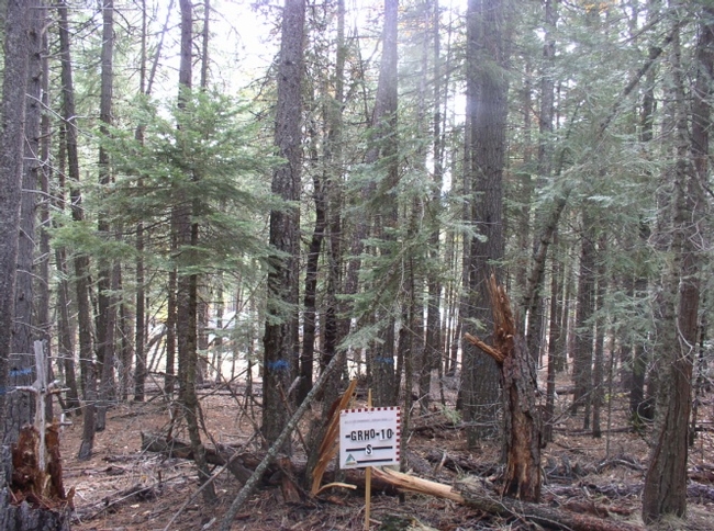
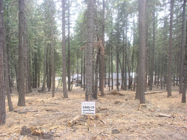
The monitoring was conducted both prior to and following the fuel reduction treatment to address concerns that the projects were not meeting goals and to develop educational information.  The monitoring included photographs, description of stand structure and composition, quantification of surface fuel ladder fuel and canopy cover and economic analysis.

Lasaux ILasaux II
  Pre-treatment                                                Post-treatment

Pre-and post-treatment photography involved capturing images in the 4 cardinal directions from each plot center.  The images graphically illustrate the fuel condition and how the treatment has reduced ladder fuel.

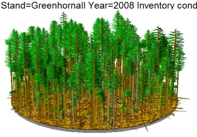
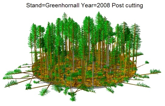
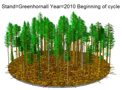
Each community fuel reduction project involved from 9 to 12 tenth acre plots where all trees were measured to characterize stand structure and composition.  Stand visualization software was used to develop a graphic depiction of the stand prior to and following treatment.

Lasaux IIILasaux IVLasaux V

Monitoring found that prior to treatment “high risk” ladder fuel existed on an average of 54 percent of the plots with 4 communities having greater than 60 percent of the plots having high risk ladder fuel.  In one case 98 percent of the plots had “high risk” ladder fuel.  Post-treatment an average of only 3 percent of the plots had “high risk” ladder fuel while an average of 92 percent of the plots were now “low risk”.

Canopy cover averaged 82 percent prior to treatment and was reduced to an average of 47 percent.

Monitoring of community fuel reduction costs has shown that it will be difficult to complete fuel reduction at the community level without grant support.  Cost of treatment per acre has averaged over $1,500 with grants covering about 63 percent of the cost and the value of fiber removed in the form of sawlogs and biomass covering the other 37 percent.  Only recently has the Plumas County Fire Safe Council begun collecting funds from the landowners to conduct the project and the amount has been limited to $250 per acre.  It may be difficult to coordinate multiple landowners to accomplish fuel reduction at the community scale when they all need to have financial capacity at the same time.

Surface fuel, stand structure and fire behavior data analysis have not yet been completed.

Thus far the monitoring information collected has been used to help other property owners determine whether the Council’s community fuel reduction program is appropriate to their property or community.

Interactive map of California's fire history

This interactive map of historical wildfires in California, developed by the Sacramento Bee and CALFIRE, includes fires dating from 1950 to 2010 and can be organized to show only fires from individual decades within that range. The map can also be organized to show the 20 largest fires in the state... interesting to note that most of these seem to have taken place in the last two decades.

 Click to go to the map


Wildfire Summit pulls together Tahoe basin residents and agencies on the fourth anniversary of the 2007 Angora fire to improve implementation of defensible space

Written by: Susie Kocher, UCCE Advisor, CFSC Sierra Nevada Team

The Lake Tahoe Wildfire Summit was held in Tahoe City on June 24th, 2011, four years after the Angora fire which started on June 24th, 2007 in South Lake Tahoe. The summit drew together over 100 basin residents, agency staff and policy makers to focus on ways to reduce wildfire risks to Tahoe homes and communities. Presentations centered on wildfire issues in the Tahoe Basin and how to reduce risk to homes and communities by creating defensible space, improving building materials and design, and implementing forest fuels reduction projects. Participants also went on field trips to the nearby Washoe fire, to a forest fuels reduction project implemented at Granlibakken resort (the hosting venue), and to a nearby neighborhood to examine the flammability of home construction.

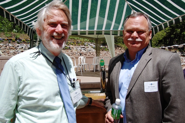
Steve Quarles and Ed Smith at Granlibakken Resort
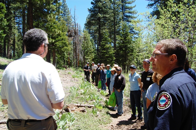
Ron Parson, manager at Granlibakken gives an overview of the fuels treatments done by the resort

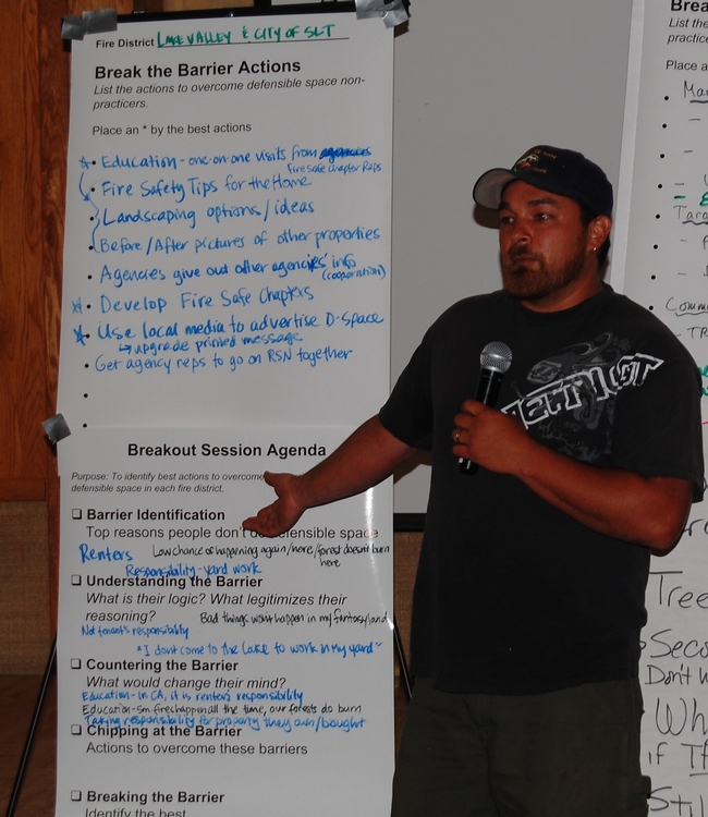
After reaching a highpoint in 2007 due to the Angora fire, the level of concern about wildfire and motivation to do defensible space seems to be tapering off at the lake according to many fire agency staff. Participants cited residents’ and homeowners’ attitudes as the foremost barrier, saying that people don’t care about fire hazards, don’t think of natural vegetation as needing maintenance, or would rather recreate than do yard work. This attitude may be deeply ingrained at Lake Tahoe, a community where leisure and recreation in the “natural” outdoor environment is deeply valued.

Lack of understanding about the issue and denial that a wildfire could happen again were also cited with some reporting time they had been told by locals that Tahoe had an “asbestos” forest and wouldn’t burn. Other concerns are that vegetation removal for defensible space will look unsightly or reduce privacy. Also, there is a perception that defensible space actions are illegal or clash with water quality best management practice requirements required by local and regional government to preserve Lake Tahoe’s famed clarity.

Ownership patterns, including second home ownership and a high percentage of rental properties, reduce the opportunity and ability for some to complete defensible space. Costs are a factor for some residents, especially during the current recession (though there are currently rebate programs in place that can pay up to half of the cost of defensible space treatments). Disposing of materials can also be difficult.

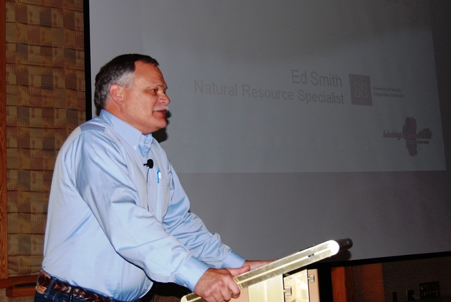
Ed Smith describing 15 reasons why people don’t do defensible space

Attendees at the Summit brainstormed and prioritized strategies to overcome these barriers to defensible space implementation. Education was cites as the major need to increase implementation. Education should focus on increasing awareness and understanding of the fire issue at Tahoe and highlighting the attractiveness of defensible landscapes. A major goal should be to develop a culture that doing defensible space is just a part of living at Lake Tahoe. Helping residents understand that defensible space is not only legal, it’s required and will eventually be enforced was also key. Following up with actual enforcement actions was identified as critical to this effort.

Participants reporting back from the fire district break out sessions

At the end of the day, all participants said the summit helped to clarify wildfire issues in the Tahoe Basin. 88% said it will help their communities work together to reduce wildfire risk and that they personally had a better idea of how to reduce wildfire hazards in their community.

Partner agencies included the seven local fire agencies in the basin, CalFire, the Nevada Division of Forestry (NDF), the Tahoe Regional Planning Agency (TRPA), the US Forest Service and both the University of California and University of Nevada Cooperative Extension. Funding for the event was provided by the NDF, TRPA, fire resistant construction material manufactures, and local defensible space contractors.


For a full account of the event, please download the Summit Report

For more information on how to implement defensible space at Lake Tahoe, go to: www.livingwithfire.info/tahoe

"Preparing Tomorrow’s Fire Professionals: Integration of Education, Training, and Experience Through Science-Management Partnerships"

The most recent issue of the Joint Fire Science Program's Fire Science Digest - titled "Preparing Tomorrow’s Fire Professionals: Integration of Education, Training, and Experience Through Science-Management Partnerships" - details many of the emerging opportunities and challenges for prospective and current fire professionals. As the understanding and use of fire science and fire ecology in land management has expanded in the past half-century, and the use of fire as a management tool has simultaneously grown, the demand for new job skills has increased. This JFSP digest provides brief history of how fire professions have evolved, and details new opportunities for receiving training and education in the areas of fire science and management.

Download the Fire Science Digest, Issue 9

Using fire to control invasive plants - two new research briefs and papers posted

Matt Brooks, the leader of the CFSC's Mojave and Sonoran Desert Region, has just written two short briefs that each summarize publications regarding the use of fire as a management tool to control invasive plant species. You can read them below, and both are also posted in the Desert Resources pageas well as under "Management Guides" under the central "Resources" menu on the top bar.

This review evaluates the current state of knowledge on prescribed burning as a tool for invasive weed management. Prescribed burning has primarily been used as a tool for the control of invasive late-season annual broadleaf and grass species, particularly yellow starthistle, medusahead, barb goatgrass, and several bromes. However, timely burning of a few invasive biennial broadleaves (e.g., sweetclover and garlic mustard), perennial grasses (e.g., bluegrasses and smooth brome), and woody species (e.g., brooms and Chinese tallow tree) also has been successful. In many cases, the effectiveness of prescribed burning can be enhanced when incorporated into an integrated vegetation management program. Although there are some excellent examples of successful use of prescribed burning for the control of invasive species, a limited number of species have been evaluated. In addition, few studies have measured the impact of prescribed burning on the long-term changes in plant communities, impacts to endangered plant species, effects on wildlife and insect populations, and alterations in soil biology, including nutrition, mycorrhizae, and hydrology.

This manual targets fire management staff and is designed to summarize the links between fire management and invasive plant invasions and management. It also provides practical guidelines that fire managers should consider with respect to invasive plants. Minimum recommendations fall into two broad categories. First, prevent dispersal of invasive plants by: 1) locating fire camps and staging areas in areas relatively free of weeds and other invasive plant; 2) washing vehicles and equipment before and after being used within a project area (i.e., treatment area, fireline); and 3) ensuring that any revegetation (e.g., seed mixes) or other organic material (e.g., straw mulch) that is introduced into the project area is certified as weed-free. Second, minimize resource available to invasive plants by: 1) removing only enough vegetation to accomplish the management objectives (e.g, creating a managed fuel zone, constructing a fireline; and 2) replacing highly flammable vegetation with less flammable vegetation as an alternative strategy to complete vegetation removal when creating a managed fuel zone.


Publication list for managers and stakeholders in the Mojave and Sonoran Desert region

Matt Brooks, leader of the CFSC's Mojave and Sonoran Desert Region team, has compiled a list of 80 relevant scientific publcations for managers in the Mojave and and Sonoran Desert region of the state.

This bibliography organizes 80 scientific publications relating to different management and ecology topics in the Mojave and Sonoran deserts. Publications are organized into the following topics: Fire History, Fire Effects and Postfire Succession, Ecological Effects of Fire Suppression Actions, Postfire Management, and Fire and Invasive Plants, as well as other unsorted publications.

You can download a PDF of the document by clicking on this link:

Mojave and Sonoran Desert Publication List for Resource Managers

UC Cooperative Extension Forestry Blogs

UCCE Forestry Specialists have recently begun maintaining two new blogs - Oak Conservation and Forest Research and Outreach. Both blogs are updated regularly by Cooperative Extension forestry experts, and are used to highlight current issues, new research, and upcoming forestry events in the state (such as public field trips or symposiums).

Greg Giusti, UCCE Forestry Specialist, speaks with landowners and managers during a trip to the UC Sierra Foothills Research and Extension CenterA recent blog post by Rick Standiford, "Fire History for Blue Oak Stands in Southern California," may be of particular interest to those interested in the fire ecology and management of the state's oak woodlands.

Steve Quarles, a member of the CFSC WUI team and former UCCE Building Materials Specialist, has also written two entries in the Forest Research and Outreach blog on the recent conference held by the American Society for Testing and Materials Committee on fire standards for building materials. You can read both entries by clicking on these links:

New Fire Standards out of Anaheim Conference, Part One

New Fire Standards out of Anaheim Conference, Part Two

Arizona fires commentary

This op-ed on the wider implications of the Wallow Fire in Arizona and the land management policies that have contributed to it, by Professor Stephen J. Pyne of ASU, is worth reading:

The Wallow Fire: The monster that didn't have to awaken

This interview with Donald Falk, associate professor at the University of Arizona School of Natural Resources, on the relationship between restoration ecology and climate change does not relate directly to the Arizona fires but is relevant in terms of addressing landscape-scale treatments in the face of changing climactic conditions. The interview was conducted by the Climate Adaptation Knowledge Exchange.

Upcoming webinar series: "Wildlife and Sensitive Plant Considerations in Forest Fuel Management"

The University of California Cooperative Extension will be hosting a series of four webinars on the subject "Wildlife and Sensitive Plant Considerations in Forest Fuel Management."

Yoiu can register any or all of the webinars in the series by clicking on this link: http://ucanr.org/fuelwildlifeplantwebinarregister

Description:

"The Northern California Society of American Foresters and University of California Cooperative Extension in collaboration with their partners are offering a webinar on the topic of wildlife and sensitive plant considerations in forest fuels management."

"Landowners and agencies implementing treatments to reduce fuel loads in forest stands need to acknowledge and mitigate potential impacts on wildlife and their habitats and on sensitive plant species. The objective of this webinar is to provide participants with basic information on wildlife and sensitive plant habitat requirements and suggestions on how to maintain habitat values while improving forest health and reducing fire hazard. The intended audience for the webinar is natural resource managers, environmental and forest activist groups, residents of forested regions who are affected by fuels management projects and the general public concerned with forest management."

Schedule:

August 4, 2011 2:00-4:00 p.m.

  • Prescriptions Balancing Wildlife, Forest Health and Fire Hazard: Richard R. Harris, Ph.D., RPF #1961, Northern California Society of American Foresters, Dixon
  • Prevent Forest Fires and Protect Wildlife: Lorna Dobrovolny, California Department of Fish and Game, Rancho Cordova

August 11, 2011 2:00-4:00 p.m.

  • Sensitive Plants and Fuels Treatments: Tim Nosal, California Department of Fish and Game, Rancho Cordova
  • Incorporating Habitat and Species Best Management Practices into Community Wildfire Protection Plans: Miriam Morrill, US Fish and Wildlife Service, Willows

August 18, 2011 2:00-4:00 p.m.

  • Fuels Treatments and Their Effects on Fire Behavior, Wildlife and Other Resources: Carl Skinner, US

Forest Service, Pacific Southwest Research Station, Redding

  • Trade-offs between Forest Ecosystem Services and Fire Hazard Reduction: David Saah, Spatial Informatics, Inc., Berkeley

August 25, 2011 2:00-4:00 p.m.

  • Impacts of Fuels Treatments on Birds and Small Mammals: Ryan Burnett, Point Reyes Bird Observatory, Point Reyes, Station and Doug Kelt, University of California, Davis
  • TBD

Webinar recording now available

Thanks to all who were able to join the consortium for its first webinar! If you missed it, you can view a recording of the webinar by clicking on this link:

Mixed Conifer Fuels Treatment Webinar

Here is a description of the webinar:

"The California Fire Science Consortium is happy to announce the first presentation in our 2011 Webinar Series. Dr. Zander Evans, the Research Director of the Forest Guild, will be presenting on his Joint Fire Sciences Program-funded report on fuels treatment practices. The report focuses on the mixed conifer ecosystems of California, the central and southern Rockies, and the Southwest.

The first half of his presentation will review the historic conditions, past land use, natural fire regimes, impacts of altered fire regimes, and future prospects (given climate change) of mixed conifer forests. The second half of the presentation will address fuels treatment objectives, techniques, barriers, and successes across a range of ownerships, and draws on the experiences of 75 interviewed managers and experts who work in mixed confer ecosystems."